Another mixed, cool day with sunny spells and scattered showers. Passing low pressures will bring wind and rain as the nippy nights continue.
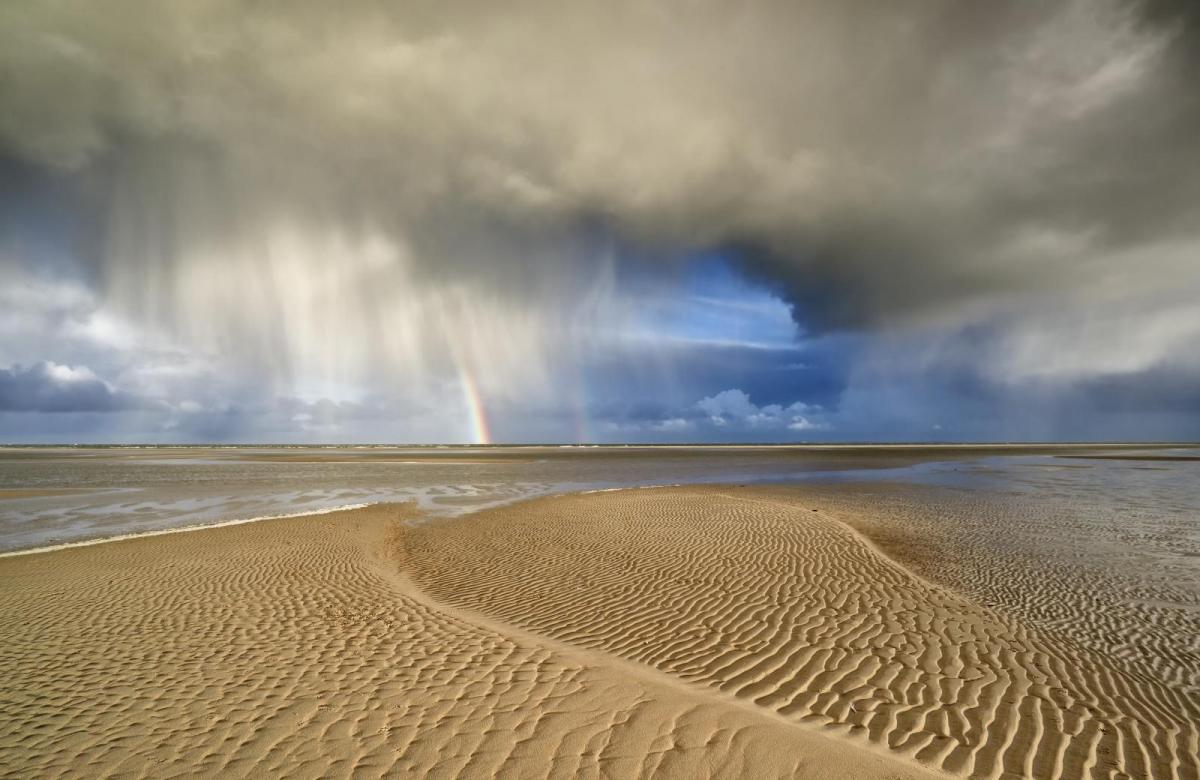
Tuesday morning was not as lively as Monday 15th when an active cold front brought a narrow band of torrential rain, wild winds and high gusts down the UK. We are still in the cool air flow veering a bit more to a northerly now and a few spots have dipped to freezing overnight. There are bright spells even sunshine but also cloudier areas with showery outbreaks of rain. This is rotating around the weekend low pressure that is drifting away from the southern North Sea into Germany. This cooler flow is ending the unusual April heat that has taken hold of parts of Europe in recent days. France and Spain had seen temperatures above 30C with other central and southern countries seeing monthly records broken. The UK had seen some warmth for the end of last week and the sun is trying to warm and dry the ground now, after a soggy winter. We all know what April is like, changeable. Bright sunshine one minute that can enchant you to not take a coat or be beguiled by the ‘window weather’ and then the skies darken and the heavens open. You are drenched, the trees are shaking as blossom flies down the road followed by recycling bins.
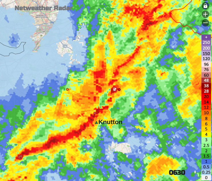
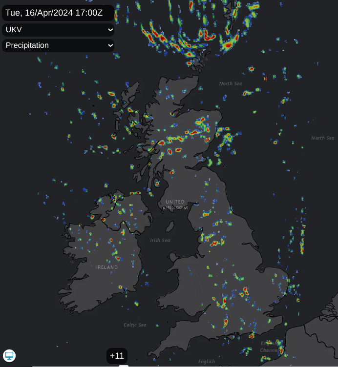
Netweather Radar from Monday 15th April
Monday’s band of rain was quite something. Structural damage, such as damaged roof tiles and chimneys along with fallen trees, sheds and an overturned caravan, is being investigated. To see if it was just strong straight-line winds with high gusts or if there was some rotation, suggesting a tornado. Please don’t call it a mini tornado. The phrase would be ‘weak’ and the UK does see numerous tornadoes in a year, but they are very localised events.
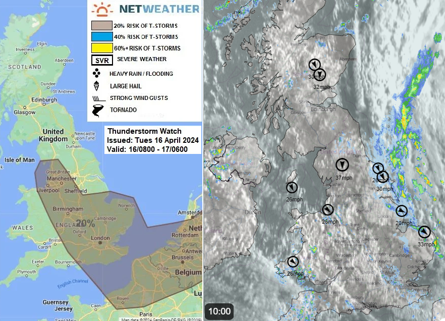
"Wind convergence zone between NW and N winds looks to develop between NW and SE England through the day, this will increase the risk of a few thunderstorms developing in this zone as well as perhaps across East Anglia close to a front this afternoon, with a risk of hail, localised flooding and gusty winds." Convective Forecast 16/04
Tuesday’s showers are more scattered with wider sunny areas in between away from North Sea coasts. With the low pressure lurking nearby eastern England stays cloudy with rain and a brisk northerly wind, making it feel cold. Around 8am the showery rain was extending from Newcastle down to Norwich. It will gradually brighten up for the northeast, becoming drier as more showers reach East Agnlia late morning with a fresh northwest wind.
For the rest of the UK, the winds will be lighter. The showers will be slower moving, with the risk of hail and some heavier ones but there will be bright spells in between.
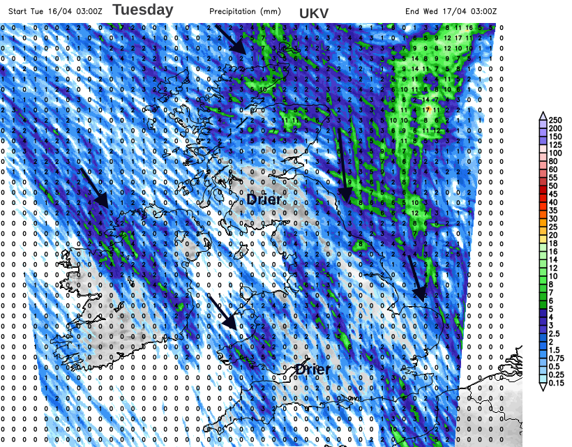 An idea of the focus of showers today
There is high pressure waiting out west with a promise of something drier and more settled but potentially quite cloudy. To get there over the next few days is a rather mixed picture with the risk of frost by night.
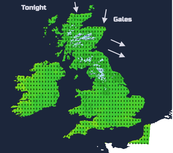
This evening there will be large clear and dry areas with a scattering of showers inland with light winds. Temperatures will fall away in the cool airflow. Wales and northeast England should see a few sharp showers. A small low centre is forecast to move southwards towards Aberdeen tonight. The winds will strengthen for the Northern Isles before midnight with more showers appearing. This wet and windy weather will cross northeastern Scotland with further showers for eastern England in brisk, chilly winds.
Wednesday
For much of Britain, Wednesday should start off sunny but cool in the northerly flow. For Northern Ireland, frontal cloud and rain will topple in from the Atlantic. There will be light winds but it will feel cold until later in the day when milder, brighter conditions should reach County Fermanagh. The frontal rain will reach over the Irish Sea to western Wales in the afternoon as the brisk N/NW winds in the North Sea continue to bring showers to eastern England and the Midlands. Everything sinks slowly southwards during the day. By day temperatures are around 9 to 12C with a few places seeing 13 or 14C on Tuesday.
It will feel cool after dark this week and by Thursday there will be a lot of cloud across the UK with another little low pressure diving in from the north Atlantic. This will bring wet and blustery weather to Scotland, clipping Northern Ireland and reaching northern England in the afternoon and evening. Further south a brighter, more settled day.