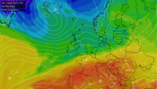
April temperature records were broken in many locations in Spain and France this weekend. Cooler air is on the way with a wet and wild Monday morning in the Midlands.
Last week warm air from Africa flowed up through Spain and France reaching parts of Britain. North London saw 21.5C on Friday 12th. Saturday 13th saw the highest UK temperature of the year, so far, near Chelmsford in Essex with 21.8C, 71 Fahrenheit. It soon faded, as the taste of spring was cut off and temperatures returned to the April average or below.
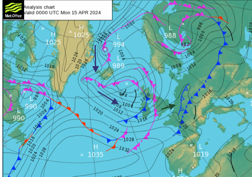 One cold front had already started a cooler turn for northwest Europe during the weekend. That cold front was reaching into northern France and across to the Baltic States by Sunday night. A more decisive cold plunge took place on Monday morning. Any lingering warm air displaced after heavy, thundery rain along an active cold front. This brought sudden gusty winds with a narrow band of torrential rain, resulting in structural damage in the Midlands, suggesting the possibility of tornadoes.
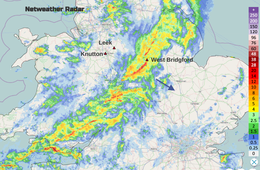 Active cold front on Netweather radar with damage areas of Knutton, Leek and West Bridgford Monday 15th April 0730BST
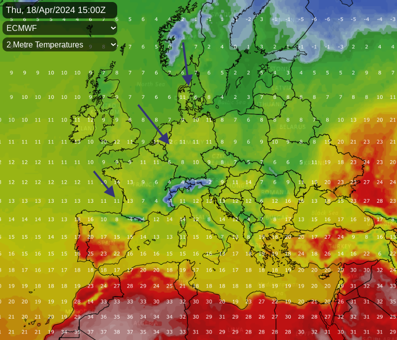
This north to northwesterly flow will continue down into mainland Europe with a more dramatic temperature change here. In central and southwestern Europe, it has been unusually warm with numerous April temperature records falling. There was widespread anomalous heat and the all-to-familiar story of long-standing records begin passed. The week ahead looks cooler, although taking its time to reach southern Spain.
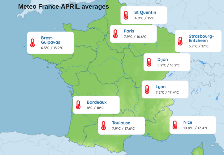
Mid-April weekend record high temperatures for April in France and Spain.
‘From Friday April 12 to Sunday April 14, the country experienced a new early heat peak. On Saturday, monthly maximum temperature records were broken. On Sunday, the heat persisted particularly in the east with remarkable values.’ Meteo France
Warm air from the Sahara was transported over Iberia towards southern France around an area of high pressure. This proved exceptional for the beginning of April with ‘an average temperature in France (average of temperatures over 30 reference stations) reaching 17.9° C, which had never happened before April 15.’ Meteo France
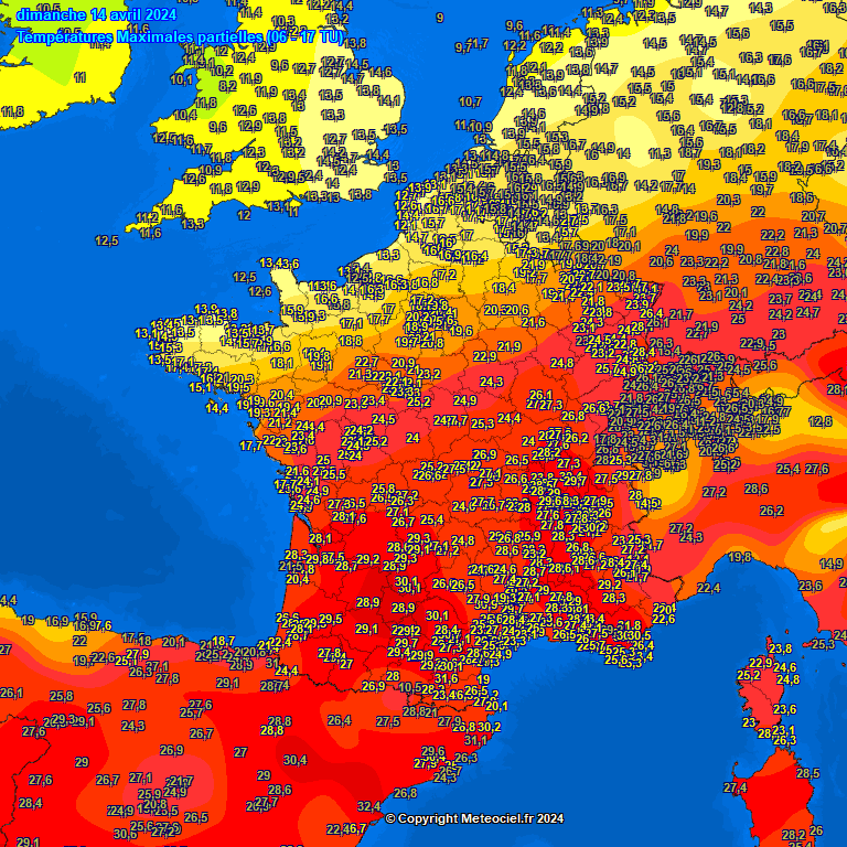
Many month records were broken in France on Saturday and Sunday. Over 140 stations passed their April high-temperature values. Grospierre, Ardèche in the central south saw 31.4C. Carcassonne, in the south between Toulouse and the coast, saw 31.3°C beating a previous record from 1949. 28.9° C in Aix-en-Provence, Bouches-du-Rhône, also a new April record, opened in 1955
And it was warm in the French Alps too. The heat was unprecedented in April with Alpe-d’Huez, Isère, 1860m seeing 19.6° C beating 18.9° C from 2011. Sunday saw further high temperatures with 30.2° C in Grenoble and 29.6° C in Lyon-Bron which are 11 or 12C above average.
In Austria, around a third of all stations broke their monthly record with temperatures not quite reaching 32°C, the April national record.
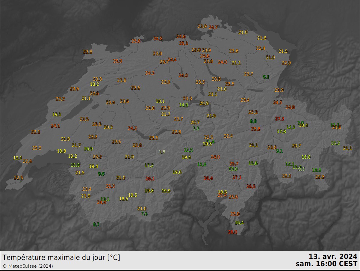
Meteo Suisse reported record heat with the April record falling. Genèva, Switzerland provisionally saw 28.3°C on Sunday. This long-standing record dated from 1934 with 27.7°C. On Saturday Zermatt at 21 °C and other Swiss stations broke their April records.
Earlier last week the Canaries have been subjected to haze, heat from Africa and Saharan dust clouds, a phenomenon known as the Calima. It was exceptionally warm during the middle of last week (April 11th) with 38.2 ºC recorded in Tenerife South. This beat the previous month's record of 36.2°C from late April 2008 with records back to 1980. There were also high temperatures in mainland Spain which continued into the weekend.
 To the south of Bilbao, in the Basque Country, the province of Araba-Álava saw temperatures on Saturday reach 15 ºC above average. The heat in the northwest shifted eastwards across the northern region of Spain with temperatures more usual for summer. 32.8C Tortosa (Catalonia) and Fabra, NW of Barcelona, set a new record of 29.1°C (provisional) dating back to 1914.
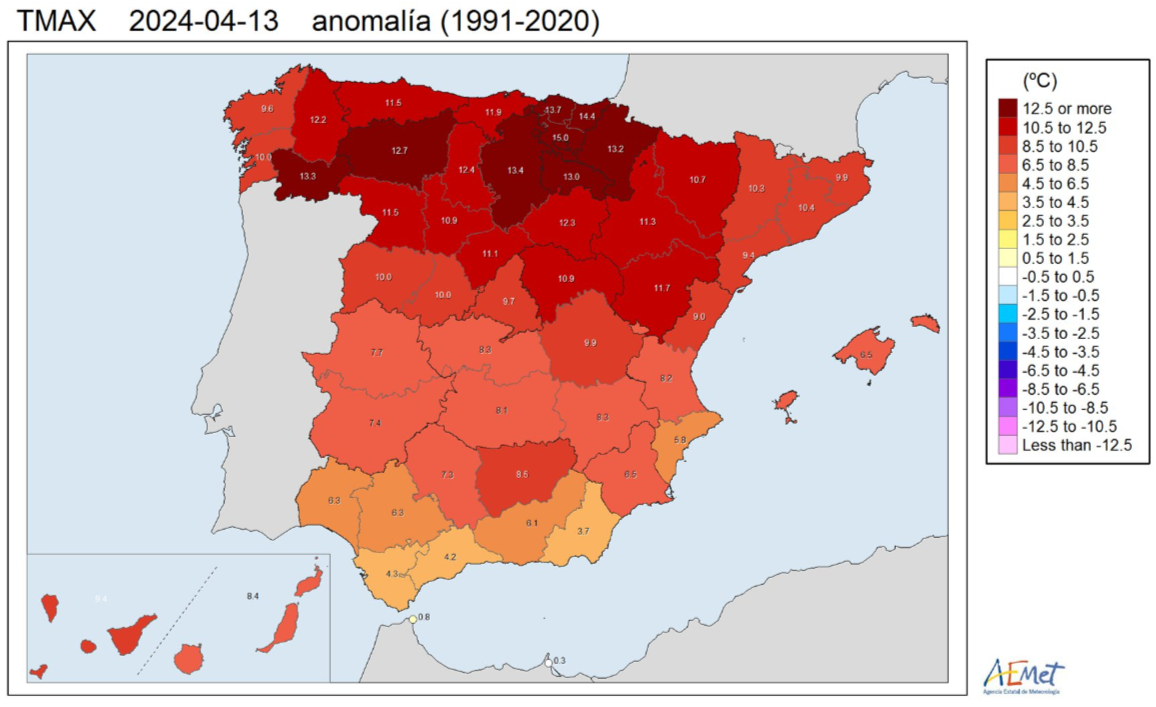
‘During the last three days, maximum temperatures have been extraordinarily warm for the time of year in the northern third of the peninsula.’ AEMET
It felt warm across Spain throughout the weekend. For the start of this week, records in the north had been between 7 and 15 ºC higher than normal. The cooler airflow will make a difference in northern Spain but southern Spain will keep some extra warmth until midweek. Malaga should see 28C on Tuesday with the heat just easing back down to 20C later this week.
April is a changeable month, one minute its fine and sunny, the next a downpour and it's cooler. But this warmth, this heat, so early in the month. It just keeps happening and these records keep on falling. What will the height of summer bring?
Met Office "Climate change is already having visible effects on the world. The Earth is warming, rainfall patterns are changing, and sea levels are rising. These changes can increase the risk of heatwaves, floods, droughts, and fires."


.png?w=350)