The cold, northerly air doesn't want to let go just yet. Southeast England will feel warmer this weekend, away from the rain but it's a mixed weekend coming up.
Milder air will try to tuck over southeastern areas this weekend, so it won't feel as nippy there. The risk of frost continues further north, though. Usually, low pressures arrive from the west, swinging in from the Atlantic. This isn't the case for the rest of this week. On Friday, a deepening low will move southwards to Iberia before curling up across the Bay of Biscay. This low will be the main feature across the UK by Sunday, with heavy rain reaching northwards over SE and then more of England. There is some uncertainty about the reach of this rainband.
It's been a strange but often steady week. The winds have been lighter with high pressure nearby, but the northerly airflow has felt cold. When the spring sunshine appeared, it was lovely as long as you stayed in a sheltered spot. However, under thicker cloud, or where it was damp, then the cold soon took hold, as it did in the evening. If you decided not to take a coat, it wouldn't have taken long to realise it's too early for that. Perhaps you were deceived by the 'Window Weather'. It looks stunning outside, but in reality, it feels rather cold.
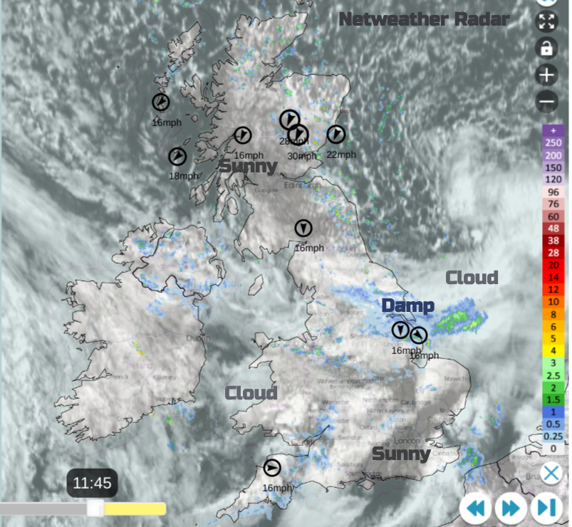
There has been some rain, but it has mostly been light. On Thursday, a small low pressure swept down the North Sea. This has brought a bit more rain to northeast England, and there is a cool, unstable showery flow following to the north, with even a bit of snow for the highest routes of inland Scotland today and the North Yorkshire Moors. Further south, it's still quiet but mixed, with some parts seeing clear blue skies and sunshine but others cloaked in low cloud.
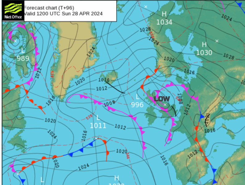
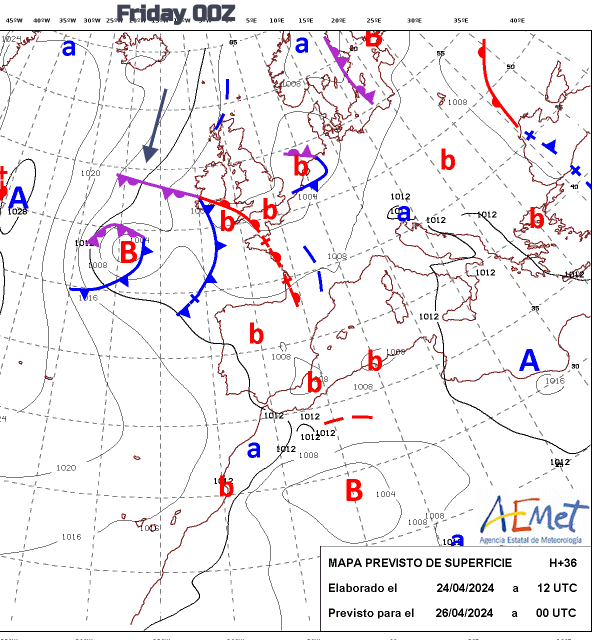 Initial weak low b by Cornwall followed by major Low B, which is heading for northern Spain.
The first feature (b) will bring more cloud and showery rain to southern England this evening. The frontal bands from this first, weakening, low pressure will dance around over the English Channel through Friday and on Friday night. There will be heavier bursts by then for southern counties and along the Bristol Channel. To the north, it will be clear, with light winds, mostly dry with dipping temperatures and a frost. For Thursday night, it will be for Northern Ireland and northern parts of the UK and similar on Friday night, although clear for all of Ireland. The southern rain and cloud will gradually edge northwards during Friday night. There will be some heavy bursts for London and the Home Counties, also along the M4.
 The colder, northerly flow is never far away.
Saturday will start chilly and bright for Northern Ireland and northern Britain. Further south, cloud and showery rain from the first feature will still linger and edging northwards. For England, there will still be a cool easterly breeze off the North Sea, but as the frontal band moves away from southeastern England, it will feel better with sunny spells.
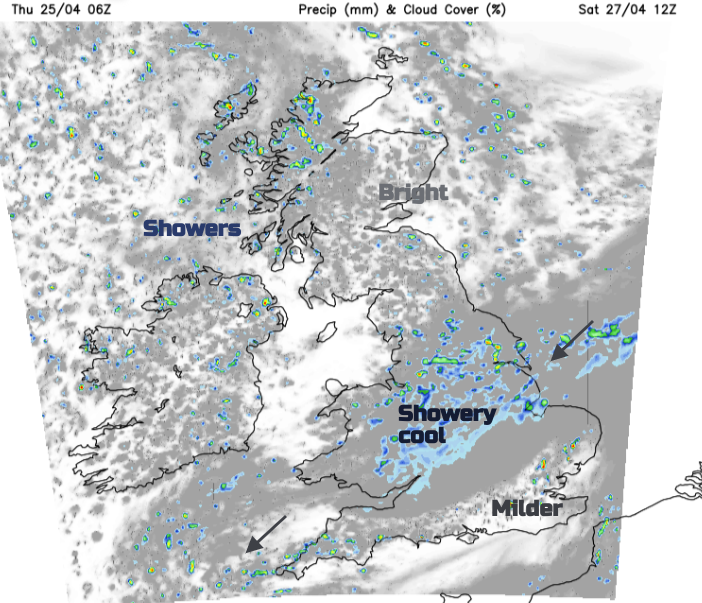
By lunchtime, scattered showers will appear, followed by bright or sunny spells. Temperatures will be around 10 to 14C, so they will still not be warm, but at least the cold air will have eased its grip on southeast England. Here, it will feel warmer in any sunshine.
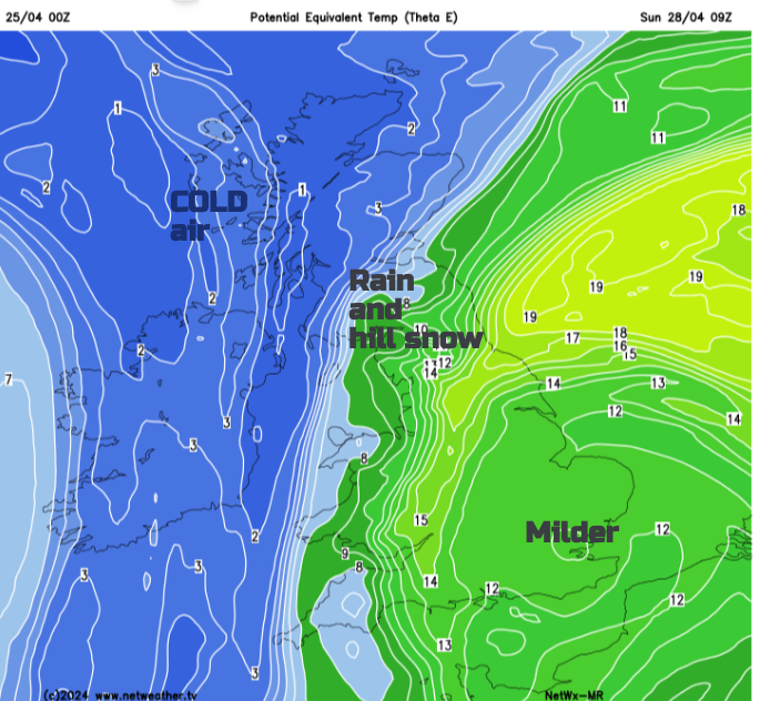
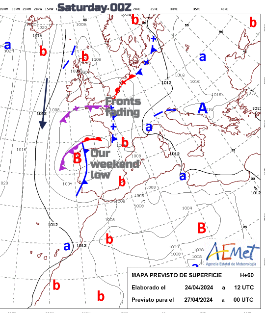
During Saturday night, the main weekend, low pressure will appear over northern France. The northeasterly to northerly winds will pick up for central and southwestern England and Wales. As the frontal rain hits the cold air, there will be sleet and hill snow. Where it reaches depends on how far north and west it reaches. Possibly over the Pennines, maybe the Cheviots by Sunday morning
Ahead of all this for NW UK, it will be calmer. It will still be chilly but fair. Under the frontal band, it will feel cold, especially in the wind with rain and further hill snow. The main area of rain will rotate northwards but there is some uncertainty around how much of Britain will be affected by the rain. The ECM model keeps the heaviest rain east of the Humber and barely brushes Aberdeen by Sunday evening on its way to the Northern Isles. Showers will trouble western counties in this scenario, but many parts of the country will see a fair day.
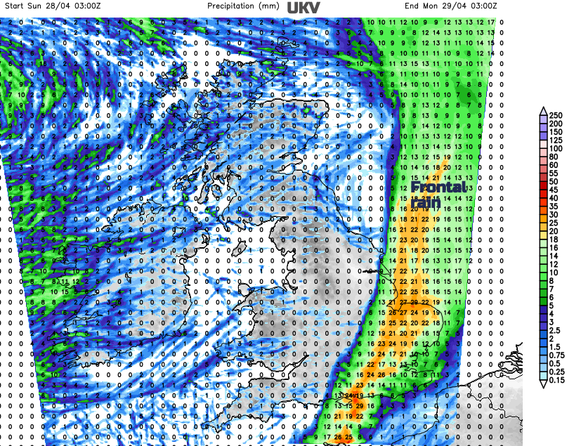
Other models show the rain reaching further into Britain, so bear this low confidence in mind if you are looking at weather symbols for Sunday. Temperatures are a bit tricky as it depends on the location of the rainband. Under that, it will be cool, even cold. If the rain does drift further inland, there will be brighter skies in eastern England, and temperatures will be around 14C. This western drift looks less likely now. If the rain band clears from eastern England before lunchtime on Sunday, it leaves the cool air over more of the UK but a greater chance of bright or sunny spells. So Sunday could be a fine day with just a few passing showers rather than the washout of frontal rain.
Timings differ but there is a clearance eastwards, shoving the milder air over the North Sea, shoving the frontal rain away with a quieter spell for Sunday night.