Jan 87
-
Posts
126 -
Joined
-
Last visited
Content Type
Forums
Blogs
Gallery
Events
Learn About Weather and Meteorology
Community guides
Posts posted by Jan 87
-
-
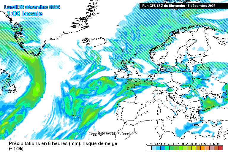
Check out the GFS 12z. Where the hell did this come from?
-
 1
1
-
-
Perhaps signs of retrogression on the 06z, may end up like GEM
-
 4
4
-
-
24 minutes ago, northwestsnow said:
Could just do with the sister lobe edged further west..
But yes , we need momentum now..
And some cold air to tap into if a block does set up in the right place
-
- Popular Post
-
13 minutes ago, bluearmy said:
beginning to get a feel for later week 2 to evolve in a similar way to late nov into dec …… whether we actually see a scandi ridge retrograde is another matter but there are some jigsaw pieces falling into place
Could be fair play to that long ranger METO forecast from late December when we were looking for straws to clutch
-
 1
1
-
-
main GFS not bad at day 10
-
 4
4
-
-
-
a fair few of the GEFS have those greeny heights and keep us on the cold side of the jet. this is a good one
-
 1
1
-
 1
1
-
-
GFS still persisting with the greeny heights. doesnt really help us yet of course, but who knows down the line
-
 1
1
-
-
27 minutes ago, TEITS said:
Im not as confident on the outlook as others on here. Look at the handling of the deep low pressure on the N America charts from +72 to +144 and then compare with the ramifications it has on the UK at +120 to +144. The GFS handles this low pressure very differently to all the other models and is the cause of the differences at this timeframe for the UK.
So im not suggesting a change to a prolonged, significant cold spell. However the scenario of a snow event is possible if the GFS is correct as it looks as though a low pressure may move N and bump into the colder air that has arrived over xmas.
Indeed. We maybe just p"ssing in the wind, but GFS op and control and fair few GEFS still build a wedge over greenland, other models do not. Until it comes into line, there remains some hope for a more positive outlook
-
 2
2
-
-
2 minutes ago, January Snowstorm said:
I'm 100% the gfs will back down
Probably, but if its true that it handles the crucial area better than others, then its possible though unlikely the other models will back down. At least both the op and control and a lot of the GEFS built the block. We await the pub run with greater anticipation than usual!
-
 1
1
-
-
1 minute ago, Cuban Zebra said:
I’m pretty sure we all agree that it’s currently bonkers, nothing is fixed past 48-72 hours and how anyone can call anything for Christmas Day and after is beyond me!!
It all depends on that system coming out of north America. GFS still keen on building some sort of ridge that is sustained for a while, others are not.
lets see if its still there on the 18z
-
 2
2
-
-
just look at the range of options on the GEFS at 120. With so much uncertainty at close range, nothing can be ruled out. But Scotland is looking favourable for a pasting, in London probably wet but there is still hope
-
 1
1
-
-
-
-
snow or rain event on xmas day on the control
The old M4 corridor again!
-
 2
2
-
-
-
-
7 minutes ago, Alexis said:
If the lows behaved a bit better on the ECM you'd end up with a run like the GEM with northerlies.
Seems like just small differences can give us wildly different outcomes at the moment, hence the confusion.
the ops always seem to the mildest option. Perhaps the lower res ens are not to be trusted, but we can only hope its a case of the ens leading the way. GEM op and control are encouraging in terms of clearing the trough quickly, it has been consistent
ICON 06z looks much better than the mornings run, shame we cant see what happens next
-
 1
1
-
 2
2
-
-
26 minutes ago, Penrith Snow said:
The whole set up reminds me very much of the Christmas period in 1978, then as now a mid month cold spell relaxed just before Xmas as mild air swept north, a pronounced temperature boundary then developed over Scotland with a sausage shaped low pressure separating the air masses.
Eventually towards New Year the cold air moved slowly south bringing heavy snow to Scotland, by New Years Eve the cold was across the UK and a Channel runner gave Blizzard conditions in the South.
Interesting that a Iberian High was also evident throughout the period.
Andy
The original "winter of discontent"
Interesting how the weather pattern is so far very similar! Let hope the trend continues as it was a great winter even if the country was in mess, as it is now!
-
 2
2
-
-
-
Ens mean for Xmas day similar to GFS
Shame we got another mild op, or the mood would be much better here. But we need those heights in Europe to drain away
-
 2
2
-
-
-
GFS control looks perhaps what UKMO would show later
Nice Christmas for us all, but who knows with all the chopping and changing
-
 7
7
-


Model Output Discussion - Colder but how cold and for how long?
in Forecast Model Discussion
Posted
Most likely an outlier, I dont think the next phase of strat warming will kick in that fast