


Hatewarmth
-
Posts
99 -
Joined
-
Last visited
Content Type
Forums
Blogs
Gallery
Events
Learn About Weather and Meteorology
Community guides
Posts posted by Hatewarmth
-
-
As always the Pennines stopping and snow from hitting our area with any sort of intensity
-
 2
2
-
-
25 minutes ago, winterof79 said:

What do the think the chances are of the rain forecast at the weekend could be snow. Model look to be extending the cold a tad but not sure
-
1 hour ago, Rocheydub said:
Not on this run. But I can feel it in my waters! A watching brief continues!
I’ve been saying look NE fir a week now. This is where the holy grail will come from. Think we looking around end on month. Hopefully with a SSW to help things along

-
4
-
-
1 minute ago, Drifter said:
You seem to be revelling in these, but I don’t think it will pan out this way at all.
Is it just me or does anyone feel the cold air will put up more of a fight than us currently been shown. We all know when cold air had been established fir a while it can take some shifting. My thinking is yes it will warm up briefly before the next cold shot from the NE but I think it will be cold throughout the whole of next weekend possibly with some snow
-
1
-
-
32 minutes ago, sheikhy said:
Guys just forget about the frontall snowfall that ship looks to have sailed!!we gota he focusing on swirly bands of snow and showers now!!!ukmo look very very cold out to 144 hours and so does gfs!!
Totally agree. As many keep saying that system will almost certainly track more and more south in the next few days. Snow will crop up anywhere at anytime in this setup. Won’t be picked up by the model till 1 or 2 days before. Expect surprises

-
5
-
 1
1
-
-
32 minutes ago, MATTWOLVES 3 said:
Mogreps still not finished the run..but word on the grapevine is after a milder interlude the chances are we go colder with blocking and winds more likely to be from the N/NE/E the form horse.
Now was it my inside informant who told me this....mmmmmm

No it was me. I’ve been telling g everyone to look NE

-
4
-
-
2 hours ago, KTtom said:
How come when it comes to cold we must wait for the reliable (120) but when mild is showing at plus 8 days it’s nailed on. The models do not have a clue and are changing SIGNIFICANTLY at 3 days out so how on earth when it shows mild we are certain.
It may well turn milder through the weekend but there is so much to get through before then. I think what it is with all these mild tampers is that they want it that bad they are scared of getting hurt when it does not come so they play reverse psychology with themself to protect themselves

-
4
-
-
5 minutes ago, Scott Ingham said:
The UK is so small and these lows can change so much at this timeframe that not a lot can be said really! We’re looking at the weekend before we’ll even have some kind of idea
Totally agree. I think the track of the low won’t get sorted till Monday at the earliest. Would be shocked if it didn’t track a 100 miles further south but we will see. Good news is cold locked in fir longer and could we start to look to the NE
-
2
-
-
12 minutes ago, Scott Ingham said:
Day 7 is an imby chart if I’ve ever seen one! Nail biting if your in the south!
Yes it is. BUT can the cold air hold snd push back south to maintain the cover of the 6 inches we would get. Not so sure
-
10 minutes ago, MJB said:
Not much different to this mornings Luke, just 50-60 miles further North
This is good for the Yorkshire folk in here as it would give them a better chance of seeing snow mid week but we really need the model to go to Scandi to reinforce the cold. There are hints of this appearing so maybe
-
2 hours ago, terrier said:
Think that low will trend further south as the week goes on. Personally not a bad thing as keeps us in the cold for longer.
I stated the exact same half hour ago in the mod thread. Sadly for us I feel your right wrt mid weeks snow. I personally think the UKMO is best in winter especially when predicting cold spells. Also it only goes to 7 days for a reason. Basically because there is zero point in looking further.
As stated in the mod thread my feeling from what limited knowledge I have of reading charts is that I can’t help but think we must look NE. Yes it may be dryer in the short term but the longer this cold PATTERN is locked in for the better chance we have (especially in our area) of hitting the holy grail.
Memory tell me that our area MUST have a NE wind for significant and LONG LASTING snow as with frontal snow it’s gone in 24 hours. Having said all that next week does look convective so we may get one or two nice surprises as the week progresses. Just a note but nearly all our heavy snow falls come from when steamer (not forecast) come in from an active north see. Anyway just my thoughts so please feel free to disagree


-
1
-
-
Here are my thoughts this evening while we are waiting fir the ECM. Lows as a rule tend to track further south as we get nearer to T+0. The GFS is well known for the this and as the UZMO shows it may well even go into France and miss us totally. This is what I expect to happen as I always back the UKMO in winter.
The good news is that it will ultimately look in the cold for longer as it keeps the jet well south but the bad news is that significant snow will be harder to come by.I said this yesterday I think but longer term I do feel that we need to look NE. The models have been hinting at this for the last few days and I think we will see this more and more in the essembles.
If wingspread snow is what you’re after I personally think we got to wait a couple of weeks but hopefully the rewards we be greater rather than looking for frontal snow. This way it could develop into something more memorable
-
2
-
-
17 minutes ago, Nick2373 said:
Wow just read it.
Can you send the link plesse
-
1
-
-
Just now, northwestsnow said:
18z a snow event for Central areas at day 8
Yes all the models are now saying this. I think the models will end up halfway house as usual but starting to look likely a snow event somewhere on Wednesday as the low in the SW move into play. My guess would be an area between Birmingham and Leeds to be worse hit as it stands but true is we won’t know till T+0
-
2
-
-
9 minutes ago, The PIT said:
Well the downgrades are beginning to pile in so wouldn't be surprised too see a one proper cold snap in the end.
What downgrades are you referring to. With the exception of the GFS all models lead to cold and some models especially the ECM are showing a very snowy outlook. Yes it’s a least 7 days away but it’s only the GFS that’s downgrading.
As long as we keep pressure high over Greenland we should be fine. There is also the possibility of a SSW later this month with will reinforce HLB. Lots to be positive about but patience is required as we are still at least a week away from any potential snow. Not trying to be argumentative just stating what the models are saying
-
3
-
-
6 minutes ago, mountain shadow said:
It most probably is all I’m saying is don’t discount it totally as no one wants egg on their face and the GFS of all models to be laughing it’s backside off at us all.

-
1
-
-
Not sure what to make of the 12z. Really think FI is no bigger than +96. If I’m been honest the trend at the moment is not our friend but still time for things to change for the better.
My gut feeling is that the main course is actually NOT next week but possibly the week after. The reason for my thinking is I’m starting to see scandi as the main source but will take time I’m afraid. The good news is it’s early in winter and if we can get a SSW which is starting to show its hand again, this could make it a very long winter.
Yes there are and will be milder interludes but the overall pattern looks really good and certainly a lots better than most winters of recent year. Patience is very much required this winter but my feeling is se will be rewarded at some point in the next 1 to 4 weeks
-
2
-
 1
1
-
-
14 minutes ago, mountain shadow said:
No, it's wrong.
As Luke stated just because it’s not showing what we want does not mean it’s wrong. The likely hood is that it is because with the exception of the GEM the other models are against it.
BUT until we have cross model agreement we can never be sure. As always don’t just on a single op run run half way through. As other have stated a million times over numerous winters, see where it sits when it’s essembles come out and wait fir the entire run to finish before judging
-
3
-
1
-
-
11 minutes ago, Bricriu said:
The presenter said he was previously the chief forecaster but is now in a different role within the UKMO - the head of situational awareness
That’s exactly what he said. Said he was in charge of warnings including advising the government
-
2
-
1
-
-
-
27 minutes ago, Wold Topper said:
Its one run for flips sake, why do some revel in despondency? I bet some of you are in the kitchen at partys!


Exactly. Some people in here look at one op run and want to kill themselves
Remember it runs 50 times not 1 so as always see where it sit. It’s just a variation of the SAME pattern abc
-
3
-
-
1 hour ago, Battleground Snow said:
Does this not mean there is less chance of fronts attacking from the SW leading to more of a cold but dry outlook?
-
1
-
-
1 hour ago, Harsh Climate said:
There's no getting away from the ECM looking great for the northern half of the UK and less so for the southern half. Not any bias here just the way I see this run
Totally agree. ECM looks great for the midlands north but looks like it’s will come again do only a brief milder spell before cold air moves back south. All proper wintry spells have milder interludes do in my eyes it’s the general pattern that looks locked in for the foreseeable future
-
4
-
-
19 minutes ago, JimBob said:
The writing has been on the wall for the south for a few days and after the next couple of coldish days, looks chilly and average for the weekend and possibly turning much milder next week.
Not too sure why you’re saying this. Your post is very misleading with respect. Can you send charts to support your statement as all the model are saying it will turn colder even in the south from next Monday onwards
granted the further north you are the longer it will stay colder but your statement is not an accurate reflection of what the models are showing
-
6
-
1
-


.png.78a273d8ee08cb4d6f882e2a9e9ddd15.png)


Yorkshire and E England regional discussion - Dec 2023 onwards
in Yorkshire & E.England Weather Discussion
Posted
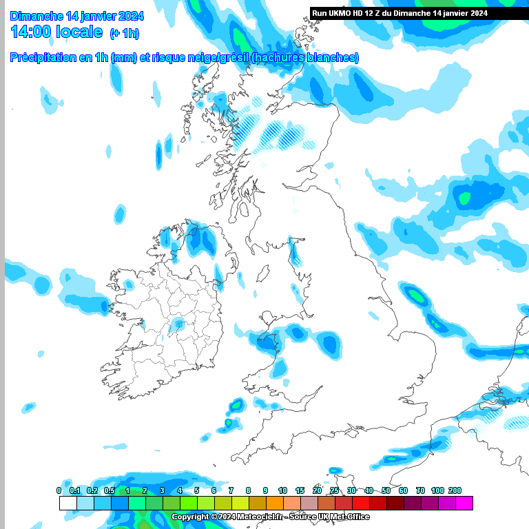
Is it me or is the precipitation dying out from the south west. Looking at radar looks to me like there will be nothing falling from around 2pm at best but can only imagine it will build up again as we go through the day