-
Posts
18,589 -
Joined
-
Last visited
-
Days Won
9
Content Type
Forums
Blogs
Gallery
Events
Learn About Weather and Meteorology
Community guides
Posts posted by summer blizzard
-
-
-
13DEC2023: Nino3: 2.1 , Nino3.4: 2.0, Nino4: 1.4
-
6 minutes ago, Don said:
Considering the climate has changed somewhat since 2010, I would say you would have to favour 2022 being the closest match?
They were very different years even allowing for warming so I don't think we have to allow a substantial discount to 2022.
-
50 minutes ago, Chris Smith said:
I definitely prefer this weather to that currently being endured in Cairns, Queensland. Have we ever had 500mm of rain in 24 hours with a promise of 500mm more?
It's at ~17 Degrees south so very tropical. Basically in Venezuela.
-
Modelling currently suggests that we flip from Nino back to Nina.
-QBO is likely to flip towards +QBO by end of year.
-PDO is likely to persist IMO.
2010 and 2022 seem to be the best analogue matches of recent times.
-
4 minutes ago, Cheshire Freeze said:
We can’t say that.
We can’t say that because at the moment we’re in unusual territory where the strat vortex is being well displaced from it’s usual territory. On top of that we’ve got weather models that can’t even resolve the MJO properly.
With the strat so weak, literally one bit of amplification in the right place at the right time could lock us into cold.
This isn’t the usual winter scenario where we’ve got a strong strat coupled to the trop with endless strong westerlies above…
As the second chart shows even if we end up with a SSW (we don't on this but it would just be a darker blue), it will still be January when it's reached the troposphere.
Thus we are as you say dependent on tropical convection but since it looks like we will miss the boat on on the late phases. Current convection suggests we might persist somewhat into 2-3 but the Indian Ocean is normally not our friend.
-
 1
1
-
-
5 hours ago, Addicks Fan 1981 said:
Wish @summer blizzardwas here as he is probably better at explaining the hovmoller charts than us two and I feel great that I am active here again after what I call myself my own hibernation period.
There are certainly some interesting times ahead and I perceive it as exciting really. It does look potentially like a west based negative NAO set up currently coming up.
Still here.
Tamara knows more than I and summed up the pattern earlier but essentially my take is that tropical convection is in/moving into a position conducive to blocking to our north east and then north west but bar a poor looking northerly attempt it looks like the tropospheric zonal flow is too strong.
We've missed the boat on this tropical cycle I think however it does look like there might be less tropospheric zonal flow and a conducive tropical pattern towards mid January.
-
 5
5
-
 2
2
-
-
3 hours ago, SqueakheartLW said:
SSW or not (not in this case), it's interesting to see that the weakness does actually propagate down.
Remember that Jan 12 failed to achieve an actual SSW but the hit was enough to give us the first half of Feb 12.
-
 1
1
-
-
Interestingly it turns out that the two most likely periods to produce a SSW are 1st-10th January and 20th-28th February.
GFS0z operational got as low as 8ms today but the GFS ensemble mean to 1st Jan was still 20ms.
37% of Euro ensembles do get a SSW between the 7th-29th January (only 17% during week 1 of Jan now) but as the mean is actually rising, I think that's noise.
So my message is essentially that it looks like we don't get a SSW during early January.
-
 1
1
-
-
-
On 15/12/2023 at 09:42, Summer Sun said:
Very little snow here for a good few years. Nothing of the disruptive sort.
Anything last March. We got 15cm.
-
5 hours ago, Cheshire Freeze said:
Looking at how things are coming together, I really wouldn’t be surprised if we see the coldest January in a decade.
The ingredients are certainly there for all to see. I’m pretty sure at this point that somewhere in N Europe is going to cop a severe wintry outbreak…let’s hope it’s the UK for a change.
Assume your referring to 14 years rather than a decade, Jan 21 was colder than Jan 13 (though the later did have the coldest spell).
I'm maybe 40% supportive.
-
40 minutes ago, Greyhound81 said:
Does going back to La Nina in spring mean 2024 will likely be cooler than this year?
There's normally a lag so globally it's impact would be 2025 however for the UK there's no strong annual link. 2011 and 2014 were very mild and during/after La Nina.
-
06DEC2023: Nino3: 2.0 , Nino3.4: 1.9, Nino4: 1.4
MEI also increased to +0.6.
-
3 hours ago, bluearmy said:
The 12z (as if to prove a point ) looks very likely upcoming ssw at the top of the strat day 16
i wonder how many ec46 members will show a reversal by new year ?
About 50% of members go for an SSW with the highest concentration between 1st-12th January.
-
31 minutes ago, marky810 said:
Pounding rain on the roof. This has to be the wettest period for many years. I haven't seen dry roads for weeks. Still at least it's fairly mild.
Aug-Nov 2019 was very wet, it just dried up a little by December while this year waited until mid October.
-
23 hours ago, Summer8906 said:
This links in with the "mild and dry months" in the historical forum.
It does seem to be quite rare for a mild, dry period to set up in early or midwinter (Dec and Jan) for a prolonged period of many weeks, though more common in Feb.
Thinking of the kind of synoptics which are zonal but with the jetstream further north, and an anticyclone over the channel or northern France.
Such synoptics did of course persist for two and a half months in winter 1988/89 and there have been a few shorter periods, but more generally, mild/dry setups tend to become something else (usually mild and wet) in a couple of weeks.
Surprising in a way, I'd have expected a strong high in the Channel or Northern France and a strong but northerly zonal jetstream with lows over Iceland to be a self-perpetuating pattern in the same way that wetter, more cyclonic zonality is.
So I'm wondering what people's thoughts were as to why prolonged mild and dry is so rare in the early/mid winter?
Others have described it well however the two simplest reasons are..
1) High pressure in winter essentially traps cooler surface air when it builds behind a cold front, this makes it difficult for a high to sustainably produce mild weather unless it remains in place several days
2) In winter the continent is relatively cool and thus a persistant SE flow will tend to draw relatively cool air while the SW flows capable of producing warmth are by their nature less likely to persist because the westerlies will tend to try push the high east.
-
 1
1
-
-
-
Perb 3 was best, placement > strength.
-
The question is whether the 16 day GFS operations have greater resolution in the stratosphere than the Euro 32 day forecast.
-
23 minutes ago, Met4Cast said:

Slightly concerned with what’s going on with the MJO, the EC & GFS continue to predict it collapsing whereas BOM remains more amplified but with increasing spread.
Latest outputs have downgraded the strength of the next WWB event too.
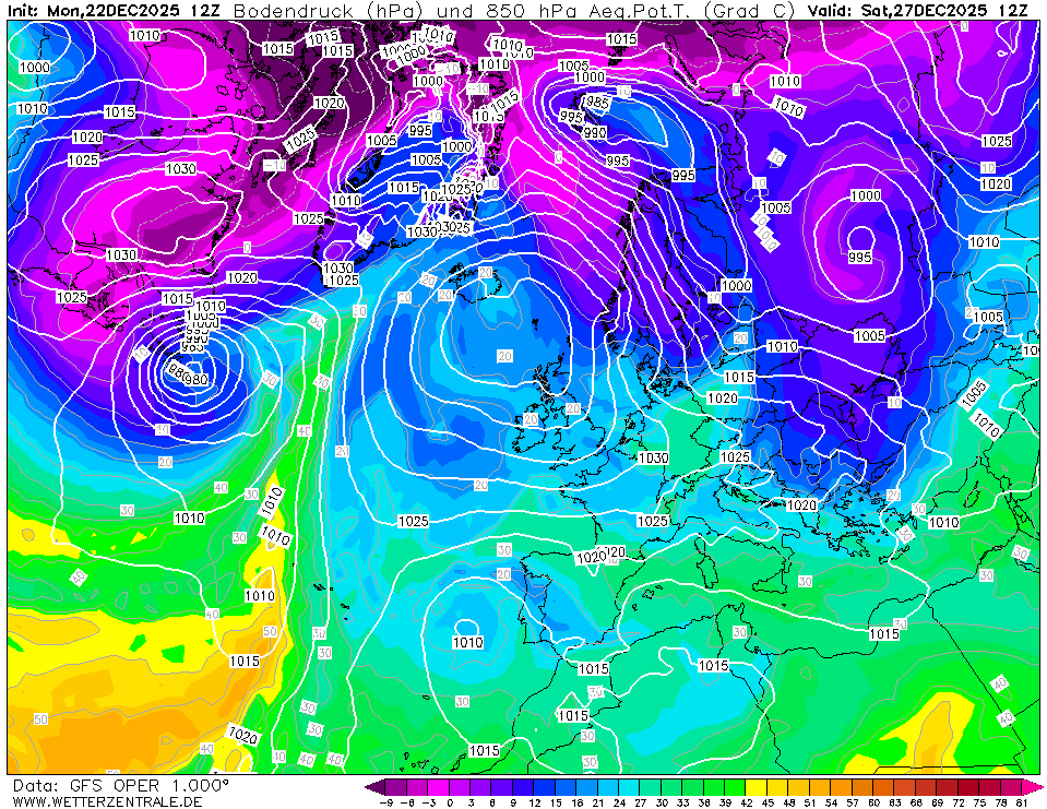
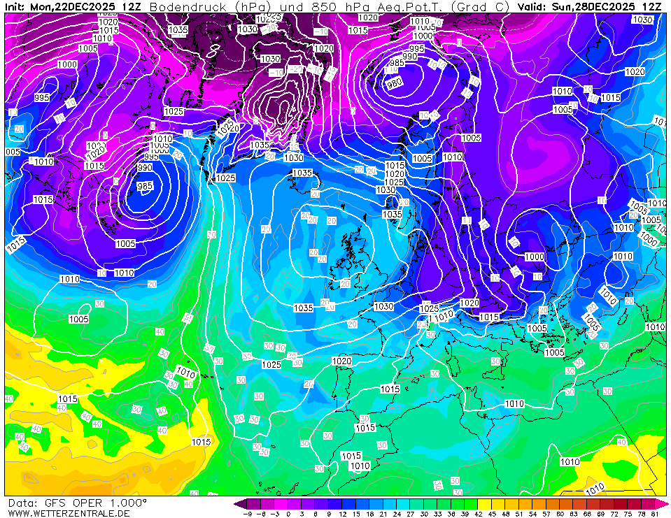
I’m certainly less confident of the UK high amplifying over the Xmas period as I was a couple of days ago.
Worth remembering that this is decaying WWB from November as per that chart. There was always a chance that it would wane, especially relative to the last orbit.
-
1 hour ago, LRD said:
I know weather apps aren't up to much but I'm still seeing 7s and 8s for next weekend onwards. It'll be double that I reckon
1 hour ago, Nick F said:59 minutes ago, LRD said:Thanks Nick. That's really strange. SW wind, high uppers and only producing those temps.
As Nick explains, when the high builds initially it traps the cooler air that passes the UK on the 14th.


Because the high is sufficiently strong, even the intrusion of warm upper air does not entirely remove this at the surface over England.

By the time the incoming low is mixing out the air, the GFS has the next cold push.

-
 6
6
-
-
1 hour ago, northwestsnow said:
I'd not worry too much. We have a reasonal amplitude tropical cycle forecast between phases 4-7 (GFS keeps going back and forth on phase (8)) and phases 4-6 in December are pretty zonal (we actually do well to keep higher than average pressure in the current output). The blocking around the UK/North East of the UK is mainly a phase 7-8 thing and current output allowing for a week or so's lag puts that near xmas.
Basically when the weather is doing what the tropical cycle says it should, that's not a bad thing because the pattern will probably shift. It's when it does its own thing that we need to headscratch.
-
 1
1
-
 1
1
-
-
That's an impressive slip back to La Nina.


.thumb.gif.89c6717ac371341f38552c7718457f08.gif)


Autumn & Winter 2023---2024 Stratospheric Polar Vortex. Events, Analysis, Discussions AND Outlooks
in Spring Weather Discussion
Posted
Three SSW clusters in that first third, the mean avoids it but largely due to spread and the strongest SSW is probably the highest plurality.