Fog and rain are resulting in tricky conditions on the roads and railways this morning. Our weather is a bit stuck for the start of the week but the rain will fade.
Not the best travel conditions this morning with fog and rain causing problems.
With a large area of high pressure just sitting over Scandinavia all week, all the usual Atlantic weather action is meeting a bit of a ‘brick’ wall. Weather fronts will be grinding to a halt over the UK bringing spells of wet weather, the flow will generally be from a non-cold southerly direction but could be quite blustery. Northern Ireland looks colder and there will be a windier spell on Wednesday and later Thursday.
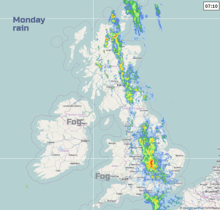
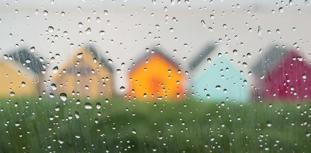
We have rain draped over England and Scotland giving a wet start to the working week. There will be some tricky conditions on the roads this morning with all the water. This rain is from an occluded cold front and has colder conditions to the west but still mild for eastern Britain. There is mist and fog for western Britain and a yellow Be Aware warning for Northern Ireland for fog until 10am.
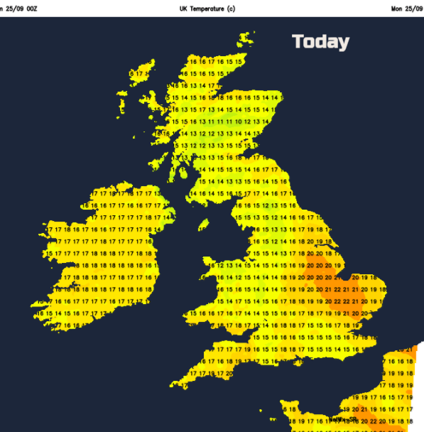
There is a fresh SE wind for Caithness, and the Northern Isles but overall winds will be very light today. Eastern England will feel quite warm today at 20 or 21C and northern Scotland could reach 18C. Other areas stay in the mid-teens, some up to 17C but cooler in the rain. The band of rain will fade through the day, becoming more patchy. So, for this morning there will be further pulses of heavy and persistent rain. The band stretches north/south through Britain and will wobble about slightly until lunchtime. Once the fog has cleared, Northern Ireland will see a fine day with sunshine, western Wales, Cornwall and Devon, the west coast of Scotland all look fine and bright. Norfolk and Suffolk will also see clearer skies and sunny spells.
By this evening, most of the rain will have gone but there will still be a good deal of cloud along the front and drizzle over the hills. It will be a damp murky picture for much of Britain, with the odd heavier burst for central inland hills. The winds remain light and so fog is likely.
Tomorrow
Tuesday will have a grey start in places but will become a fair day with bright spells and a bit of sunshine. Southern and western areas will feel okay at 18 to 20C but the SE breeze will freshen over Northern Ireland in the afternoon. With more of a breeze off the North Sea, eastern Britain will feel cooler, especially if low cloud lingers. There may be one or two showers over eastern England but overall it will be a dry day, and much better for today’s rainy areas.
So, very little synoptic movement in the first half of this week. For the second half, we will see fronts making progress across the UK and stronger winds.
Wednesday
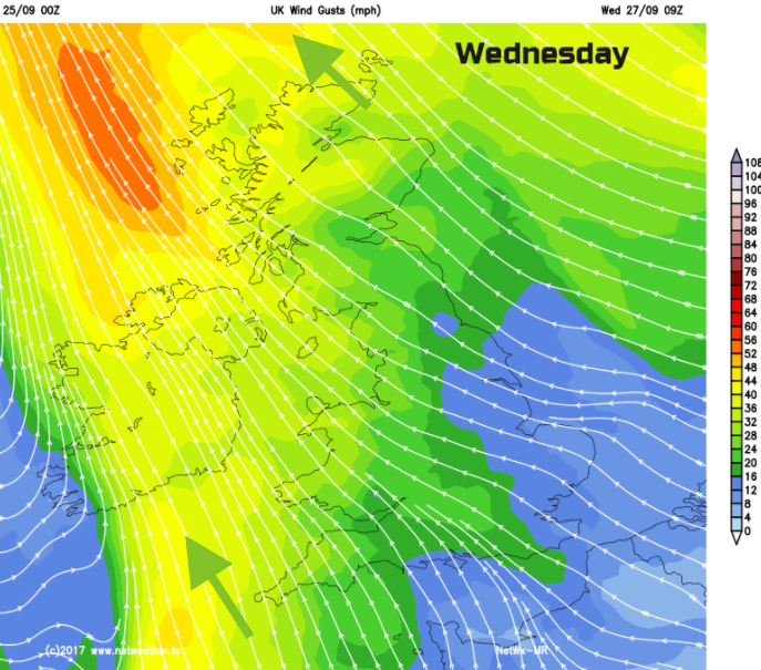
It will be a quiet start for much of Britain with mist and fog about, mainly in the SE. A weather will be heading in from the Atlantic, so there will be the chance of morning rain for Northern Ireland, particularly in the west. Here the winds will pick up from the SE with the risk of gales around western coasts of Britain too. It becomes more blustery everywhere and the rain band may push over SW Britain, and the rest of Northern Ireland during the afternoon. Cornwall and Devon look windy and will be cool at only 14C in the wind and the rain. Ahead of the rain band it will feel warm with temperatures of 17 to 20C and brighter skies. There could be a few showers about and a fair amount of cloud.
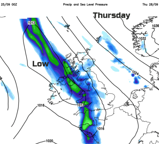
The rain band moves right over the UK during Wednesday night and will be across NE Britain by Thursday morning. The winds veer from SE to westerly and cooler air will reach into Co Fermanagh before dawn. The frontal rain will become patchy and fade and there will be a fine spell before the next frontal system lines up from the west. So, enjoy the drier, sunnier interlude with light winds. The wind picks up again for the Northern Ireland and more rain arrives, it’s an unsettled picture.
The rain band slowly moves eastwards again across the UK with blustery winds. By Friday there will be cooler air for the west and still warmish air in the east
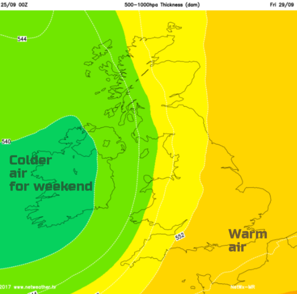
It looks cooler by the weekend as the winds turn more to the west, so more of a nip in the air by night too.
More about Fog and Mist