In the aftermath of Hurricane Maria, streets remain flooded in Puerto Rico’s capital, St Juan, days after the category 4 storm made landfall. Maria was the first category 4 hurricane to make landfall in the U.S territory, last Wednesday, since 1932, with 155 mph winds knocking out power across the entire island and dumping 20-30 inches of rain in 24 hours.
Although Maria has moved on way to the northwest, further rain has been falling from trailing rain bands and authorities in Puerto Rico have been evacuating people because of the potential of the Guajataca dam failing - which could impact 70,000 people.
Puerto Rico narrowly missed landfall from Hurricane Irma two weeks ago, which was a category 5 storm when it passed north of the island, bringing strong winds and heavy rain, but not as much devastation as Maria did a few days ago.
Maria has killed at least 24 people in its rampage across the Caribbean, including 11 people in Dominica, 7 in Puerto Rico and 2 in Guadeloupe.
After leaving Puerto Rico, Maria passed near the Turks and Caicos islands on Friday, but is expected to spare the Bahamas as it turns away from its recent track to the northwest to more of a northward motion out into the open waters of the western Atlantic this weekend.
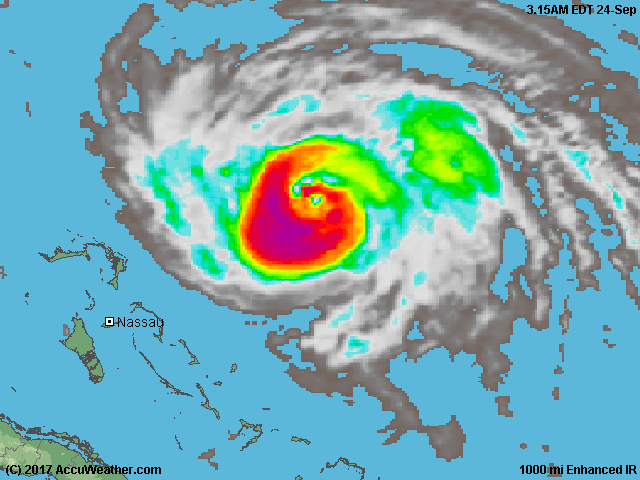
Maria was a category 3 hurricane moving NNW at 8mph, with 115mph sustained winds, as of Saturday evening BST, with little change in strength expected over the next 48 hours.
The hurricane is expected to move between Bermuda and the east coast of the United States next week, probably as a category one hurricane by then.
But the question is how close will it get the east coast? Because some most recent model runs have been bringing the hurricane closer the U.S mainland than before.
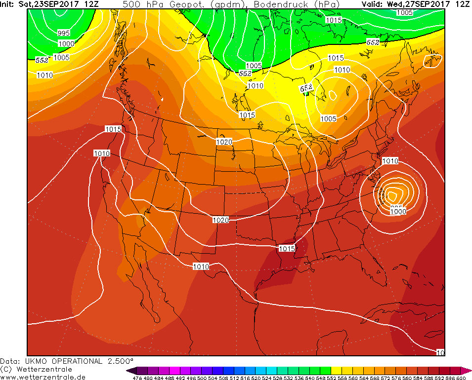
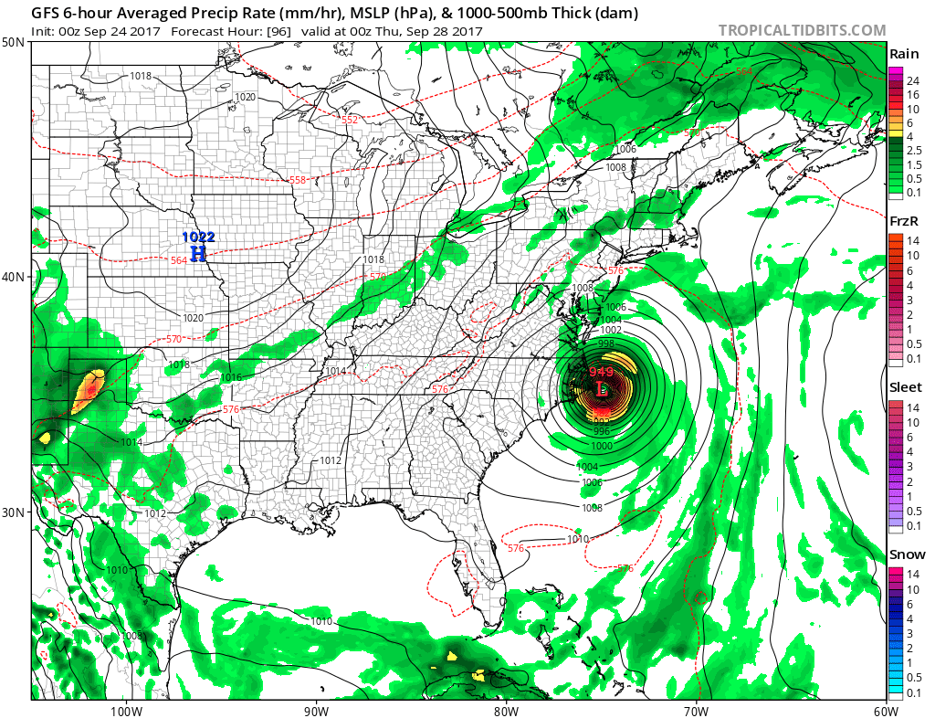
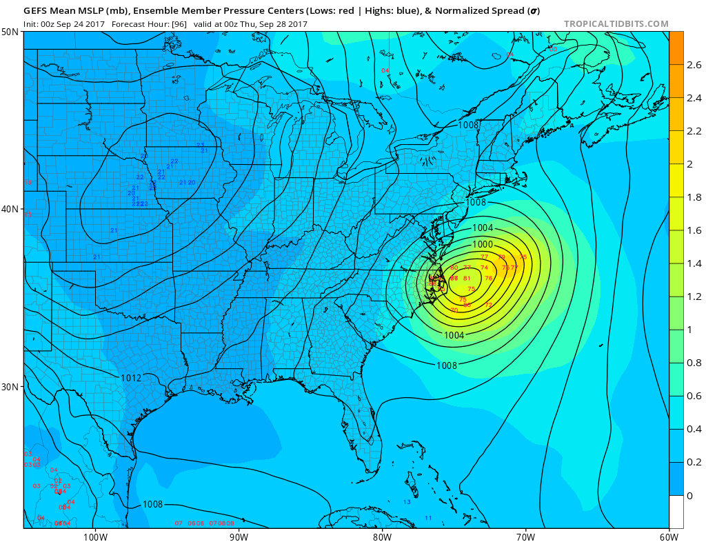
Saturday's 12z UKMO global model run brought the centre of Maria perilously close to the Outer Banks of North Carolina this coming Wednesday. An this morning's 00z GFS operational along with the GEFS (ensemble) MSLP mean brings the centre of Maria close to the Outer Banks too. Any more deviation by only 50 or so miles further west and we could even have a landfall along the coast. Though this morning 00z UKMO and ECMWF high res runs keep Maria further east out over the western North Atlantic.
Yesterday's 12z UKMO MSLP
Today's 00z GFS operational MSLP for this Wednesday
Today's 00z GEFS (ensemble) mean MSLP for Wednesday
So, residents in coastal North Carolina and even counties just inland may find themselves under a Hurricane Watch on Sunday. Maria will also bring high surf and dangerous rip currents along U.S. East Coast next week.