


Wondering why the hot weather, that teased us earlier this summer, is reluctant to return? Blame an unusually southerly tracking jet stream.
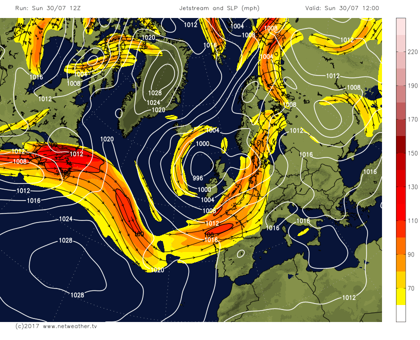
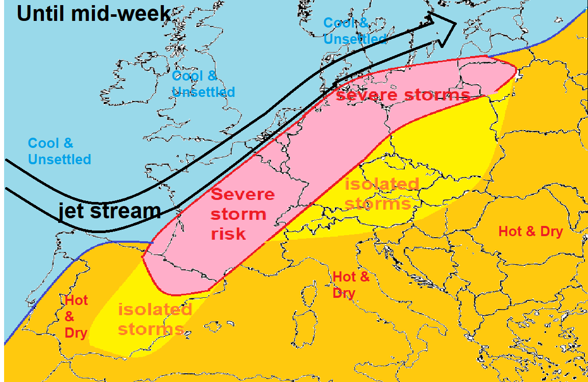
Low pressure will dominate the weather across NW Europe for much of the coming week, feeding in cool air from the far north Atlantic region and bringing unsettled and often windy conditions. The cool and changeable weather plaguing the UK, Ireland, northern France, the Low Countries and also other parts of northern Europe including the north of Germany, Denmark and Scandinavia this week will be separated from hot and humid air across southern and central Europe by a slow-moving cold front which will lie from SW France/northern Spain northeast across France, Germany and up across northern Poland. A strong jet stream will run parallel on the northern side of the cold front, helping prevent the hot air from moving further north towards the UK.
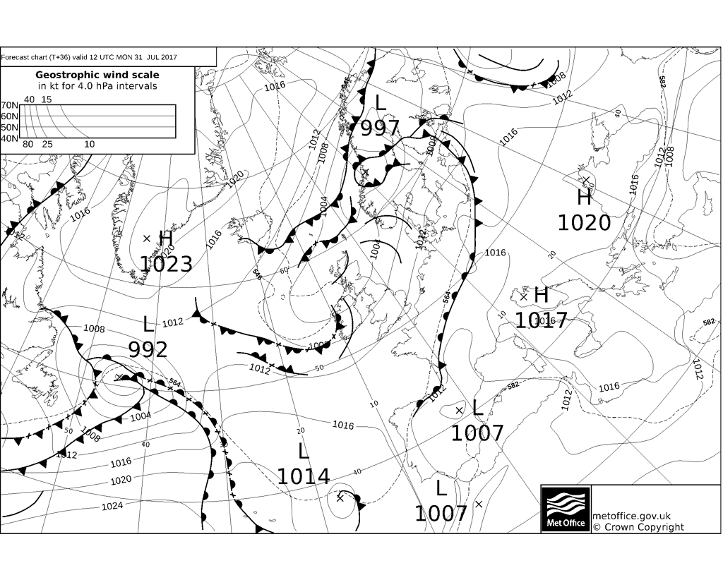
UKMet fax charts show cold front stretching from SW France NE to the Baltic States much of week, seperating heat to the south and cooler air over NW Europe.
Jet stream parallel to frontal boundary helping to re-inforce the separation of heat over southern/central Europe and cool air over NW Europe
The most intense heat across southern Europe is currently across southern Spain, where temperatures on Sunday reached 41C across central southern Spain, and although the intense heat will ease a little early this week, temperatures are then forecast to reach 40-43C across southern Spain on Thursday, central and eastern Spain along with southern France reaching the high 30s.
Temperatures mid to late week perhaps hitting low 40s across Italy
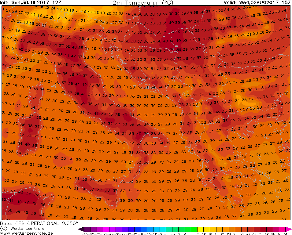
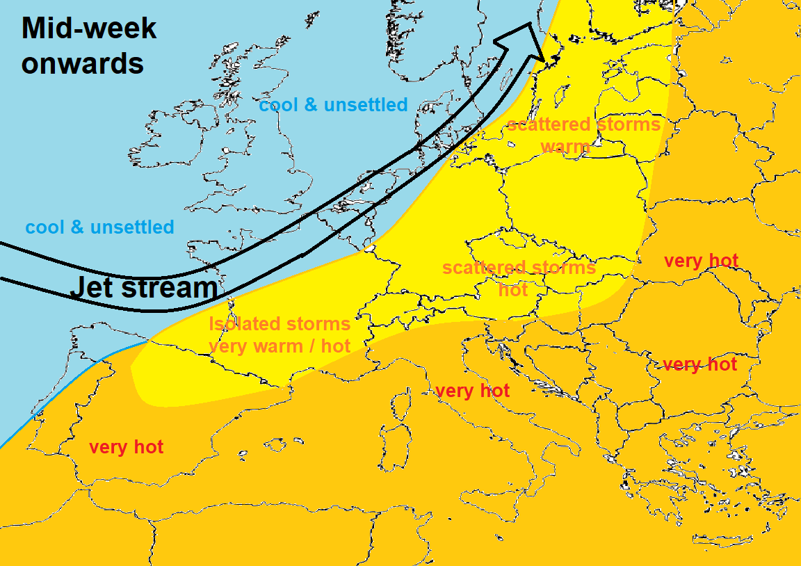
The heat will then build further east across the Mediterranean and northeast across parts of central and eastern Europe early this week. Temperatures perhaps reaching 40-42C across central parts of Italy on Tuesday, Wednesday and Thursday, widely in the mid-to-high 30s across much of central and eastern Mediterranean and across the Balkans, with temperatures reaching the mid-30s further north across Switzerland, southern Germany, Austria, Czech Republic, Slovakia and even Poland.
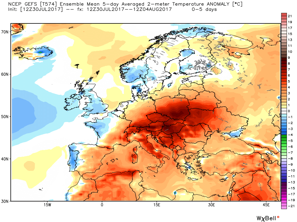
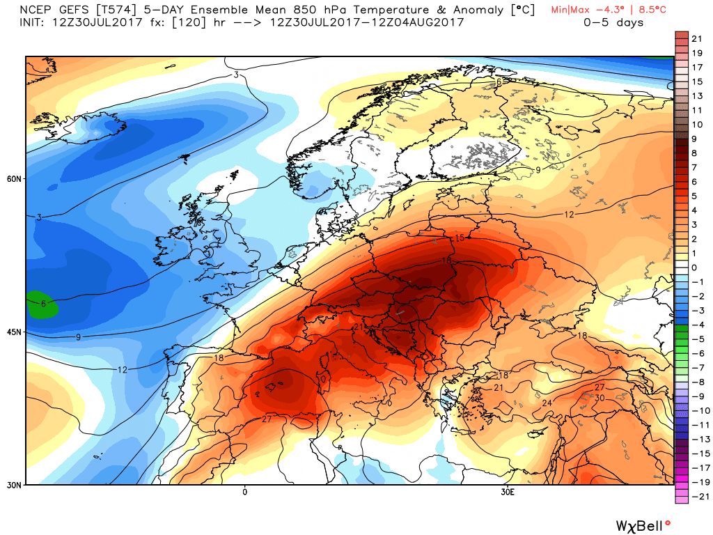
GEFS 5 day 2m and 850 hPa temperature anomaly. Credit: Weatherbell
The frontal boundary between this heat to the south and east and cooler, fresher conditions in the low to mid 20s across NW and far north of Europe will bring several rounds of severe thunderstorms in a swathe from the Pyrenees/NE Spain northeast across central and eastern France, Germany, Poland and on up into the Baltic states until at least mid-week, before the risk eases away across eastern Europe. These storms bringing a risk of flooding, large hail and squall / locally damaging wind gusts. The Alpine regions will also see a risk of thunderstorms developing most afternoon this week, but for much of southern Europe it will remain dry and hot with prolonged sunshine, just a small risk of a thunderstorm across eastern Spain.
So, if you're left wondering why the bursts of heat we had earlier this summer aren’t returning in the near future, which at the moment seems likely, then I would like to attribute blame to the jet stream’s unusually southerly track into mainland Europe recently, this coming week and probably further beyond that through the first half August. Because the jet stream is, in effect, keeping the heat suppressed to our south and keeping us in a cooler polar maritime airmass much of the time.
For the heat to return, we need to see the jet stream track to the north of the UK, not the south. Normally at this time of year the jet stream should be between Scotland and Iceland, so there is hope that it may drift north by the end of summer.


