High pressure will be in charge of our weather this week, bringing a lot of sunshine, but you'll be doing well to see much of it today.
There's a lot of sunshine on the way this week, but you'll be doing well to see much of it today. High pressure is currently trying to assert itself over the British Isles, but as it builds in from the west through today, there's a weak front trapped underneath it and a good bit of moisture in the atmosphere, so there's lots of cloud.
The front itself is over southern England this morning, bringing some patchy rain. It'll take its time to clear, finally getting away from the south coast during the first part of the night. To the north of that, the cloud will thin and break a little this afternoon from the Midlands northwards. Head into Scotland, and there'll be some better sunny spells but also some showers, where it'll also be quite blustery.
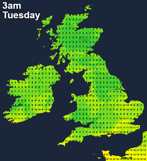
Those to the north of the front will also be into cooler, fresher air with temperatures of 13-16c. In the south, despite the thicker cloud and patchy rain highs of 18-21c will be more typical. Overnight, with clearing skies away from the far south, it'll be a chilly one with lows into single figures widely.
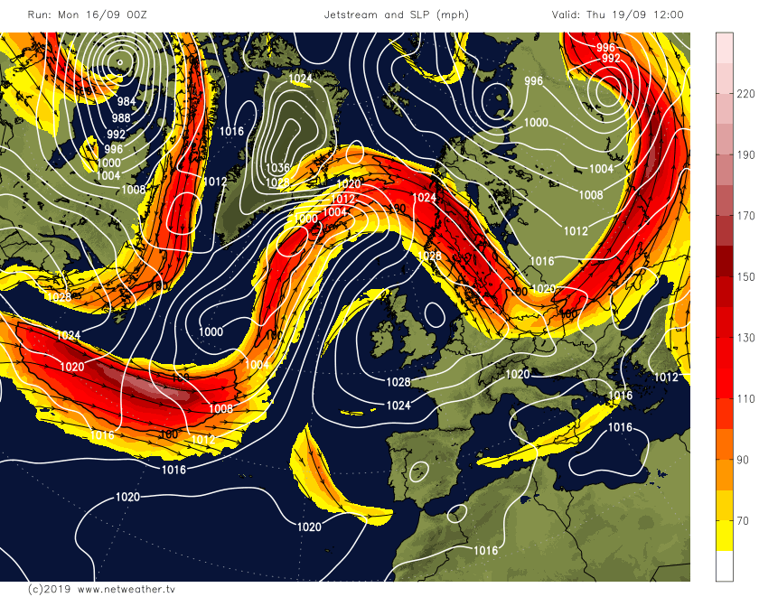
Then from tomorrow (Tuesday) onwards, there'll be more sunshine. And high pressure will be over the top of the UK right through until the weekend. Initially, we'll have reasonably cool air in place, so after some chilly starts, temperatures will peak into the teens. But later in the week, as the jet stream buckles and pushes further north of the British Isles, warmer air will push up from the south.
That means by Thursday, instead of the high teens being the max, some parts at least will head up into the low-twenties. Not too bad for the second half of September. One thing we'll have to watch out for all week, and particularly from Wednesday night onwards is the threat of some mist and fog patches developing. A few of these may be slow to clear into the mornings too.
One exception to the fine, dry rule will be the far north and northwest of Scotland, as fronts just brush in at times bringing some extra cloud and mostly patchy rain. Even here the picture should improve after midweek though.
Looking further ahead, it does appear that changes will be afoot next weekend, with the high pressure set to be shoved away further to the east. That'll allow low pressure from the Atlantic to make a move our way.
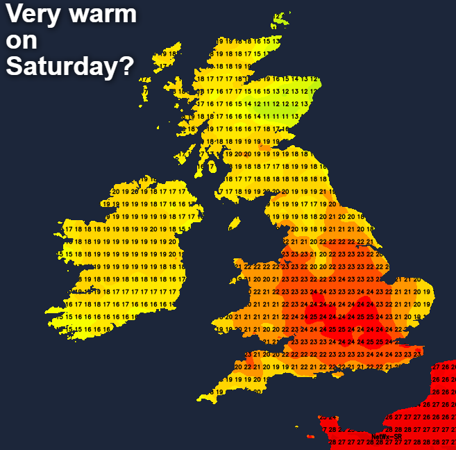
The timing is tricky to call at this point, but Saturday could see some wet weather arriving into the far west and northwest, with other parts dry, sunny and potentially very warm. By Sunday though, the unsettled weather may well breakthrough to affect other parts of the country.