


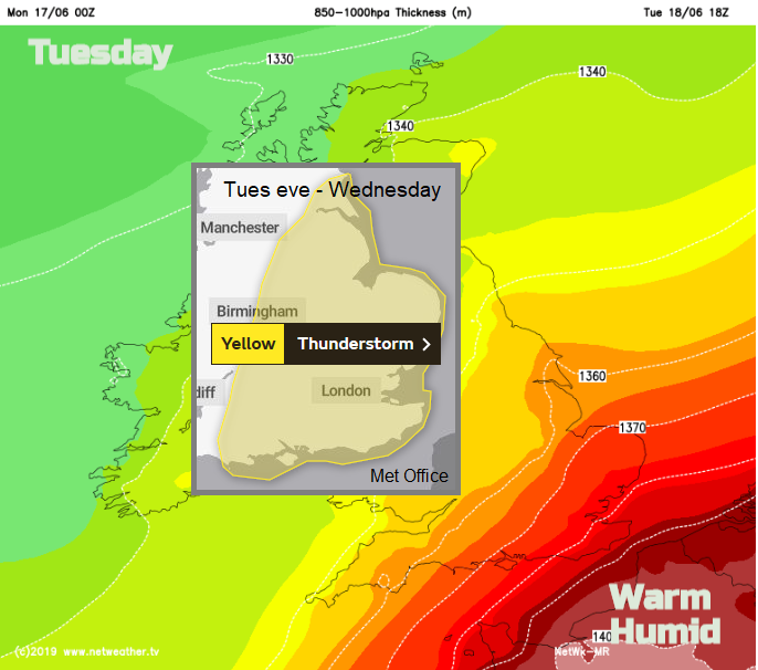
As warm and humid air arrives Tuesday / Wednesday for SE Britain there is the risk of thunderstorms and heavy rain. Some areas still haven't recovered from last week.
High pressure is lurking away to the SE over Europe and tries to build in for the end of this week. High pressure would bring more settled and drier conditions, needed after all the recent rain and flood events. However, this week looks rather mixed, with hefty showers, a Met Office yellow warning for thunderstorms but some warm sunshine too.
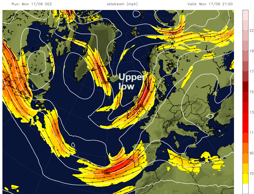
The Jetstream has partly dived away well south invigorating a low pressure near to the Azores which will head over France and in that flow bring warm and humid air to the SE and the threat of thunderstorms.
The SE of England could see temperatures up to 25C if cloud breaks occur and it will feel muggy and close. For many parts temperatures are in the high teens over the next few days, so up on last weeks dip.
 Click for latest image
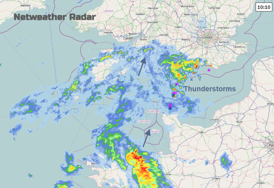
There was more rain overnight for NW Scotland and this morning we could be seeing the first signs of hefty showers crossing the English Channel on the radar.
The Met Office warning only starts at 6pm on Tuesday evening, running through Wednesday, but there will be downpours before that with more cloud in the south. The central swathe of the UK has a fine day and there will be more scattered showers for Northern Ireland and NW half of Scotland .
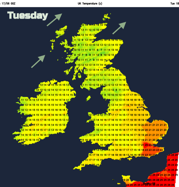
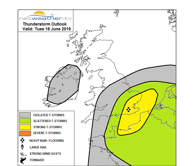
The southeast could see 25C today if sunshine breaks through the cloud cover. The Met Office Thunderstorm warning covers an area Dorset to Lincolnshire south wards The area may shift slightly to include western England as there are still flood warnings for the Severn and Vyrnwy catchments, and still for Lincolnshire from last week’s rain. Also, the timing may alter as the main passing of hefty showers and potential thunderstorms looks to have passed by early Wednesday evening as the warmer, humid air clears away and everywhere looks fresher. Temperatures in the high teens just low 20sC. High pollen values for parts of England this week.
The rest of the week, sees a westerly flow bringing showers, but as pressure builds there will be more settled conditions, but not completely dry, for the end of this week.
Worried about flooding, how to get information and stay up to date


