More rain over the next few days for Northern Ireland and NW Britain. Blustery winds too but warm for midweek, often muggy and close. Fresher on Thursday.
Temperatures values today won’t be that high, but the air is feeling close and muggy. It will be warm in the low twenties or high teens for much of the UK, London managing up to 25C with more sunshine. Through this week temperatures peak in the low to mid-twenties, maybe higher for the SE on Sunday but it’s not the over 30C heat from earlier in the summer. You might still find the humidity a struggle though.
Yesterday’s thunderstorms and heavy showers have faded. There was plenty of weather action during the Monday evening rush hour for parts for northern and eastern England. It’s different today. There is rain coming in from the Atlantic, a frontal band bringing more cloud and wet weather over Northern Ireland, into Scotland and then this afternoon over the far north of England.
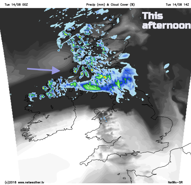
Many areas are cloudy this morning, with breaks appearing allowing bright or sunny spells to come and go. The SW to westerly wind picks up a bit today and will help with breaking up the cloud to the lee of high ground. So, more sunshine for Powys, eastern England and Aberdeenshire until the lunchtime rain arrives.
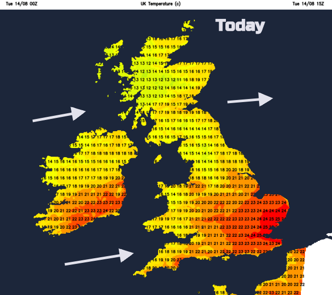
The cloud and rain will affect the temperatures, holding them back in the mid-teens. Belfast could see 20C and eastern Scotland. Wales will reach 18 to 21C. England will feel muggy at 20 to 23C with higher for London and Essex.
The rain becomes more patchy, with a cloudy band still over Northern Ireland W and SW Scotland and NW England into the evening. To the north there will be clear spells, a few showers from the west and a fresher feel to the air with temperatures falling into single figures. To the south of the frontal band it will be clear and dry but staying milder.
During Wednesday the weaker waving front reinvigorates as another area of low pressure heads in. The winds freshen, and further bands of rain appear from the NW.
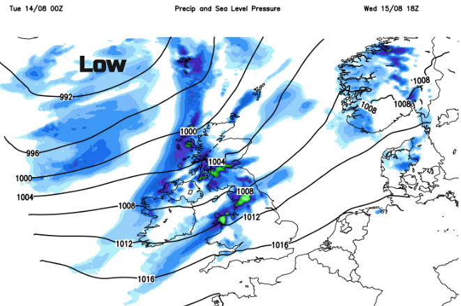
The UK is rather stuck this week in a westerly flow as low pressures nip past to the NW, with more cloud and rain and high pressure lurks away to the SW, trying to build in but floundering rather.
The midweek setup will be active enough to force a frontal band SE down through England, so there will be a spell of rain starting on Wednesday afternoon over Cumbria and NW Wales, moving through Wales and the Midlands overnight. This will then pass over East Anglia and SE England during Thursday but will become more patchy and showery by then.
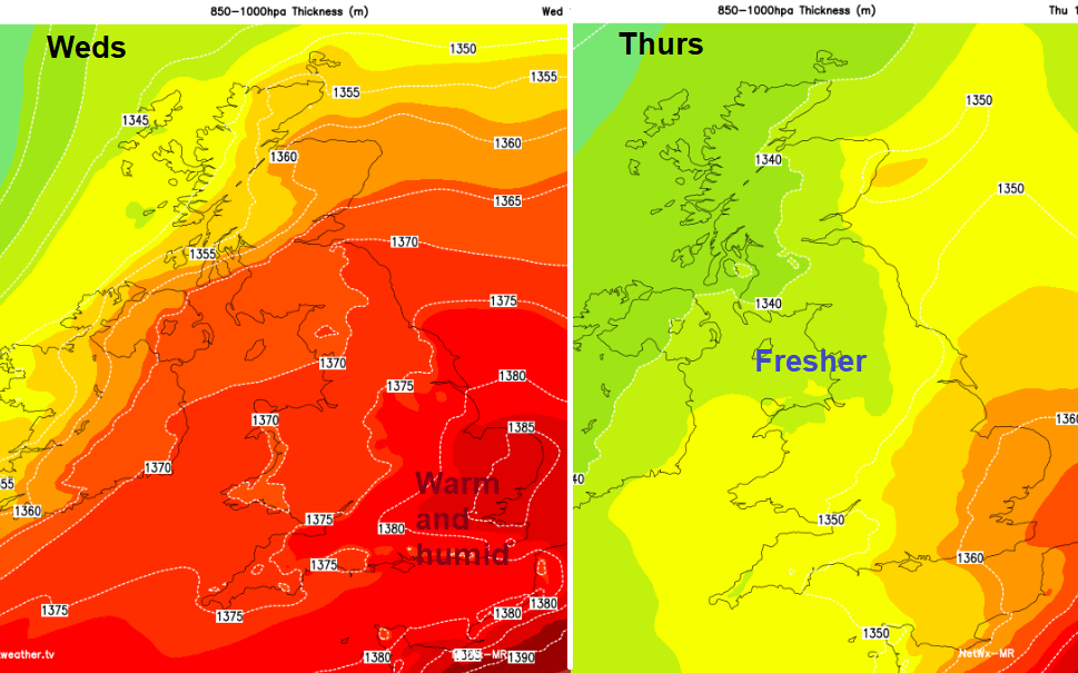
This will bring a change of air mass, with a much fresher feel for Thursday. It will be bright, with blustery showers again from the west. Then another bout of wet and windier weather heads in for Friday.
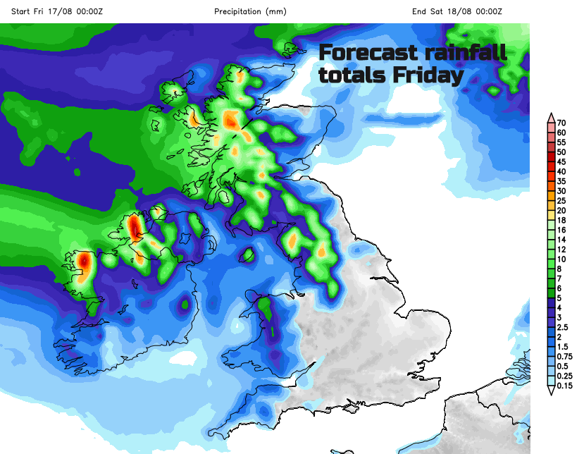
The rainfall totals image shows the areas forecast to see the rain, and again the SE half of Britain missing most of it.