A northwest - southeast divide in our weather will be a regular feature this week with hot, often sunny weather further southeast, more cloud, cooler and some rain at times further northwest.
We have a hot week on the way, but not for everyone. It's probably the most common split in our weather that we see, with the northwest often seeing cooler, fresher, windier and from time to time at least, wetter weather. Whereas further southeast, it's sunnier and hotter.
The animation below (from the ECMWF model) shows what'll be going on. With low pressure moving near to the northwest at times, but high pressure staying in charge further southeast, keeping the warmer air in place.
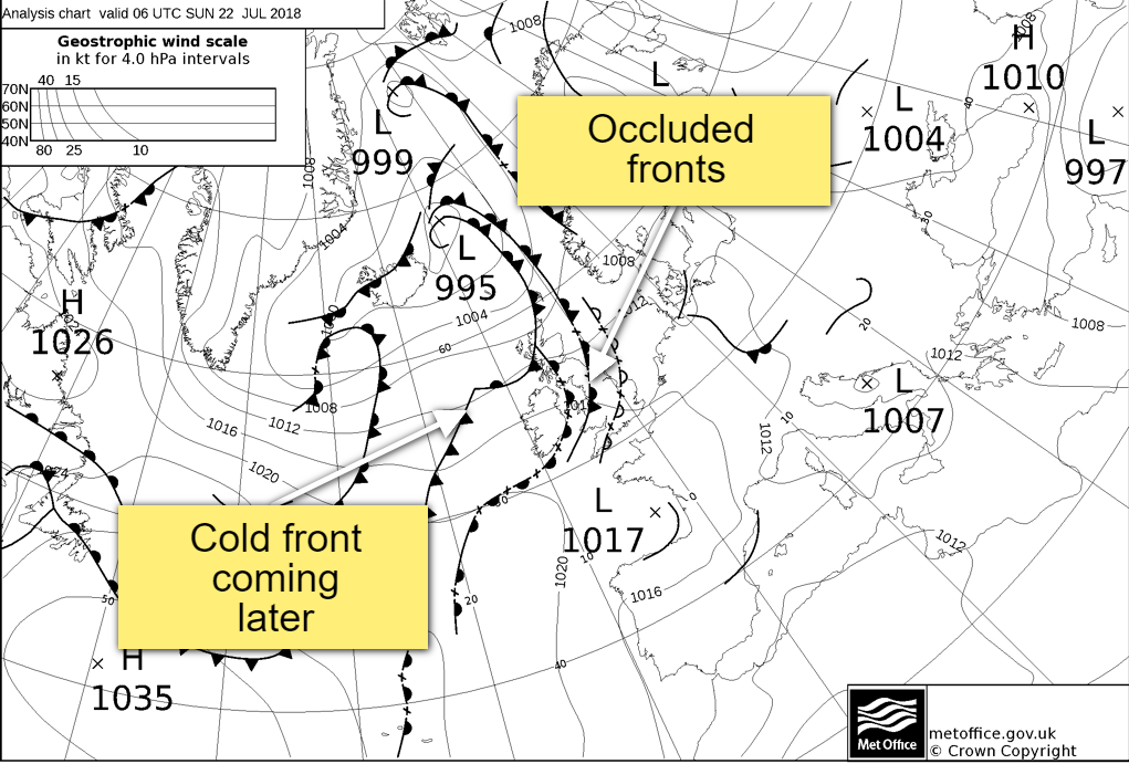
What you may also have spotted on the animation is that the milder air (oranges), does get squeezed further southeast at times. And that's as weather fronts move down from the northwest, a few of which are with us today. There isn't much rain associated with them, but they're the reason we have cloudier skies across a good bulk of the country. This set are occluded fronts, but a cold front will be following down from the northwest later and into Monday - it'll bring more in the way of rain, especially to the northwest, and will introduce some fresher air behind it.
There will still be some sunny spells today though, especially in central and eastern parts of the country, and it's here where it'll be warmest with highs into the mid-high twenties. Elsewhere, 18-22c will be typical but feeling humid everywhere.
Overnight, and into tomorrow, that cold front starts to move down from the northwest. It'll bring a few heavier bursts of rain with it to the northwest of Scotland but will tend to break up and ease down the further southeast it moves. For the northwestern half of the country though, tomorrow will be another often cloudy day with some patchy rain in places. The best of the sunshine will further south and east, and temperatures by this point may well be touching into the thirties in the southeast corner.
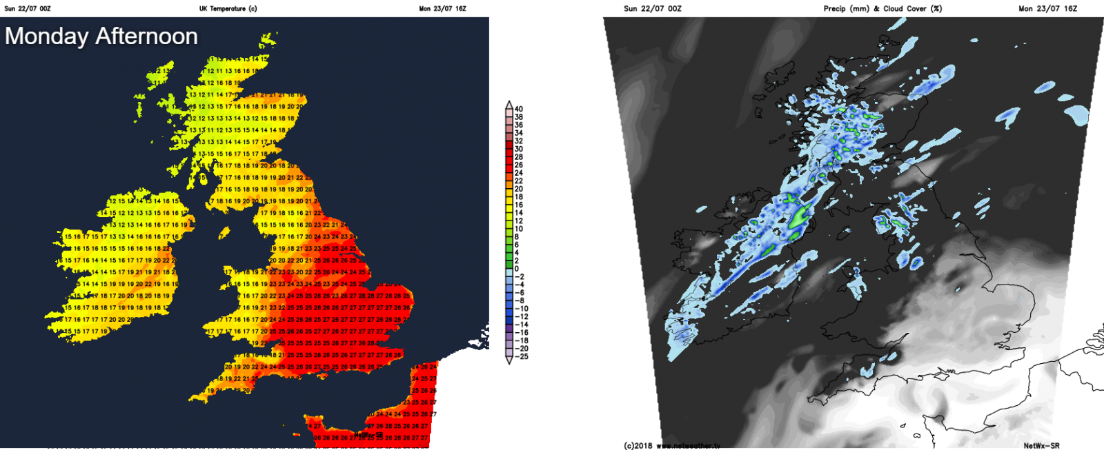
The front will still be in situ over northern and western England into Tuesday, with a little patchy rain on it. To the southeast of it, more heat and sunny spells, to the northwest, fresher with sunny spells and maybe one or two showers.
Into Wednesday, the front fades to leave a good part of the country dry and fine. The warm air will be allowed to creep further northwest again too with most parts seeing highs nicely into the twenties, but the southeastern quarter of Britain will still be hottest with maxes into the high-twenties or low-thirties. Thursday will be a very similar day, but cloudier skies and patchy rain may well make their way into western regions through the day.
The end of the week is set to bring an Atlantic low toward the northwest of the country, so there's liable to be some rain and windier weather arriving into the west. Elsewhere though, another fine dry and very warm or hot day, with highs by this point perhaps edging toward the mid-thirties in the southeast.