Cool and changeable over the coming days, with spells of wet and windy conditions interspersed with sunshine and blustery showers.
We will all see some rather autumnal weather to end the week, through the weekend and likely into next week too, as Atlantic depressions pass close to the north of Britain, bringing spells of wet and windy weather interspersed with sunshine and blustery heavy showers. Sunday looks like seeing a particularly deep low cross Scotland later in the day, which could bring gales around coasts.
Although we will some wet and windy weather over the next few days, it’s a teddy bear’s picnic compared to Hurricane Irma which is bringing sustained 185 mph winds and devastation to parts of the Caribbean. Irma, a category five hurricane, passed just north of Puerto Rico last night and will graze the north of the Dominican Republic today, before passing between Cuba and The Bahamas during Friday and early Saturday, before perhaps making landfall across southern Florida on Sunday, perhaps as a category 4 or 5 hurricane, though the track by this time is still uncertain.
To keep up-to-date on Irma, read our dedicated thread on our weather forum.
Back to a somewhat calmer UK today and across much of England it’s dry and fine start to Thursday, with the best of the sunshine across central, southern and eastern England. It’s a different picture further north and west, as an Atlantic depression approaches the northwest of Scotland, bringing outbreaks of rain across Scotland, Northern Ireland and recently Cumbria, heavy over western hills, with some showers further south across parts of Wales and SW England.
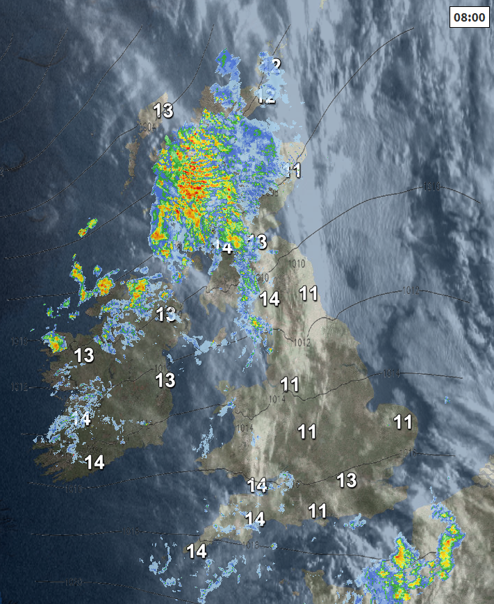
Through the day, the wind will strengthen across the west and later southern coasts too, with further outbreaks of rain spreading east across Scotland, N. Ireland and northern England, heavy across hills in the west. So, a thoroughly wet day across the north today. Further south, cloudier skies with showers across Wales and SW England will spread eastwards across England, after a sunny start across eastern England.
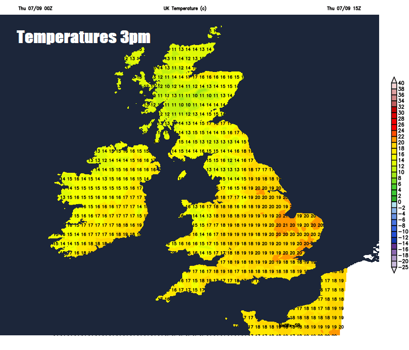
Temperatures reaching 16-19C across southern areas, perhaps 20C in London and parts of eastern England. But for the cloudy and wet areas in the north, temperatures reaching a cool 13-16C at best this afternoon.
Becoming windy everywhere with bands of showery rain spreading south-eastwards across Britain Thursday night into Friday morning, clearer spells and blustery showers following across northern parts. Temperatures falling to 10-13C in the north, 13-15C in the south.
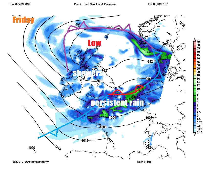
Southern parts of England and the far south of Wales seeing outbreaks of rain, locally heavy, through much of Friday, accompanied by a strong westerly wind along the south coast. Elsewhere it’s a case of bright or sunny spells and blustery showers – which will be locally heavy and perhaps thundery. A brisk westerly or northwesterly wind everywhere, so feeling rather cool, temperatures reaching 14-16C in the north, 16-18C in the south.
A cool and windy picture for the weekend, certainly feeling autumnal. Sunshine and showers for most on Saturday, which will be locally heavy with hail and thunder, temperatures reaching 14-18C in a cool and blustery northwesterly wind.
A bright start on Sunday towards central, southern and eastern England, but a deep low approaching NW Scotland will already be bringing wet and windy weather across the west early morning, before sweeping east across all parts during the day, followed by bright spells and blustery thundery showers in the north and west in the afternoon. Rain clearing the southeast in the evening. Gales developing in the west.
A quick look into early next week and looks like Monday will be windy with sunshine and showers. Tuesday perhaps calmer, drier and brighter, before another potential deep low arrives towards NW Scotland Tuesday night bringing a return of wet and windy conditions into Wednesday morning, before clearing to sunshine and showers.