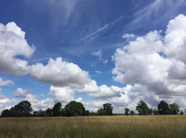
We have a lovely Saturday with plenty of blue skies and warm sunshine. Things begin to change from the west with rain and brisk winds on their way.
It’s a lovely start to Saturday with sunshine, plenty of blue skies and just a slight autumnal nip in the air. Temperatures fell away overnight under those clear skies, so we have a cool start, but it will be a lovely day. Tomorrow starts off fine one more for much of Britain, but rain will spread in from the west.
This morning we do have a few pockets of mist and patchy fog as there are only light winds and it is colder this morning. Also, there is some low cloud over western Scotland and the NW Highlands, but this will break up. There was a cracking line of thunderstorms overnight for SE Britain, skirted by London and is now away in the eastern Channel.
There is a small chance of a shower for East Anglia and SE England as the instability remains close by. With little wind, they will be slow moving and spoil a super day, but hardly anywhere will see one

Temperatures
At times, even though it is sunny, the air does still feel cool. The top temperatures this weekend are only high teens to 21 or maybe 22C (72F). This is about average. There is nothing hot showing up in the coming week. It won’t be as nippy tonight with more cloud and a breeze.
Winds
Overall the winds are very light today, with more of a southerly taking hold for western Britain and Northern Ireland by lunchtime. This afternoon there will be a fresh wind blowing over Northern Ireland and through the North Channel, so blustery here.
By teatime, it looks like rain will be arriving for Co. Fermanagh. There are a set of fronts pushing in from the Atlantic. These will bring more cloud, rain and freshening winds. Northern Ireland turns wet through Saturday evening whereas much of Britain stays dry with clear skies.
Tomorrow
By Sunday morning eastern Britain will still be fine and bright with a bit of high cloud. The rain will have reached Wales and the West Country and also be over western Scotland. There will be a southerly wind and more cloud about with outbreaks of rain creeping over NW England and the West Midlands. Northern Ireland will see some improvement with the rain becoming more patchy but will stay quite cloudy. It will be windy along the Antrim coast, across to Arron and through the Irish Sea. Eastern England and Aberdeenshire should manage to stay dry for much of Sunday but just turn more cloudy.
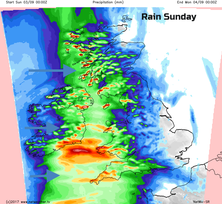
Temperatures could reach 21 or 22C again for Lincolnshire, Cambridgeshire, and London again. Under the cloud and rain, it will feel quite cool with temperatures of only 15C. Later in the day, warmer air will creep into SW parts of Northern Ireland and Cornwall. The rain becomes quite patchy as it moves across Britain overnight, with a few heavier bursts for Western Scotland.
Outlook
A deep low near Iceland pushes, even more, weather fronts our way with the heaviest rain over Scotland particularly the NW, maybe trailing into Northern Ireland. Monday looks breezy with outbreaks of rain mainly for western areas, a good deal of cloud and the highest temperatures in the east again at 21C. It will feel quite warm and humid though. More schools will be Back to School this week and stays quite mixed. Tuesday will still feel warm and humid for England and Wales, but there could be a pulse of heavy rain spreading in from the SW, keep an eye on the forecast for its progress as there is low confidence about where it will move over Britain and so it may not be showing on your app. Wednesday looks drier but quite breezy and won’t feel as humid. By Thursday, there is more rain from the NW, but it’s still looking settled for the south and east.