Harvey continues to bring even more rain to Texas as the catastrophic situation persists. This system will have no direct impact on the UK but another circualtion is developing off the eastern seaboard
Atlantic Hurricane season 2017
Harvey continues to cause mayhem in Texas and problems in Louisiana with days of heavy rain and catastrophic flooding. Still, at Tropical Storm strength, there are continuing warnings about the rainfall "ADDITIONAL HEAVY RAINFALL OVERNIGHT IS EXPECTED TO WORSEN THE FLOOD SITUATION IN SOUTHEASTERN TEXAS AND SOUTHWESTERN LOUISIANA."
The news is full of footage and photos of the flooding in Houston and surrounding areas as this storm just grinds away in the Gulf, feeding on the warm waters, sustaining its life and drenching the southern states. Later on Wednesday, it is forecast to move inland across Louisiana, finally cutting off its energy source and should then weaken as it heads north. Then the recovery can truly begin, and it will be a long, long process.
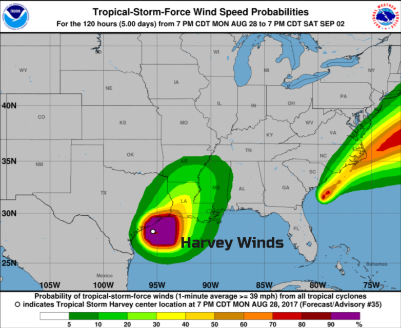
You'll notice on this wind graphic that it is not only the winds from what was Hurricane Harvey, showing up. There is also a streak of strong winds along the eastern seaboard. This is already being listed by the National Hurricane Centre as Potential Tropical Cyclone Ten. It's just off the coast of the Carolinas, and already there is a Tropical Storm warning out:
RAINFALL: The system is expected to produce total rain accumulations of 3 to 6 inches along northeastern South Carolina, North Carolina, and southeast Virginia coasts, with possible isolated maximum amounts of 9 inches. The heavier rains may result in some flooding concerns along coastal areas
With the possibility of tornadoes and dangerous swells and surf. Currently, it is 50/50 that this will form into a tropical cyclone, but even if it doesn't, this system is producing heavy rain and strong winds, enough for warnings to the east coast. The next name on the list for this year is Irma then Jose.

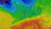
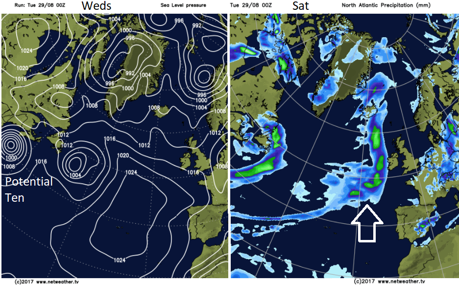
This one will head up across the Atlantic and become entrained in the weather heading towards the UK. It could give a bit of oomph to weather systems coming in from the west. After a fine looking Friday and start to the weekend, a frontal system with some tropical energy could bring heavy rain off the Atlantic and that 'weird too warm feeling' air we get with tropical remnants. However, it's all a few days off, got a lot of forming to do first and high pressure over the UK could hold any Atlantic unsettledness at bay.
We'll await developments off the east coast of the US, see when Harvey finally moves inland and it stops raining in Houston and even now another formation area is being watched off the west coast of Africa. With 70% likelihood of a tropical cyclone developing just south of the Cape Verde Islands, there are already warnings of heavy rain over the eastern Atlantic island group. This could then track right across the Atlantic and trouble the Caribbean or US next. Harvey did both, moving by Barbados and the Lesser Antilles a week before hitting Texas as a Category 4 storm and we still have September til November left in the official Atlantic hurricane season.
More discussion on the Community Forum - Hurricane Harvey


.png?w=350)