


Unfortunately the change of month will not see a change from the cool and unsettled conditions, with further showers this week and a spell of wind and rain on Wednesday.

As we end July and start August, the weather shows little signs of getting out of the current cool and unsettled rut, with the prospect of low pressure nearby bringing further showers this week, with a spell of wind and rain on Wednesday.
A blustery Sunday saw widespread thundery downpours develop across Britain, courtesy of low pressure parked nearby to the northwest. A persistent line of showers that formed along a wind convergence zone inland across the SW Peninsula of England, colloquially known as the ‘Brown Willy Effect’, named after the highest point on Bodmin Moor, brought over a month’s worth of rain to Okehampton – which received 84.5mm (3.3 inches) in 6 hours.
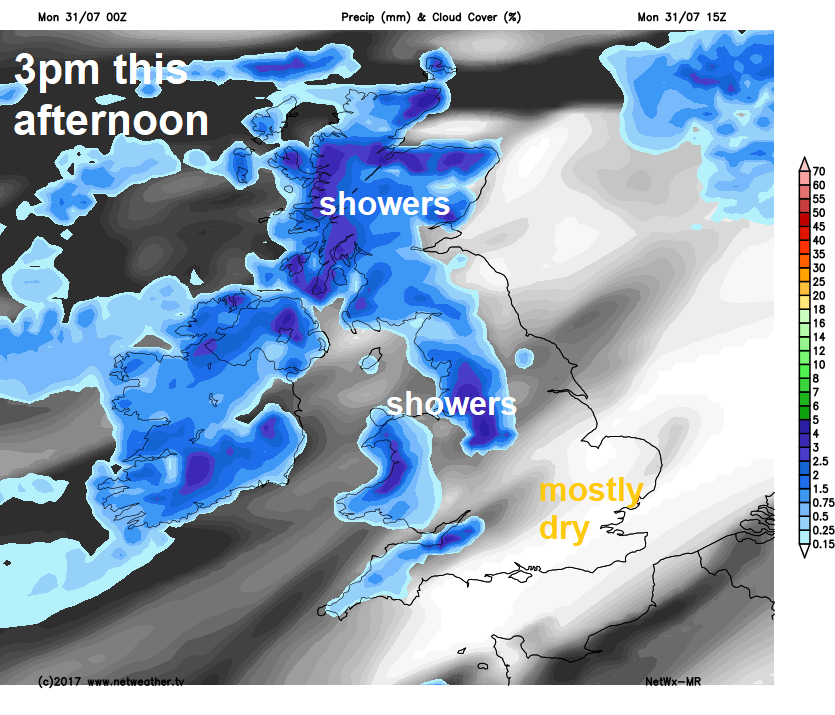
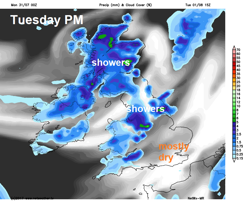
There are more showers to come today and again on Tuesday thanks to low pressure over northern Britain, though southern and eastern England will escape most of these showers and generally it will be less windy than recently too. A new area of low pressure arrives on the scene off the Atlantic from mid-week, bringing rain and strong winds across all parts on Wednesday, followed by a return to sunshine and showers on Thursday and Friday. So, an unsettled outlook this week!
For now, a spell of rain, locally heavy, spreading northeast across northern England and Scotland overnight will clear northeast Scotland in the next few hours. Otherwise, there are heavy showers from the word go across western Scotland, NW England, north coast of N. Ireland and Wales this morning. The rest of England mostly dry and sunny this morning and some southern and eastern areas of England may stay dry and sunny throughout Monday. Showers will develop further east across SW England, Wales, Midlands, northern England, N. Ireland and Scotland through the morning and into the afternoon, some locally heavy, but the heaviest and most frequent showers, with a risk of hail and thunder, will be across Scotland and N. Ireland today.
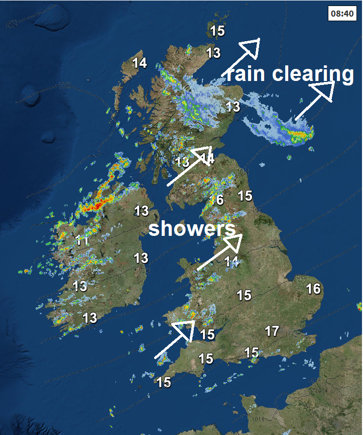
Although it will be breezy today, not quite as windy as recently, so feeling pleasant in the sun across southern and eastern areas of England – where temperatures should reach 21-23C. Elsewhere, temperatures reaching 16-18C across far northwest, 18-20C across Scotland, northern England and Wales.
Showers will tend to fade away tonight to a largely dry night with clear spells developing, away from western coasts where showers will likely continue. Turning chilly where skies clear.
Showers from the word go towards western coasts, then scattered showers developing more widely across much of the UK, locally heavy with hail and thunder across more northern areas, however, like today, SE England and East Anglia staying mostly dry and sunny. Temperatures reaching 16-19C in the showery areas, but in the drier and sunnier southeast reaching 22-23C.
Although exact timing not certain, wind and rain looks to arrive across SW England, Wales and southern Ireland by breakfast time on Wednesday morning, then after a dry a bright start elsewhere, rain and strong winds will spread northeast through the day, reaching all but the north of Scotland by early evening. Rain will be locally heavy, particularly over western hills and also across southern counties of England. Risk of gales along southern coasts. Temperatures reaching 19-21C in sunshine across northern and eastern areas before the cloud and rain arrives, falling back to 16-18C under the cloud and rain.
Sunshine and showers regime returns for Thursday and Friday, heavy and locally thundery on Thursday, showers perhaps fewer and lighter though on Friday. Both days southern areas may escape with mostly dry and sunny conditions. Temperatures reaching 16-20C generally, perhaps 21-23C across SE England and East Anglia.
We could see some drier, sunnier and warmer weather for England and Wales, though still a chance of some well-scattered showers developing, but most staying dry. Scotland and N. Ireland seeing sunshine and showers.


