


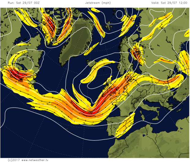
The jet stream will be over or close to the south of the British Isles throughout the upcoming week. Bringing lots of unsettled weather.
As Michael Fish was saying yesterday, if you want some warm, dry summer weather, then having the jet stream right over or to the south of the British Isles isn't the way forward. But, like it or not, that's where it is, and that's where it'll be staying right through the next week.
This all means we're going to have to get inventive with new ways of saying 'sunshine and showers or longer spells of rain' because that's going to be a phrase which could well cover most days. There'll be some regional variations though, and if you're on the hunt for some warmer, drier weather at times, then it's the southeast which may enjoy the best of it.
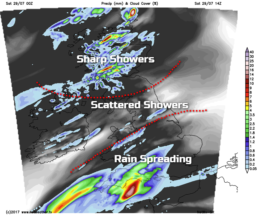
The weekend has started on a mostly dry note, but as you may expect, it'll not continue. We've got three areas of weather today, the southern part of the country is going to see wet weather spreading up from the southwest during the day. The north of the country is going to see quite widespread and at times heavy showers. And the slot in between is going to see a more scattered selection of showers.
It'll be a breezy if not blustery day in places. With southern regions, in particular, seeing some strong, gusty winds this evening and overnight. With the rain and cloud around, temperatures are going to be a bit disappointing, mostly reaching the mid-high teens. The southeast and East Anglia will reach 21-23c before the rain arrives later in the day though.
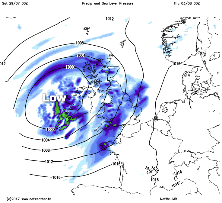
Overnight, the more prolonged rain will clear away into the north sea eventually, leaving a decent scattering of showers in the west. That gives a hint as to what's to come on Sunday, with the showers powering up and spreading west to east through the day. Some will be heavy and thundery, with the southeast and East Anglia best placed to avoid the majority of them.
Away from the calmer north of Scotland, we'll still have a brisk south to southwest wind at this point, which'll help to keep a lid on the temperatures. Highs will typically peak in the 15-19c range.
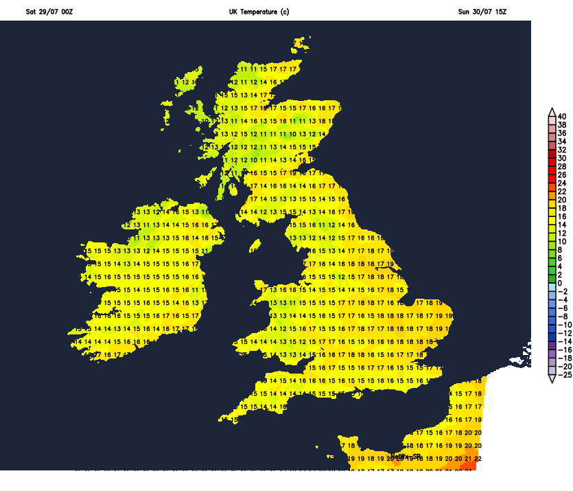
With low pressure just slowly drifting northeast away from the north of Scotland during Monday, it's going to be another day of sun and showers. The showers will be most frequent in the north and west of the country, with some decent sunny spells possible further south and east. That'll allow the temperatures to creep up a bit, getting into the low twenties in the southeast with most other parts into the high-teens.
The sunny spells and showers theme continues into Tuesday, again with the north and west seeing the main bulk of the showers. Into Wednesday we're likely to have a brief respite, But wet and windy weather won't be far away as it moves up from the southwest, driven in by a quite deep area of low pressure.
Once the main band of rain clears, that takes us back to square one, with you guessed it - more sunshine and showers as we move toward the end of the week. If you're on the lookout for some improved weather, according to our monthly forecast the second week of August may be the period to watch. Fingers crossed!


