Plenty of warm sunshine to start the week. Heat and humidity will build by midweek with thundery showers from the SW. Back to the westerly flow to end the working week.
Clear skies and sunshine this morning over much of the UK. There is lingering cloud over the south coast of England from a decaying cold front and also rippled cloud over north and west Scotland in brisk westerly winds.
This week will see a warm start with plenty of fine weather thanks to high pressure, then a messy middle with heat and thunderstorms, before the fresher westerly flow sets in once more.
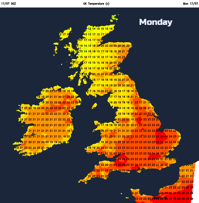
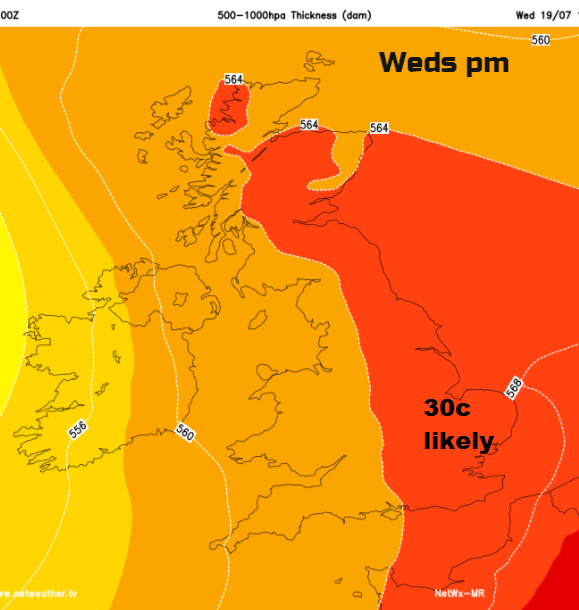
Today will be fine and sunny for most. The Northern Isles will have a grey, damp start as Orkney brightens up later but Shetland stays wet. The Channel Islands will brighten up after a cloudy morning. UK temperatures will be widely up into the 20s Celsius today, many parts even warmer tomorrow, yet breezy. Wednesday could see the highest temperatures of this week, for eastern England just into the 30s.
After the fine start to the week, high cloud begins to appear over south and SW Britain, with a bit more about for Tuesday morning. It will be one of those days when you can feel thunder in the air, slightly ominous and feeling close. It will be blustery with a brisk SE or E wind blowing around the edge of the high. A shame as many parts will have another lovely day with sunshine. This breeze will cool off coastal parts of eastern Britain, the Thames estuary and along the English Channel
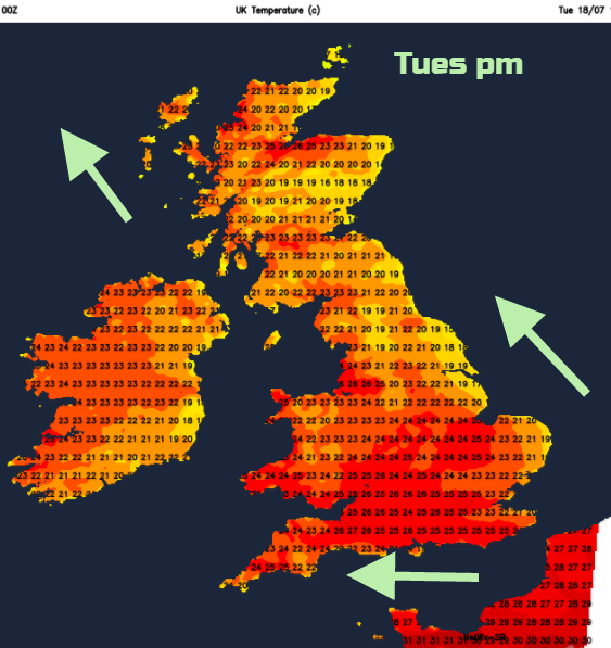
Inland it will feel hot, as the more humid air flows up from the continent. Inverness or Manchester could see 26C. Gradually showers will appear over SW Britain. These will include heavy and thundery downpours and there will be gusty winds.
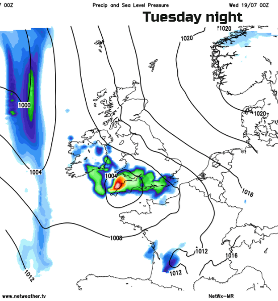
If you are looking at location forecasts, say the 7 day one, it will show showers or thunderstorms yet this is just the potential for a downpour. As always with showers, there will be some areas getting drenched and others seeing little rain. The main areas for Tuesday evening/night are southern Britain and Wales with the threat moving northwards through the Midlands. There is low confidence about how far west/east the storms will sway, so Northern Ireland could see heavy rain overnight for western counties with the cluster over Wales heading into the Irish Sea by Wednesday morning. This then moves up through northern England, more of Northern Ireland into southern Scotland. By midweek, an Atlantic frontal system will be edging in bringing outbreaks of rain but nudging all the lively showers across to NE Scotland later on Wednesday
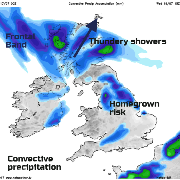
So, midweek does have this threat of rain but heat will remain over eastern England with temperatures in the high 20s, even low 30s Celsius as it continues to feel muggy and humid here. The temperatures will soar in any sunny spells and there is the risk of a few more thunderstorms, with NE England looking prone
The weather steadies overnight into Thursday with a brief nose of high pressure. Thursday looks to be a fine day with sunshine, feeling more comfortable and fresh before low pressure appears from the Altaic with rain for Northern Ireland. This low will then bring a wet and blustery end to the working week, although the frontal rain may fade before reaching London and the SE on Friday evening.