Plenty of sunshine and warm temperatures on the way, but with thundery weather by Wednesday.
Some rather typical British summer weather on the way in the next few days and, to be honest, continues a trend of some, particularly varied and changeable weather. Plenty of sunshine is expected to start the new working week, warm and increasingly humid too, but it just isn’t going to last!
Today
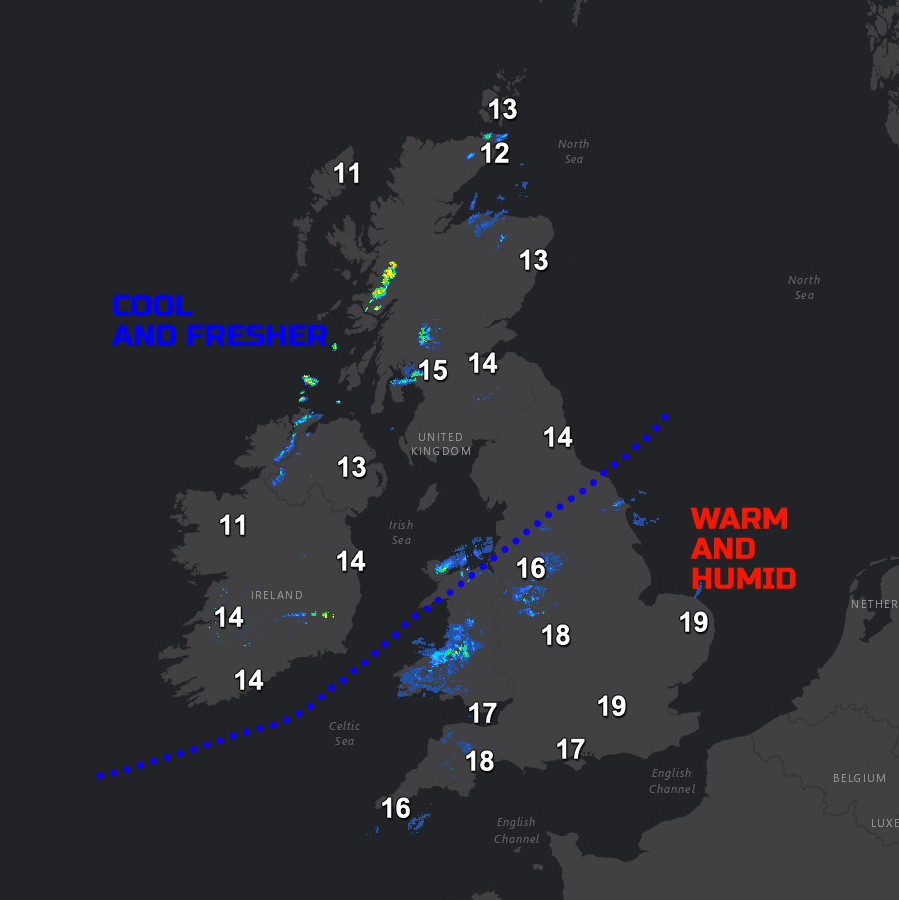
Back to the short term and we do have a weak cold front moving slowly south-eastwards across England and Wales at the moment. The weather front isn’t bringing much in the way of rain, apart from some nuisance value light and patchy rain, or drizzle, across Wales and the Midlands. It is, however, a marked dividing line between some warm and particularly humid conditions across central and southern areas of England, but much cooler and fresher weather across the north and west.
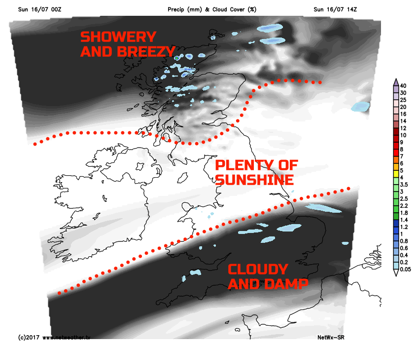
Through the rest of Sunday and a region of rather cloudy and damp weather, with some further patchy light rain or drizzle will only very slowly move into central and southern areas of England. However, following on behind will be a marked clearance in the cloud. As a result, plenty of sunny spells will develop across Scotland, Ireland, N England and, eventually, parts of Wales and the Midlands by evening. It is across more central, northern and western areas of the British Isles that a lovely Sunday afternoon will develop, pleasantly warm, but without the humidity of Saturday. Some showers will, however, develop across the far north and west of Scotland by evening, along with a fresh W’ly breeze.
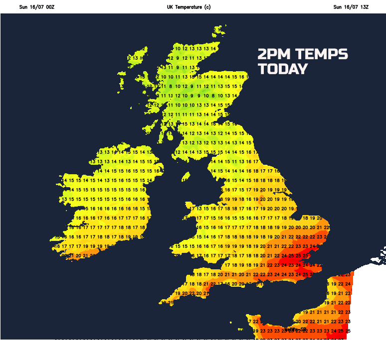
Temperatures this afternoon will be near or a little below average across more northern and western areas, but this offset somewhat by the July sunshine. Some further warmth and humidity will linger across the far south and south-east of England, temperatures still perhaps nearing 25C around the Home Counties. For many northern and western parts temperatures will range between 14C and 20C overall.
Tonight
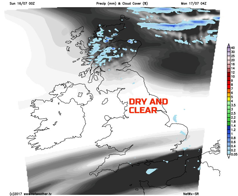
Through into Sunday night and it is, for many, a clear, chilly and dry night. High pressure will be nudging its way into the UK from the west and south-west, this a sign of things to come to start the new working week. There will be some further showery weather, perhaps even with some spells of rain across central and northern areas of Scotland, but this the exception to the rule. Many regions will be dry with prolonged clear spells and with much lower temperatures too than compared with recent nights, especially in rural areas.
Next Week
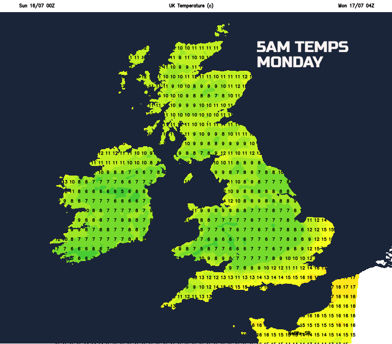
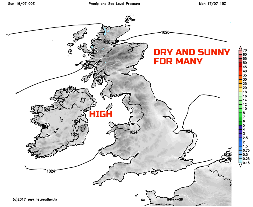
So, looking ahead into next week and it is, most certainly, a case of ‘two fine days and a thunderstorm’. The high pressure that will be nudging its way into the UK, from the west tonight, will dominate the weather through Monday and Tuesday. As a result, the first half of the week is, overall, looking fine and settled with high pressure bringing plenty of dry weather too. Monday, in particular, will be a glorious day with prolonged spells of July sunshine and with just some variable amounts of cloud. Warm or very warm in the July sun, but without being too hot and at least initially not too much humidity either.
As we move into Tuesday and it will, for many regions remain dry with some further spells of sunshine, but probably with more cloud around than compared with Monday. Temperatures will be on the rise as well, perhaps locally hot across urban areas of the south through the day and with increasing amounts of humidity as well. Towards the end of Tuesday then the breakdown to thundery weather is set to arrive from the south. Thunderstorms may well spread northwards on Tuesday night, bringing some potentially fantastic displays of lightning across England and Wales, cameras on standby for that!
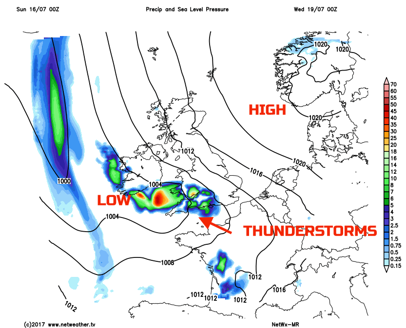
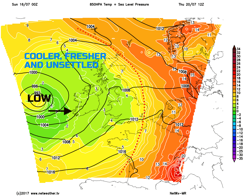
Further heavy downpours and thundery conditions are then forecast to continue into Wednesday of which will be a hot and humid day across England and Wales. However, as soon as the summer weather arrives, it’ll all be over by the time we get to Thursday as the high temperatures clear away to the east. Some uncertainties over the details over the end of the week, but it does look as though it will become markedly cooler and fresher, along with some wet and perhaps windy weather developing too by Friday.
A case of the British weather bringing something for everyone this coming week.