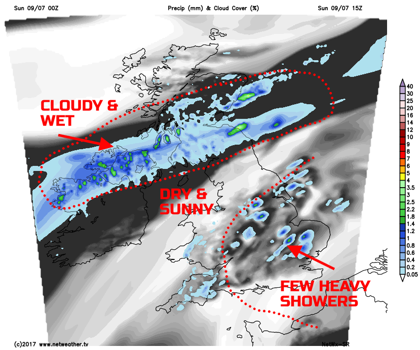
Rain across parts of the north, dry and sunny for central areas, locally heavy showers in the east.
After plenty of dry weather across many areas of the British Isles yesterday, Sunday will produce more varied and, at times, wet weather. However, not everywhere will be affected and the UK will see three distinct regions and types of weather through the course of the day. Like a layered weather sandwich!
We do have some wet weather present already across parts of Scotland, especially S Scotland and stretching back across parts of N Ireland, this wet weather is associated with a weather front. Equally, there are some light showers across parts of W Wales and SW England, but much of England and Wales is dry with some bright or sunny spells.
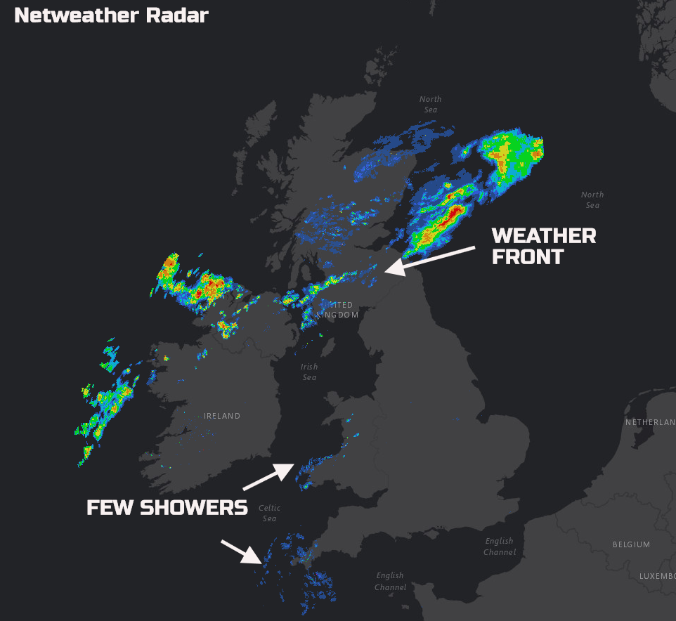
Check the latest on the live radar here.
Through the rest of Sunday, the weather front across the north will be slow moving. As a result, a rather wet day is forecast across more central and southern areas of Scotland, along with parts of N Ireland too with light or moderate, locally heavy rain. More northern areas of Scotland will, however, be mainly dry with some sunshine. Across much of England and Wales it will be another predominantly dry day, but with more cloud than Saturday. Bright or sunny spells are still to be expected mind, especially so across parts of N England. But, as the afternoon progresses, the cloud may well develop enough to bring the risk of some locally heavy showers. These across parts of central and eastern areas of England, perhaps even with an isolated thunderstorm.
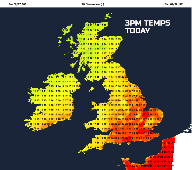
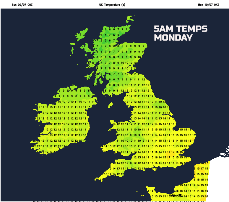
It will be another warm and humid day across much of England and Wales. But temperatures will take a nose dive if any showers develop across E England this afternoon. Overall, max temperatures ranging between 19C and 24C are likely, but locally 25C or 26C across SE England, feeling humid too. Markedly cooler across parts of the north and west, beneath the persistent wet weather, temperatures struggling to just 14C or 15C.
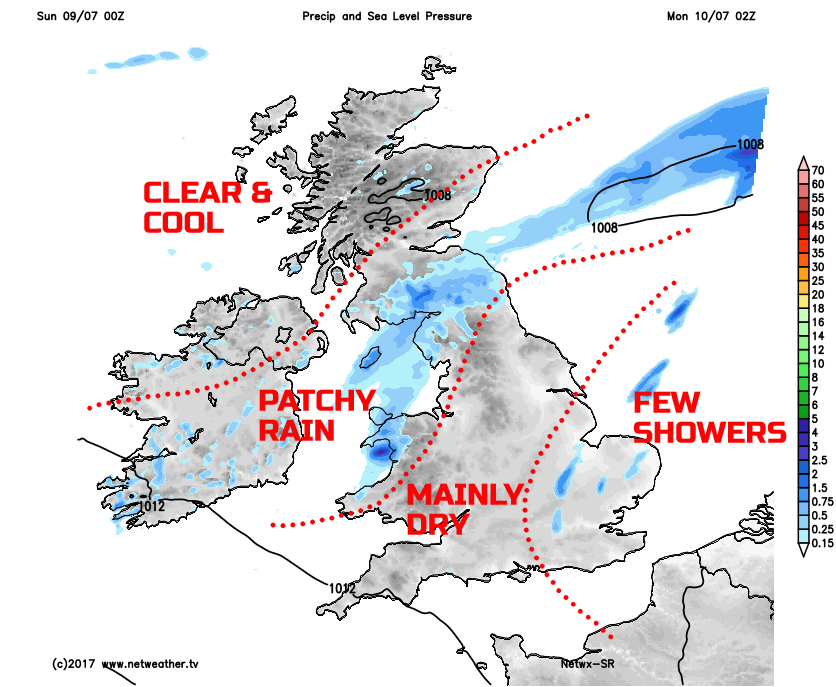
Through Sunday evening and overnight and any heavy showers and isolated thunder storms across E England will clear away into the N Sea. The wet weather across N Ireland and S Scotland will slowly move down into N England, but with the rain becoming increasingly light and patchy here. To the north, across central and northern areas of Scotland, it will become clear and rather chilly as we end the weekend.
Next Week
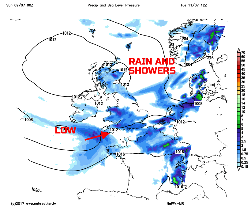
Looking ahead into next week and it is low pressure that will become the dominant feature of the weather across many areas of the British Isles. As is often the case nothing is straightforward when it comes to the British weather, and there will be a real mix of conditions. Spells of rain and showers are forecast at times early in the week, especially across more central and southern areas of England where some thundery downpours may develop on Monday. Tuesday, in particular, looks like being a wet day across the south as well, with some likely disruption to Wimbledon. Low pressure is set to approach from the south-west and then track eastwards, bringing more prolonged spells of rain, perhaps heavy rain in places too.
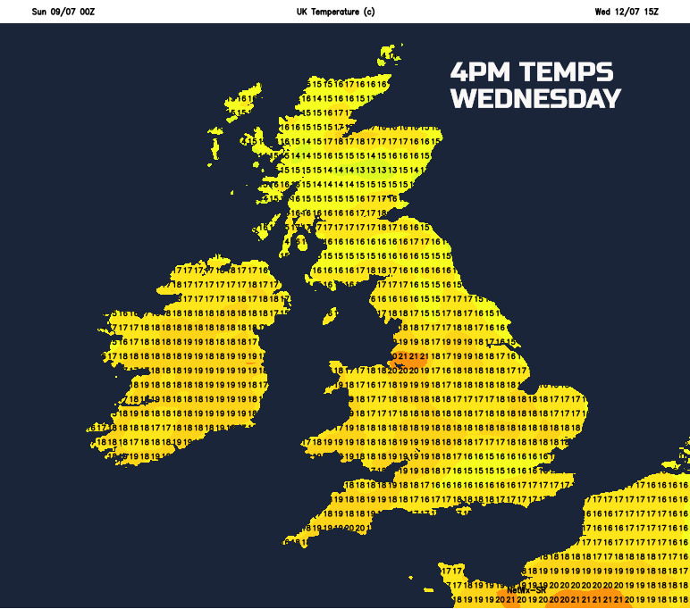
Wednesday may well see some improvement with mainly dry and bright weather for many during the day. However, while confidence in the details is rather low, it does look as though further weather systems will move into the UK off the Atlantic later in the week. Spells of rain and showers, initially across Scotland and Ireland into Thursday will then move further south and east, maintaining an unsettled period of weather across much of the British Isles. A cool week ahead as well, after the warmth of this current weekend. Temperatures look set to be below the mid-July average, especially in any wet weather and, using Wednesday as an example, temperatures around 15C to 20C are likely at best.