Heat and humidity take hold, particularly over southern Britain, as yesterday's rain band fades. Thunderstorm risk on Thursday. Most parts of the UK will feel warm over the next few days with just the far NW staying cool and unsettled.
If you were underneath the rain band all day like me yesterday, then welcome to a drier Wednesday. NE England does still have some damp conditions, but it won’t chuck it down all day. Wimbledon has been enjoying fine weather and the sunshine. It will be hot and humid for the next few days. However, there will be the threat of heavy and thundery showers, mainly over England, so we will be monitoring where they head.
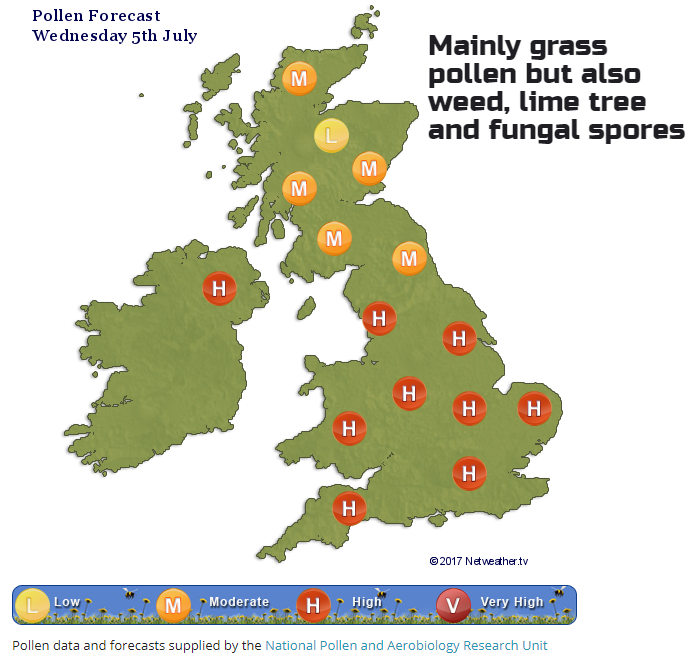
It will be a warm day, hot for southern Britain. It is feeling cooler for northern Britain and Northern Ireland to start the day with more cloud over many parts from the fading warm front. The north of Scotland has sunshine as does much of central and southern England and Wales. Southern Britain will have very high UV levels, do take care. Other areas should be fair and bright. Today, temperatures will be in the high teens for Scotland and Northern Ireland and spread across the 20s Celsius for England and Wales, with London possibly reaching 29 or 30C. Pollen levels are high, and it will feel close and muggy. Winds are mostly very light today although there is an easterly breeze coming off the sea for NE England, so added to the grey, damp conditions it will feel a bit cool here.
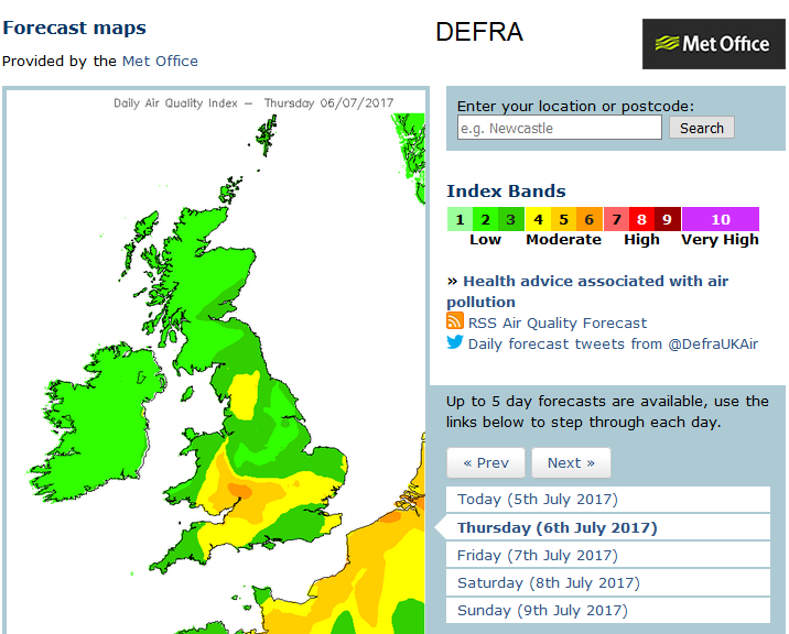
Air pollution levels begin to creep up once more as the stagnant hot and humid conditions continue.
The UK will be trapped between a low pressure forming over the southern North Sea and Atlantic low pressure throwing weather fronts in from the NW. Patchy rain will move over Northern Ireland tonight into Scotland by Thursday morning. Eastern areas will be brighter, and there will be more of an S/SW breeze. For England and Wales, it will be a fine, bright day with sunny spells and more heat.
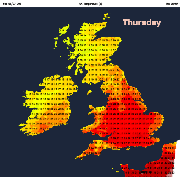
Overall for Thursday, it is a mainly warm, fine day although with patchy rain continuing for NW Scotland. Elsewhere though there is the risk of scattered hefty downpours and thunderstorms. The forecast models are showing a cluster starting over southern England then passing over Gt London on Thursday morning, Wimbledon will need to keep an eye out. Other heavy showers and potentially storms will break out moving NE from the SW. The total rainfall chart for Thursday gives an idea of areas which could be affected by the rain, but it is just a guide. Much of England and inland Wales will be at risk, but only a few areas will actually catch a downpour. There could be lightning and hail with the risk of localised flooding.
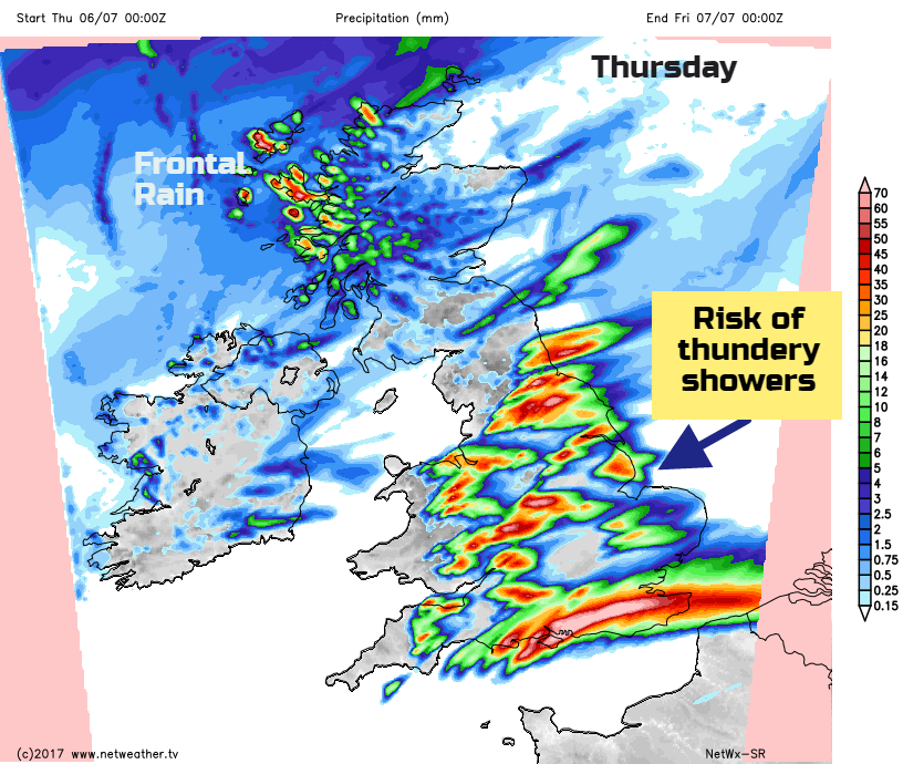
Any lingering showers should clear eastern Britain around midnight
Friday
The heat and humidity remains over the SE half of the UK. For the NW half, it will feel cooler and fresher, and there will be showers blown in from the Atlantic on a westerly breeze. Friday night looks chilly in the north, campers beware.
There will still be warmth around at the weekend, but it should be more pleasant, rather than the closeness of the working week. The precipitation forecast is a bit mixed with areas of rain moving in from the Atlantic, which will bring wet or damp spells for some, but either side plenty of sunshine. Will be worth waiting another day or so for the forecast to firm up if you do have weekend plans.