
Further heat and humidity set to dominate in the next few days, but changes appear later in the week.
The heat and humidity of the last few days are set to continue. If anything, today may well be hotter than was experienced yesterday, particularly across urban areas of S England. We do have some wet weather though this morning, primarily across the far north of Scotland as a weather system quickly moves through. However, for much of England, Wales and Ireland, along with S Scotland, it is a dry start with prolonged spells of sunshine and temperatures are already rising very quickly.
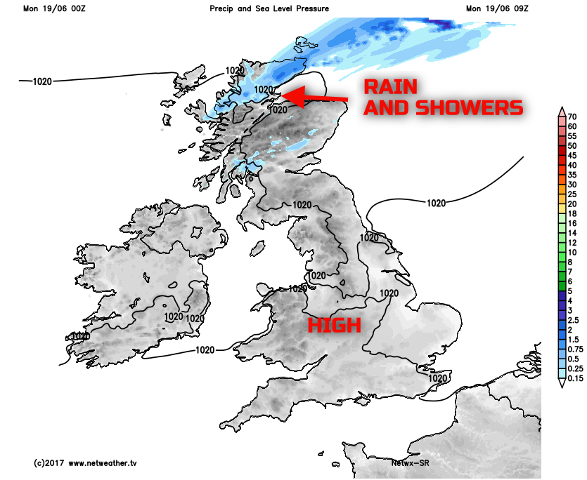
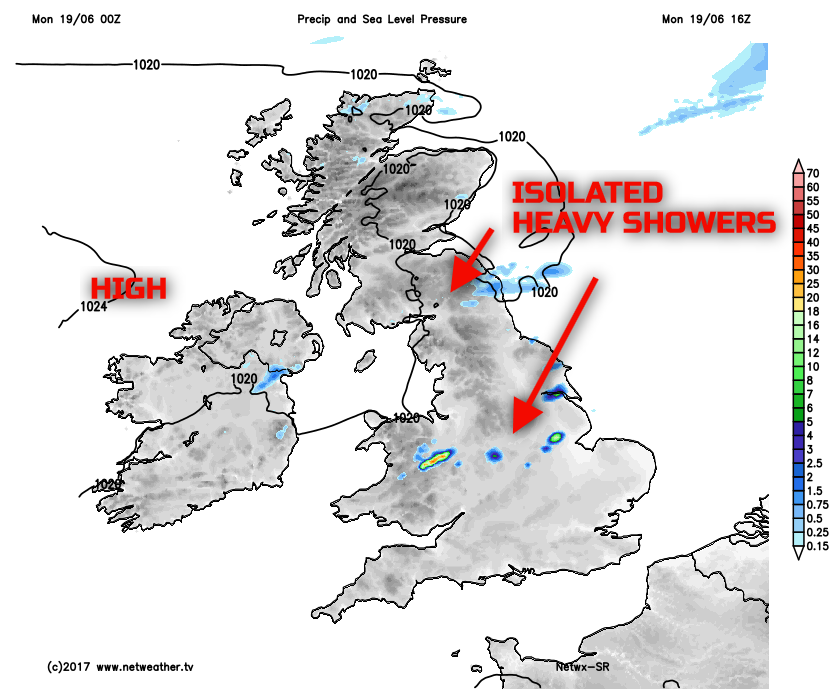
Through the rest of Monday, the emphasis is on another dry day for much of the UK with bright or sunny spells, these prolonged at times. Unlike Sunday, for example, there may well be some cloud developing during the day making the sunshine rather hazy at times, in places. Equally, the building heat and humidity may well lead to a few isolated heavy showers or downpours later on. These will be particularly isolated and localised, but some parts of N England and also some Central areas of England may be most prone by the end of the afternoon.
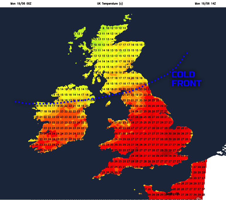
There will also be a rather significant temperature variations between the north and south of the UK today. This, primarily due to a weak cold front that is moving down across parts of the north during the day. Maximum temperatures across many inland areas of England and Wales will reach 24C to 28C, but it is across urban areas of S England that temperatures will rise to 30C to 32C. Potentially making it the hottest day of the year so far. In complete contrast, it will be much cooler, perhaps more than 10 degrees cooler across parts of Scotland, with maximum temperatures no higher than 16C or 17C.
This evening and overnight, any isolated heavy showers that have developed will soon die away, and much of the country will be dry with clear spells and variable cloud. It will, especially across many central and southern areas of England and Wales, be another uncomfortable night for sleeping. Minimum temperatures will be no lower than 15C or 16C in some instances, locally higher in urban areas. But it will be markedly cooler across Scotland and N England, with temperatures perhaps even falling low enough for some ground frost.
As we move into Tuesday, it is high pressure that will continue to dominate across many areas of the British Isles. A few isolated afternoon downpours may develop across some central and southern areas of England and Wales, but the emphasis is on another settled day for many. Further prolonged bright or sunny spells are possible, but with variable amounts of cloud too.
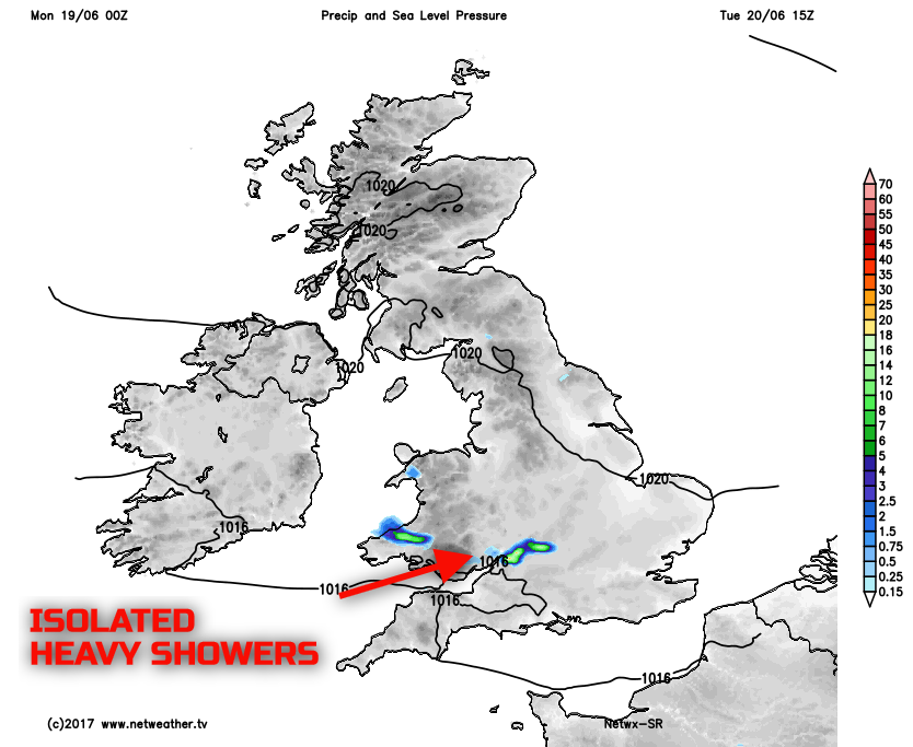
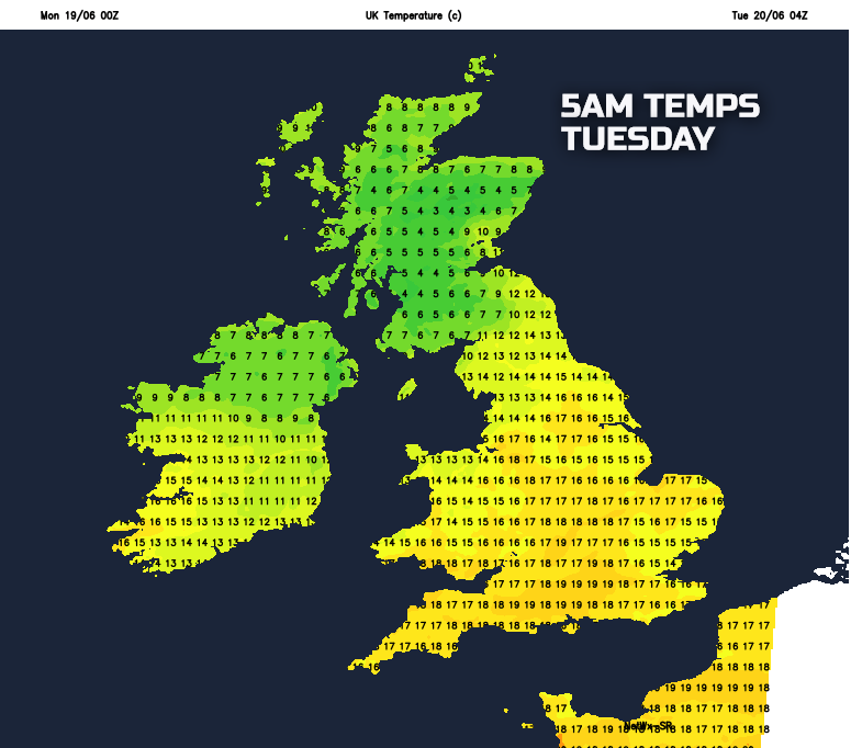
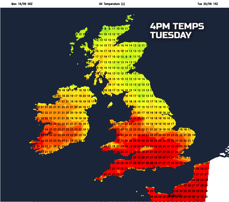
Temperatures on Tuesday will be much lower across N England than compared with Monday. This particularly noticeable across some eastern and north-eastern areas of England where low cloud may also develop. Further high temperatures are to be expected though in many central, southern and south-western parts of England and Wales, along with parts of Ireland. The variation between the north and south of the UK will be particularly noteworthy, with parts of Scotland and N England perhaps having maximum afternoon temperatures near 14C to 18C, but across S England, temperatures will be nearer 24C to 28C.
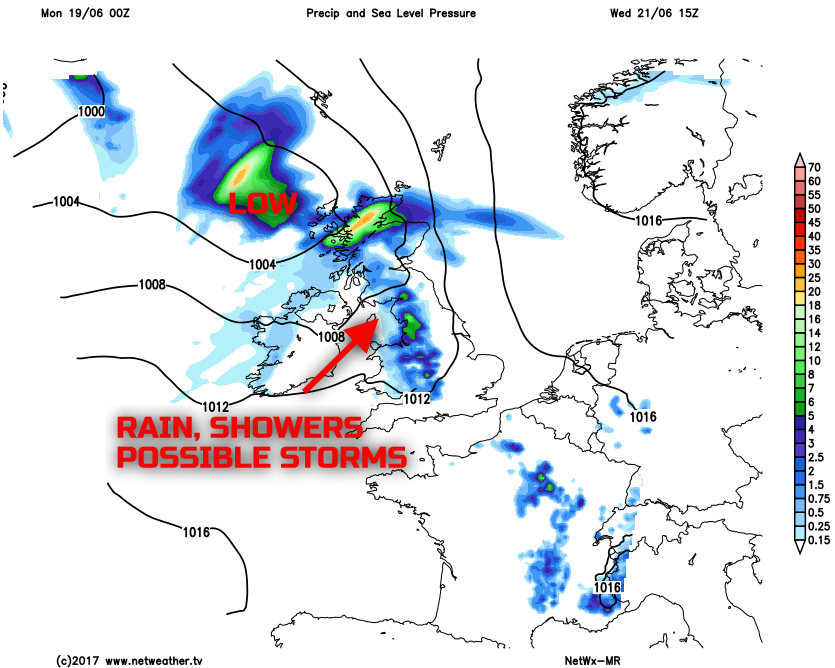
Looking further ahead and we finally see a more noticeable change in the weather during Wednesday. While the details are still uncertain, an area of low pressure will approach and track just to the north-west of the UK. As a result, there will be an increased risk of some rain and showers. These especially across parts of the north and west, perhaps with the risk of some heavy and thundery downpours as the spell of summer weather comes to an end for many regions.
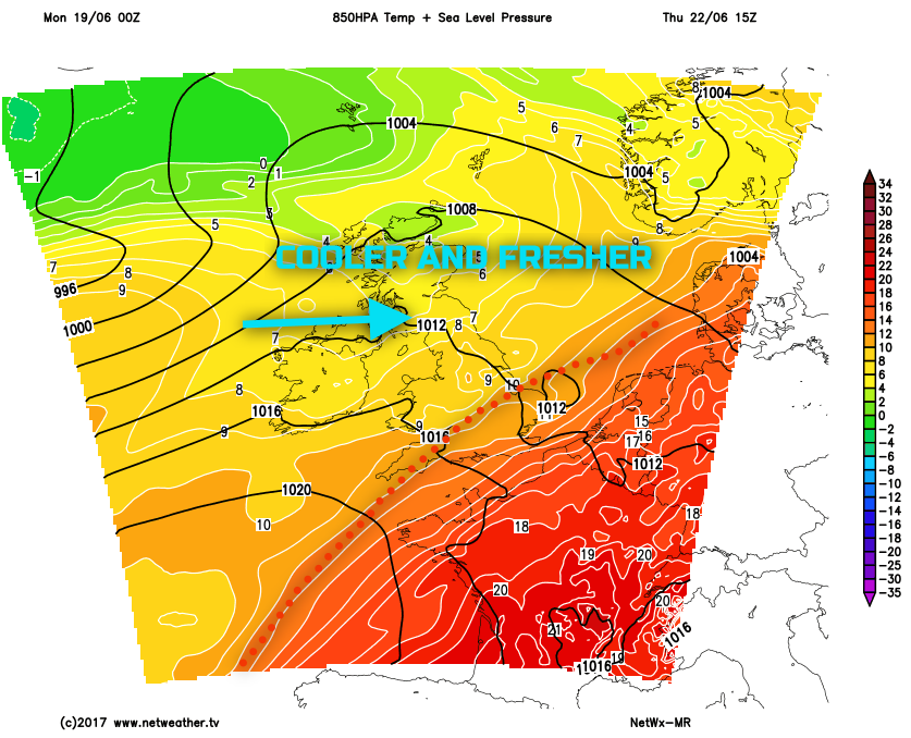
By the time we get towards Thursday and Friday and many areas of the British Isles will become cooler and more unsettled, as the heat and humidity are displaced eastwards into mainland Europe. Low pressure is set to become the dominant feature and introducing a cooler and fresher W’ly weather type off the N Atlantic. There is likely to be a risk of further rain and showers at times to end the week, especially across parts of the north and west.
So, if you’re a fan of the heat and humidity then a case of enjoying the coming few days. But, if the high temperatures aren’t for you, then change to cooler and fresher conditions will arrive later in the week and through next weekend.