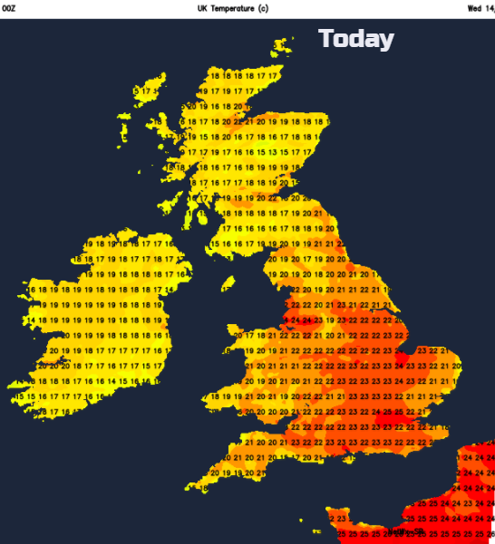
Plenty of warmth today with a muggy night in the east to come. Fresher for Thursday but looking hot for the weekend.
It is going to be warm today, feeling hot and humid for parts of England and Wales. We have a southerly breeze bringing the warm air up from the continent. Spain has been sweltering with temperatures around 38C, (which is higher than the UK has ever recorded) The UK could see 28C in London today.
There will be a lot of fine and dry weather about today, particularly for England and Wales with more cloud over Northern Ireland and Scotland with patchy rain for the far north and west. The cloud will break up a bit today, so bright spells will appear. It’s still worth putting on the sunscreen even if you have a grey unpromising start.
There is an area of High pressure away to the east over Europe and a low pressure out in the Atlantic. The UK is stuck in the southerly flow in-between. It will be breezy at times today with more of a SE to E wind coming into Kent and along the eastern Channel. It will be blustery for northern Britain and Northern Ireland with a fresh southerly picking up through the day. There is a small chance of seeing a shower over central Britain late afternoon. Eastern Wales, the West Midlands up into NE England. Overall it will be dry, but one or two showers could develop into the evening.
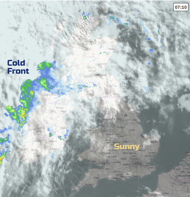
Although there are some glorious conditions over the UK this morning, there is a band of rain lurking out to the west. This is a cold front. It won’t amount to much today but overnight it will begin to move across the Irish Sea eastwards and alleviate the heat and humidity. The west coast of Scotland will see a wet night. However, ahead of this rain band it stays muggy and close and for London, in the high teens.
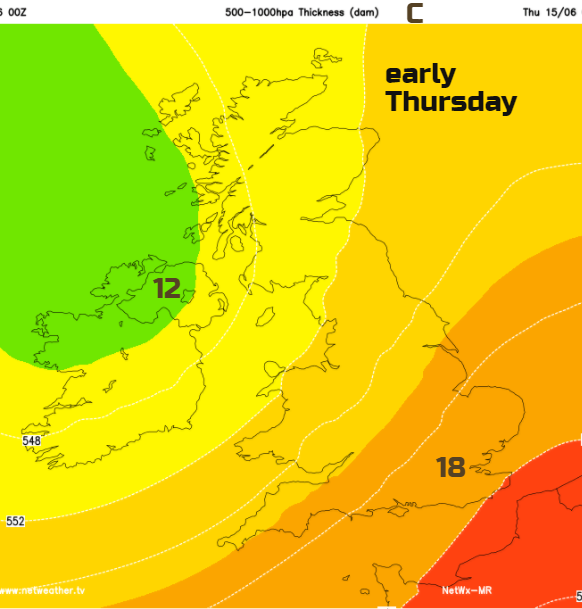
By Thursday there will a more westerly breeze. The cold front will have weakened by the time it moves over Britain bringing a little more cloud with dampness over the hills. Eastern England might manage 24C, but overall SE Britain will see 21/22C as the fresher but still warm air moves in. Wales, Northern Ireland and much of Scotland will be around 16 or 17C. Again, there will be a lot of fine weather about but with a scattering of showers for Northern Ireland and Scotland
Thursday night will feel more comfortable. Showers will continue to blow in, over Northern Ireland and northern Britain with dry conditions for much of England and Wales and clear spells.
A warm front will bring more cloud over Northern Ireland, through the Irish Sea, and into SW Scotland/NW England with damp conditions around the coasts. Rain will affect SW and western Scotland before it turns showery into the afternoon. Away from this gray damp weather temperatures will reach the high teens the low 20s for SE Britain.
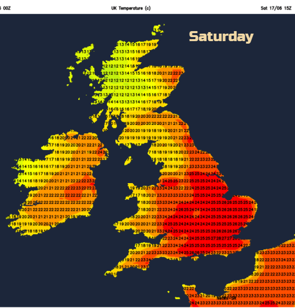
Saturday looks hot. High pressure takes hold in the south and will result in a lot of fine sunny weather across the UK. Further showery outbreaks will affect the NW Highlands with a brisk SW wind but hopefully the cold front will only graze NW UK. There is some uncertainty about this frontal band so it could affect a bit more of Scotland even into Northern Ireland and Cumbria, although currently, this shouldn’t happen until Sunday morning
Another hot day on Sunday for England and Wales. The frontal band from the NW will change things for Scotland, Northern Ireland and NW England but it’s not going to be that bad, just fresher, bright rather than full sunshine and a westerly breeze.
The heat could just hold on in southern Britain for Monday before the frontal band sinks southwards.