Heavy rain for parts of eastern and central England today, where it's still humid. Elsewhere fresher, along with sunshine and showers. All parts will be showery right into the weekend too.
Yesterday produced the highest temperature of the year so far, at Gravesend, with a temperature of 25.8C. It was also the warmest day of the year so far in Scotland, with 22.4C at Lossiemouth. The warmth and humidity for some areas of the UK will continue today, especially across E England, but this will also coincide with a lot of rain.
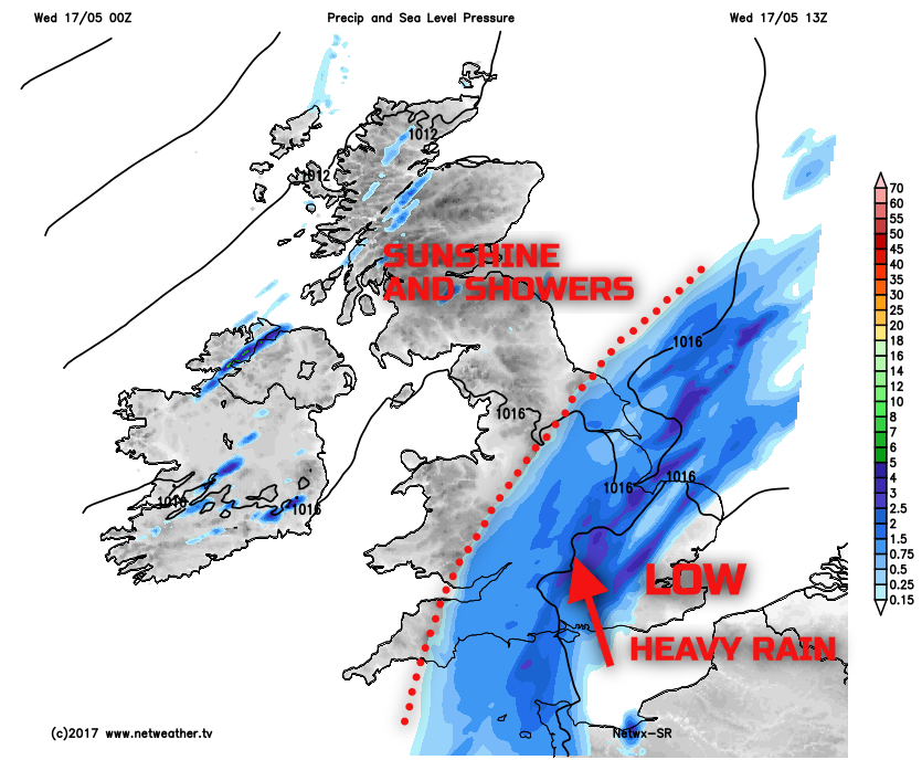
There continues to be quite a marked dividing line across the UK in temperatures, with cooler and fresher, but sunnier weather, in evidence across many northern and western areas. In fact, after yesterday’s warmth, temperatures have dropped to 0C at Aboyne in Scotland overnight. Increasingly heavy and persistent rain, associated with a set of weather fronts, is the boundary between the warm and humid air in the east, and the cooler and fresher conditions further north and west.
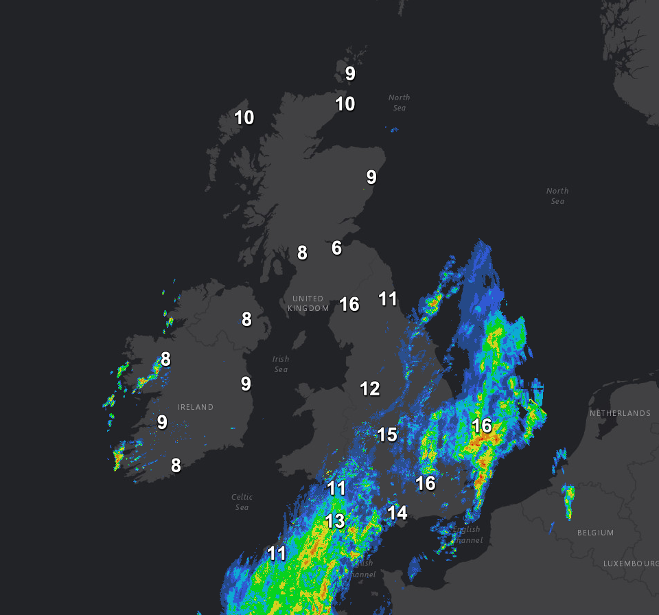
Through the rest of Wednesday, and the main aspect of the forecast that is important is the development of some widespread moderate and heavy rain across many central and eastern areas of England. There is an added complication in that across some parts of SE England some heavy, and perhaps thundery downpours may also develop later on. Through the late morning and into the afternoon the region of persistent and often heavy rain will stretch north-eastwards across many central and southern areas of England, up into the Midlands and across into eastern parts of England too. For Scotland, Ireland and most of N England there will be plenty of bright or sunny spells and just a scattering of showers.
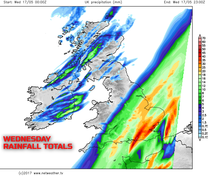
An extensive region of central and eastern areas of England, by the end of Wednesday, will likely see 10mm to 20mm of rain, if not more. However, some south-eastern regions of England, where thunderstorms may develop, could well end up with 30mm to 40mm. And a significant portion of that falling within 6 to 12 hours. The Wednesday evening rush hour period across SE England and E England will be affected by a lot of surface water and spray, something to be aware of later on today.
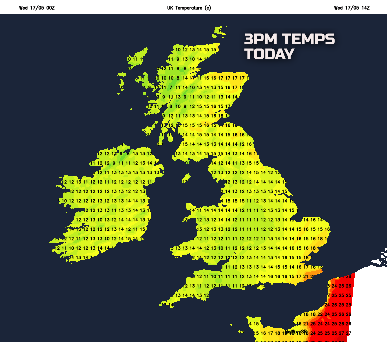
Across more eastern areas of England, another rather warm and quite humid day is expected, especially in E Anglia and SE England. In contrast, many other areas of the UK will be cooler and fresher, with temperatures only just nearing average. Also beneath the band of cloud and rain further west, so across parts of the Midlands, Wales, and SW England temperatures will be particularly disappointing here, likely no higher than 11C or 12C at best.
As we move into Wednesday night and the persistent wet weather will clear away to the east of the UK, taking any warmth and humidity with it. The rest of Wednesday night is then predominantly dry for many areas of the UK with variable cloud and clear spells. A few coastal showers are possible across parts of Scotland and Ireland. Beneath the clear skies and light winds then it becomes quite chilly, ground frost is possible in rural areas of the north, and it will be markedly cooler and fresher across SE England too after recent warm nights.
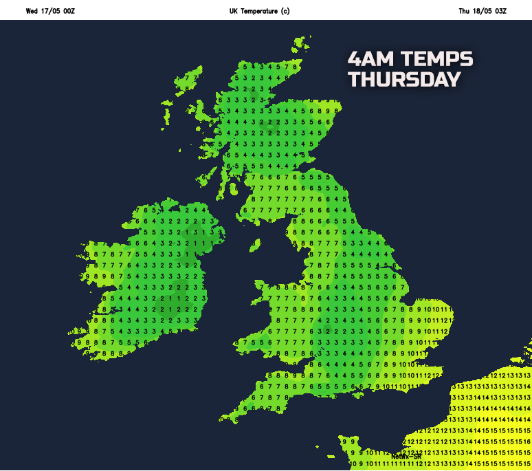
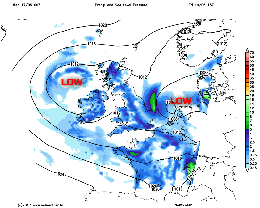
As we progress through the rest of the week, there has been little change to the forecast from the last few days. There continues to be high confidence for an area of low pressure to slowly drift into the UK from the west and north-west, through Thursday and Friday. The low pressure is set to maintain predominantly unsettled conditions, but without actually providing any widespread, persistent rain. Both Thursday and Friday will start quite chilly, perhaps with some rural frost, but then see a mixture of sunshine and showers as both days progresses. The showers could well be locally heavy too, possibly with some thunderstorms across parts of Scotland, Ireland and N England. Between the showers there will be some nice spells of sunshine, but, temperatures will struggle to near average highs of between 11C and 16C.
This mixture of sunshine and showers is currently expected to continue into the weekend as well. So if you’ve got outdoor plans, while no widespread heavy rain is likely, you’ll need to dodge the showers. Some of which could still be heavy and perhaps thundery in places too.