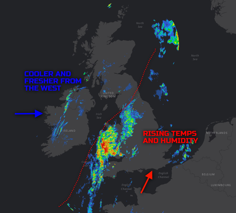
Some heat in the southeast today, but rain marks the divide between warmer and cooler air.
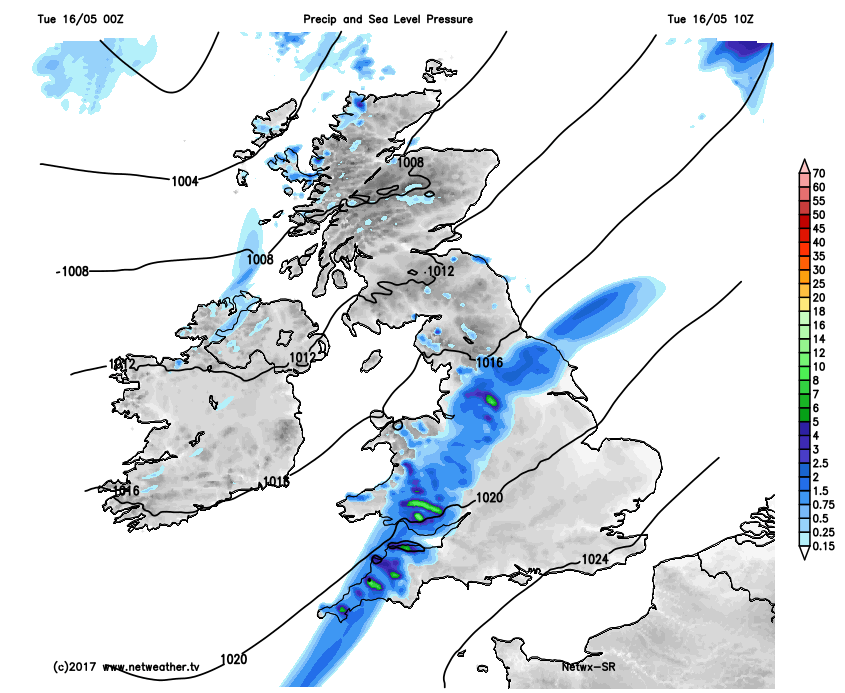
It’s a wet start to Tuesday across parts of SW England, Wales and up into NW England. Some of these regions, along with parts of SW Scotland, did observe some of the greatest rainfall totals in well over a month yesterday. The rain across this region of the UK is a dividing line between a progression towards cooler weather from the west and some temporary warmth and humidity across SE England through the next day or so. As is often the case across the UK when you get contrasting temperatures you get some interesting weather. And that will most certainly happen in the coming few days.
Through the rest of Tuesday and the region of wet weather will only slowly make some progress eastwards across England and Wales but it is not expected to reach SE England until later on today. Across Scotland and Ireland conditions will improve through the afternoon. With mainly dry weather developing along with some bright or sunny spells, despite a few showers. This improvement in the weather will also filter into N England by evening, so turning drier here as well after the wet spell of weather over the last day or so.

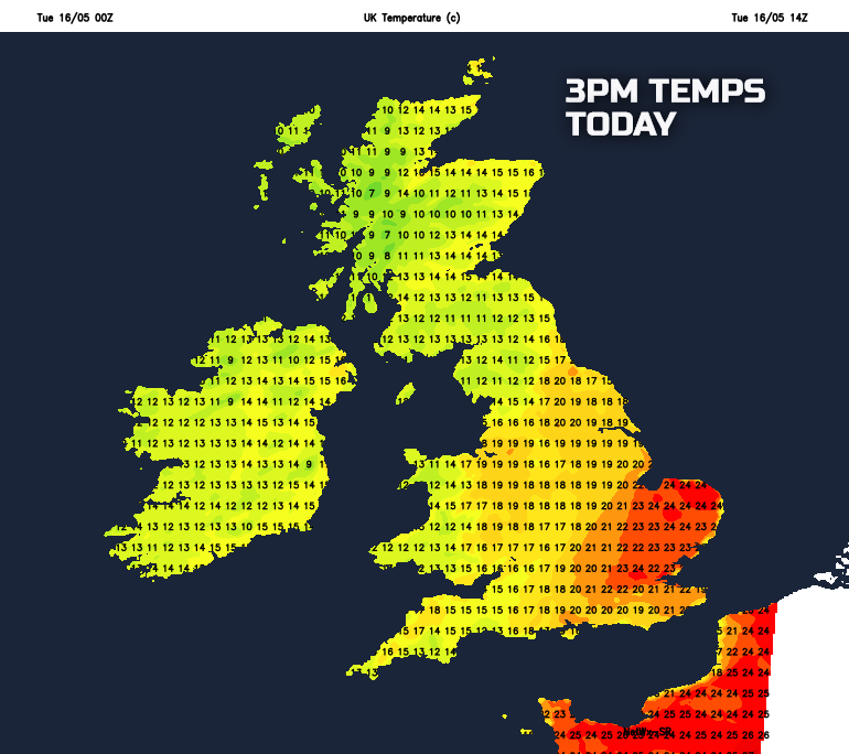
Ahead of the rain, across E and SE England, will be a particularly warm and humid air mass, this having its origins from more tropical regions of the Atlantic a few days ago. This air mass will combine with some bright or sunny intervals, and temperatures will respond and rise quickly. Maximum temperatures across SE England will comfortably reach 22C or 23C. The rest of England and Wales will also have a warm, humid day, but cooler and fresher conditions will filter into Scotland and Ireland.
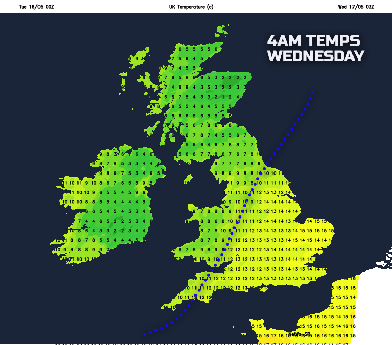
Into Tuesday night and through into the early hours of Wednesday and the rain across parts of England and Wales will become more organised and heavier. However, for the remainder of the UK, it will be much drier with clear spells and variable cloud across much of Scotland, Ireland and parts of N England. As the cooler air moves into to more northern and western areas, the contrast in temperatures will continue tonight too. Rural areas of Scotland may well see minimum temperatures fall to just 2C or 3C. This is in complete contrast to more southern and south-eastern parts of England where they are unlikely to fall below 12C or 13C.
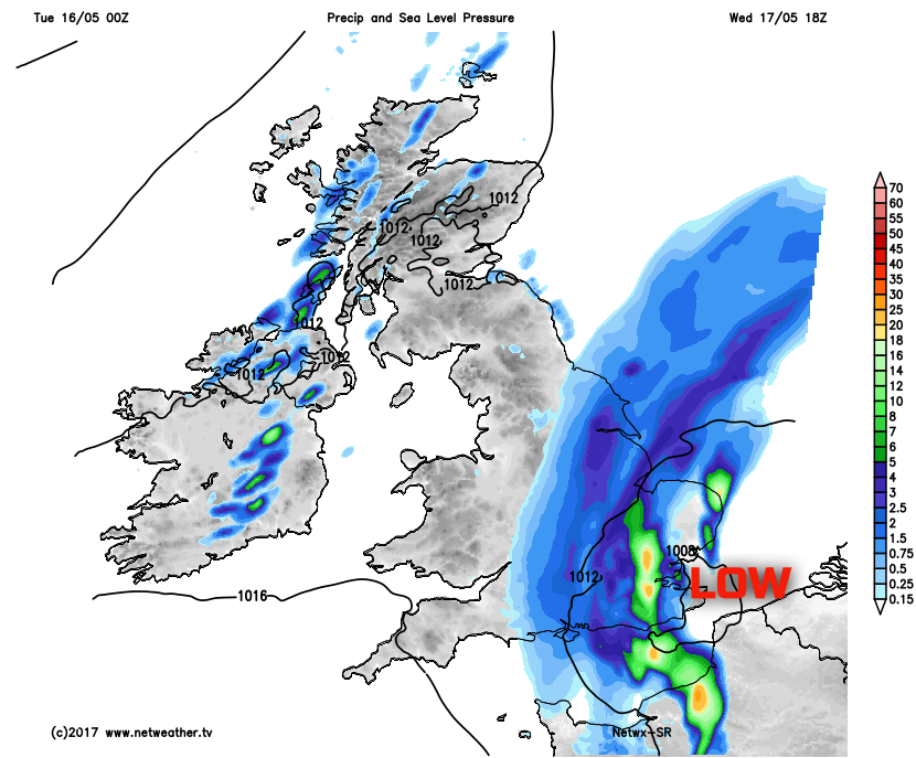
As we progress through Wednesday and some potentially severe weather may develop across SE England. In what is expected to be a particularly complex development, a front will become active and well-defined, as low pressure drifts northwards too out of France. This combination of low pressure, high temperatures and humidity will signal some increasingly heavy rain and perhaps thundery weather across SE England through Wednesday afternoon and into Wednesday evening. Some poor driving conditions are possible across the Home Counties, and surrounding areas, for rush hour period at the end of Wednesday, with a lot of surface water likely.
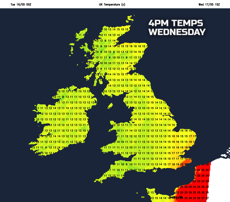
Further north and west, then except some scattered showers Wednesday will be a reasonable day. Scotland, Ireland and N England, probably Wales too, will have some prolonged dry weather with bright or sunny intervals and just a scattering of showers. Temperatures on Wednesday will, for many, be near or a little below the average for mid-May and the warmth and humidity across SE England will get pushed away in association with the wet weather.
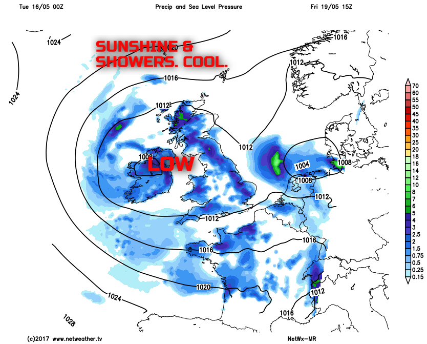
Through the remainder of the week and there have been no significant changes to the forecast. There is high confidence for an area of low pressure to drift into the UK from the west through Thursday and Friday. As a result, this will signal a continuation of the unsettled weather, with an expected mixture of sunshine and showers by day, while nights are often dry but rather chilly. There is certainly scope for some of the showers to be heavy and perhaps thundery, with hail both on Thursday and Friday afternoon. Temperatures look to be average at best, and certainly on the cool side of average, especially when any showers persist.