Land gales, damaging gusts, disruption to travel and power supplies possible. Heavy snowfall too for the wintry north. What a day #StormDoris.
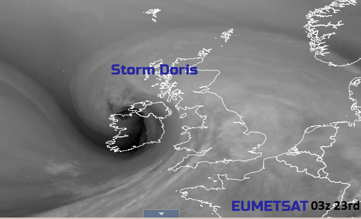
The Atlantic low pressure named Storm Doris has been developing overnight, now moving over the UK. It is bringing heavy rain and snowfall, strengthening winds and high gusts.
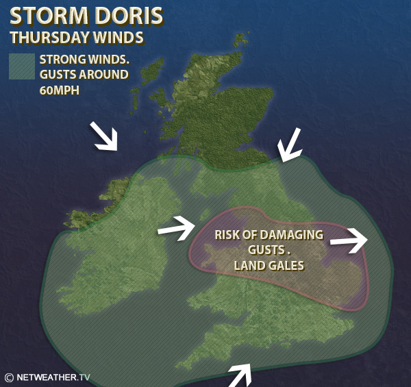
The main area of concern is the winds- strong SW then NW winds, land gales and gusts widely 50-60mph with 60-70mph across a central swathe of Britain, even reaching over 80mph possible. Gusts are the sudden, temporary blasts of stronger winds above the background ongoing sustained winds. There is currently an Amber Be Prepared warning for severe weather for the strength of the winds today.
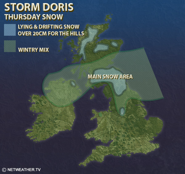
Also of concern, and attracting a second Amber warning from the Met Office is snowfall, mainly across southern Scotland into the far NE of England
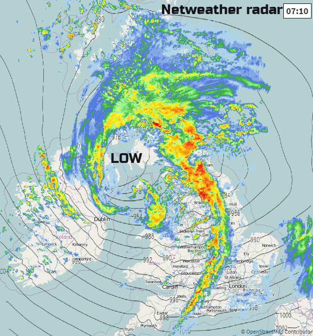
The snowfall has already begun and people are waking up to whistling or even howling winds. The radar picture from earlier shows a lovely curl around the centre of the low pressure, the defined cold front already through Wales and heading over the Midlands/NW England bringing heavy rain and squally winds.
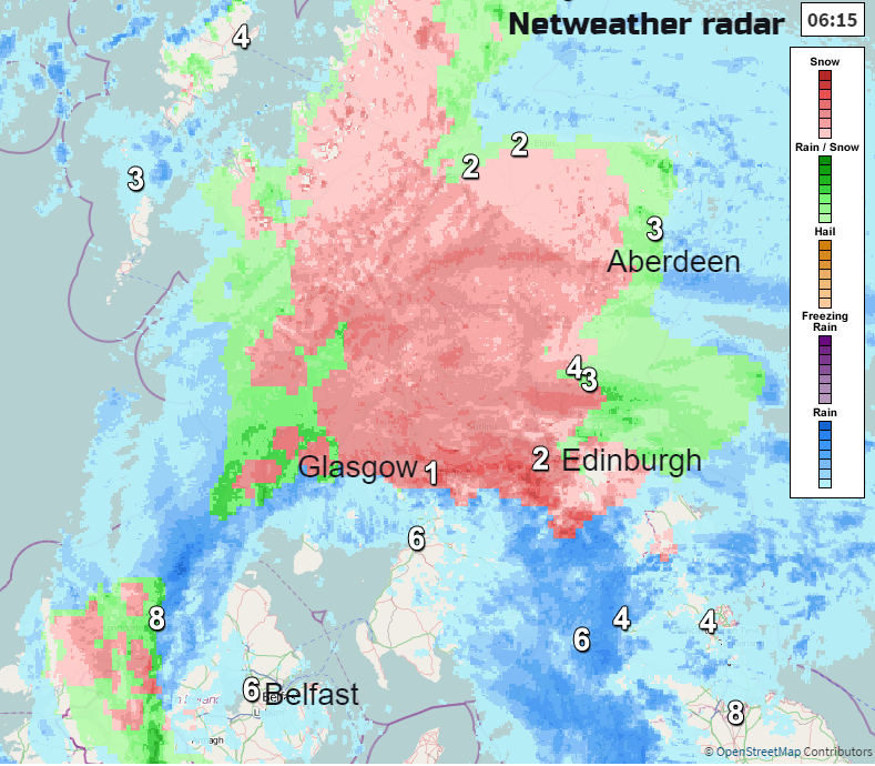
1.SNOW
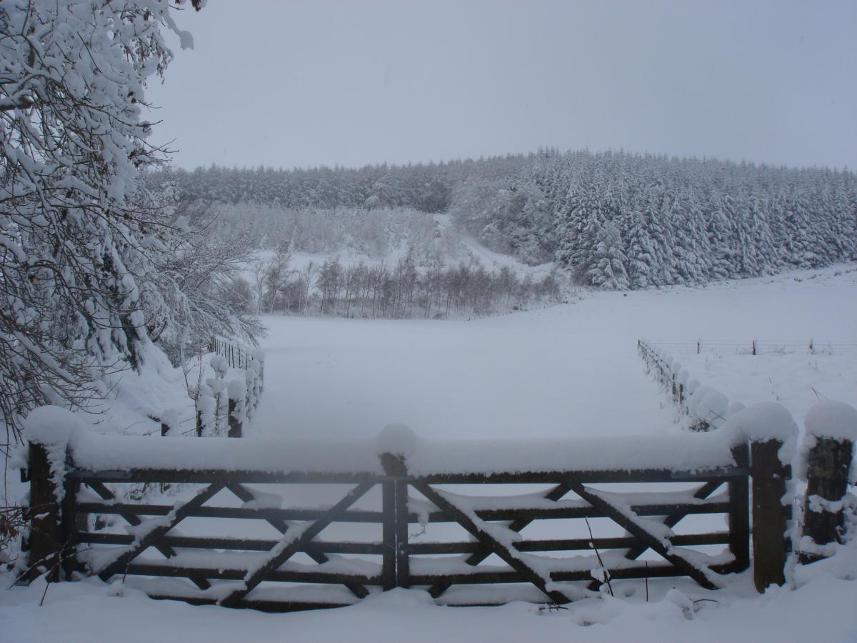
There is snow through the Central Belt with plenty of wintry weather over northern Scotland and now tucking into Northern Ireland on the colder NW winds.The worst areas for snowfall look to be through the Central Belt and the Borders, just to the north for inland Fife, Perth & Kinross, before the whole band begins to sink southwards later this morning. So further coverings this morning, tricky conditions on the roads with temperatures around freezing. This will vary from a temporary slushy 1cm covering to 15cm+ over the hills. There is a wintry mix with snow over the mountains for northern Scotland and we will see the band of rain, sleet and snow spread over the Scottish borders into Northumberland, Cumbria and Co Durham at lunchtime/early afternoon with lying and drifting snow for the Cheviots and Pennines. By mid-afternoon, there will be a wintry mix for north Yorkshire too. Already we've seen wintry conditions for N.Ireland and snow showers will really set in today over northern Britain, blowing in on a bitterly cold NW wind behind Doris.
2. WINDS
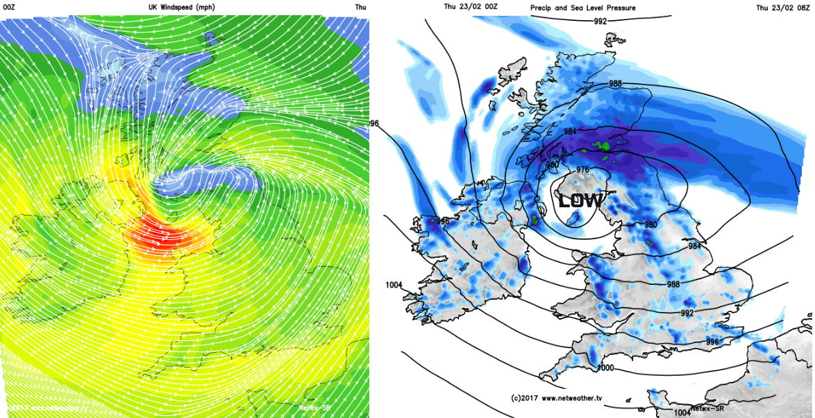
A low pressure centre is going to move right across the UK. The winds around a low centre are not even; right in the middle the winds are very light, shown on the image below in pale blue across southern Scotland at 8am. Northern Scotland also isn’t in the very windy weather today. However, you can see the circulation of the winds, with SW winds for much of England and Wales, cold NW winds over Northern Ireland and an easterly pushing up the Forth. The winds in the SW quadrant around a low are the strongest and we can see the red colours showing storm force winds in the Irish Sea. Today, the low centre will move eastwards so imagine how the winds change during the day and where that dangerous core of winds will move.
Thre have already been gusts over 70mph for Ireland and western Wales with gales for Belfast and eastern Counties of N,Ireland through rush hour. Wild conditions through the North Channel and the Irish Sea over the next few hours, with westerly winds hitting Merseyside, NW England and north Wales.
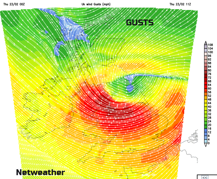
This core with potentially damaging gusts up to 80mph+ moves across the Midlands towards the Wash. The dark red area is the highest gusts but many parts of the UK stay very windy with teh orange areas showing gusts of 50mph.
The low pressure centre begins to move off into the North Sea this afternoon but still that SW quadrant of winds give stormy conditions and high gusts, through the Midlands and over East Anglia. Lincolnshire across to Norfolk will have a horrendous afternoon as the gales just keep on coming. It stays very windy for eastern England even through evening rush hour, as the rest of the UK sits in blustery cold air.
IMPACTS
With all this wet, stormy and wintry weather there will be disruption today. There are already cancellations to train services, restrictions on bridges. Conditions on the roads will be difficult with the strength of the winds and the sudden gusts, or the snow and ice in the north. There could be interruptions to power supplies as well. Take care out there today.
Rest of this week
Thursday night looks cold and wintry with temperatures around freezing, bitterly cold NW winds, ice and frost. There will be further wintry showers with snow over the hills of Scotland, northern England northern Wales and Northern Ireland. There will be sunny spells about but it stays cold in the north and up to about 7C in the south. The cold NW winds ease off by day under a brief ridge of high pressure giving some fine weather on Friday, before the next Atlantic system moves in from the NW. Southerly winds begin to pick as rain sets in for Northern Ireland and then western Scotland., There will be more snow ahead of the frontal band for Highland Scotland. A wintry mix pushes over northern Scotland with wet weather for northern Britain and staying wet for Northern Ireland as the evening turns winds with gales in the far NW. Central and northern England with Wales will turn damp and windy through Friday night.
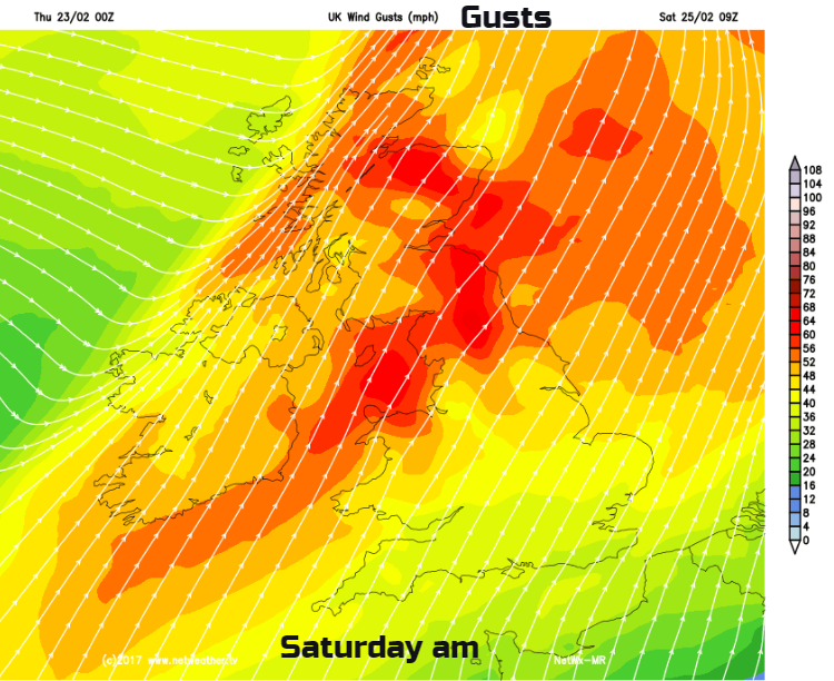
Saturday morning brings a spell of windy weather with outbreaks of rain and gusts around 60mph. Not as bad as today but not very nice for the weekend. Gusts of 60mph will affect Northern Ireland and northern Britain, with a windy afternoon for England and Wales
Sunday looks much milder but with another bout of wet and windy weather hurrying in from the Atlantic. So, plenty more unsettled weather to come
Will it be Windy? - Wind speeds and gusts at your location
Will it Snow? - Chance of snow for your location and remember the Netweather Snow App