Some warm, summery weather on the cards during next week, just in time for the end of the holidays.
Despite September being the first month of autumn, it is often a month of extremes given that it is a ‘boundary’ between changing seasons and this, as a result, can lead to highly varied conditions. One week we receive a taste of autumn, but then the situation can change quickly to something resembling late summer. It would seem, given latest forecast model guidance, that some late summer weather may well be on the way next week. Details aside at this range, but the broader weather patterns are shaping up to allow high pressure to become increasingly dominant along with perhaps with some warm or very warm temperatures too.
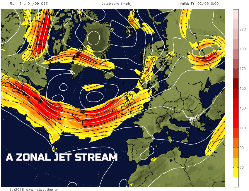
There are some primary reasons for this change and, as is often the case, it relates to the position and orientation of the jet stream. As we have been forecasting within the short term, the jet stream at the moment is moving across the N Atlantic in a general west to east (zonal jet stream) direction. This is allowing more unsettled conditions to move into the UK this coming weekend for example. However, as we progress into next week an important change is expected to take place, and that change is the jet stream will become buckled, or have more of a north to south, or south to north orientation, this is known as a meridional jet stream pattern. We can see both examples on the below weather charts, note how the jet stream is directly moving across the Atlantic within the short term, but the differences into next week are then very visible.
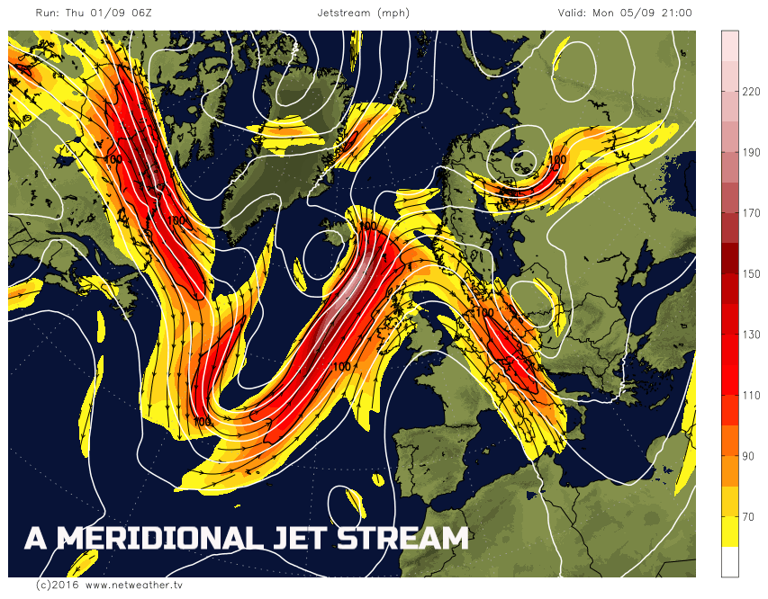
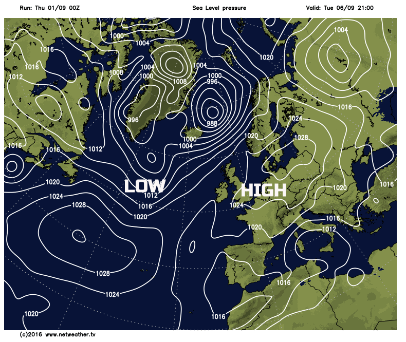
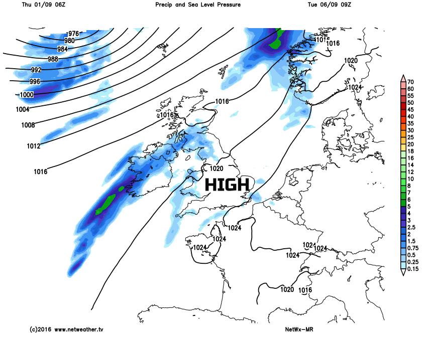
To use an analogy, it is sort of like sitting on a see-saw. If a person, or force, is placed onto one end of the see-saw then the other end responds but rising into the air. It is a similar setup with what will be the likely cause for the better weather next week. The jet stream is set to dip (a trough of low pressure) to the west of the UK, but then, as a result, the jet stream is then forced to move upwards, longitude wise, and builds to the north of the UK and essentially relates to higher pressure at the surface. This setup can be seen on the below-forecast chart as we move into Tuesday of next week.
So, what does this mean for us here in the UK? Well, within the short term the jet stream is indeed set to bring increasingly unsettled conditions to many areas as we move into the first weekend of September. Some longer spells of rain are expected to move across many areas of the UK into Saturday, but especially across England and Wales. However, it is behind this system that conditions will then quickly change to far more benign conditions through Sunday and especially into Monday of next week.
The current thinking is that relatively fine and settled weather will become increasingly dominant across England and Wales into early next week with some sunshine and warm temperatures. For Scotland and Ireland then there may well be some residual weather fronts in place to bring cloudier and more unsettled conditions here and the further north and west you are across the British Isles, then the more of a question mark there is over how much of an improvement in the weather, there will be. However, as our medium range weather model highlights, high pressure is indeed dominant early next week, and we then potentially pick up a South or SE’ly breeze off the near Continent into the middle of the week.
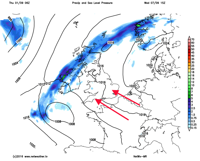
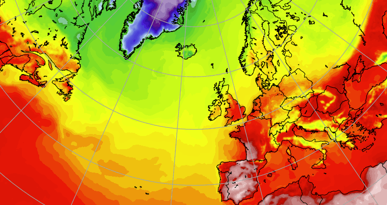
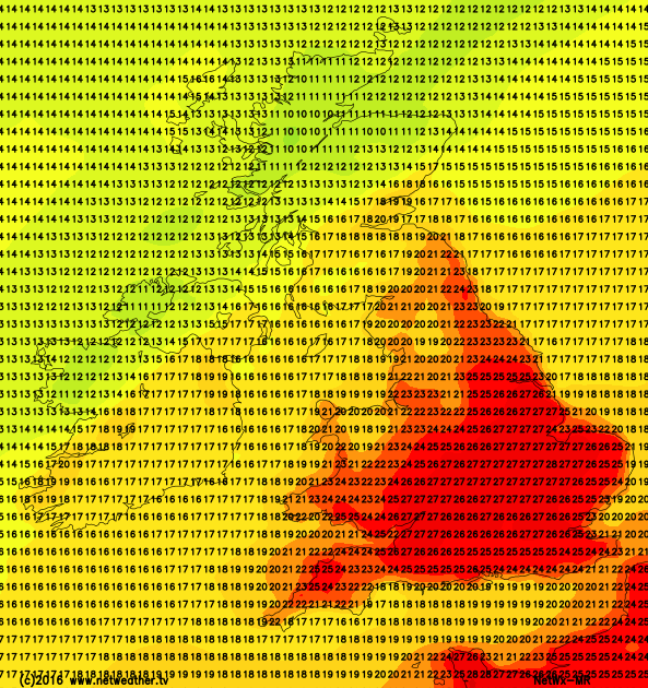
This development may then signal the arrival of some very warm conditions, again especially across England and Wales with temperatures, at the moment, signalled to rise to 25°C or more, which for early September is certainly above average, if not well above average.
So, despite a brief taste of something more autumnal this coming weekend, if you’re still in need of some late summer weather then next week may well be ‘right up your street’. This isn’t the first time this has happened either, there have been many occasions in previous years where the summer holidays come to a close, we move into September and then arrives some particularly decent weather. As ever we’ll keep you posted here at Netweather in the coming days, but don’t put away the shorts and t-shirts just yet!