Will the Bank Holiday Weekend be a washout? Nick looks more closely in his latest Blog ...

It looks like we are heading for a typical British Bank Holiday Weekend mix-bag of weather for England and Wales, with warm sunny spells and a risk of heavy showers on Saturday and Sunday – while Monday looks to turn cooler and cloudier, perhaps wet and windy from the east, but some uncertainty over the risk of rain. However, Scotland looks like staying mostly dry and warm, bar a few heavy thundery showers on Sunday
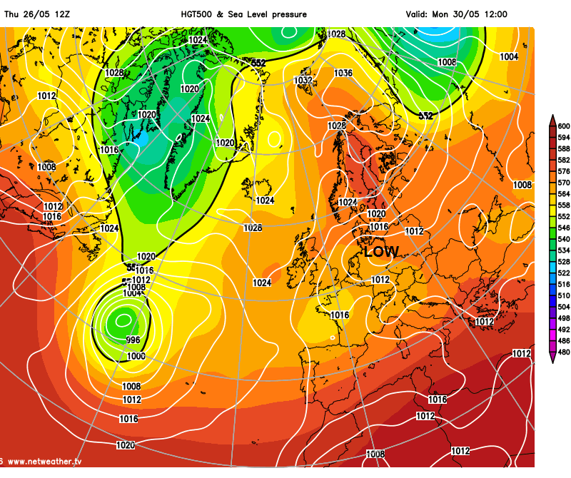
High pressure has been close by to northern Britain this week and will not be too far away over the long weekend too. Central and southern areas have been on the periphery of the high pressure to the north though. Yesterday saw low pressure and weather fronts nudge in from the east from the near continent, bringing cloud to England and Wales, with drizzle or rain in places, which has lingered through today across central areas. However, over the weekend, we see a two-pronged attack from area of low pressure to the SW tomorrow and the first half of the weekend – which threatens showers towards the west. Then early next week, a deepening area of low pressure over Germany expanding west threatens to spread rain west across parts of England and Wales.
Low pressure to the SW to start the weekend, then threatens from the east over Germany on Monday
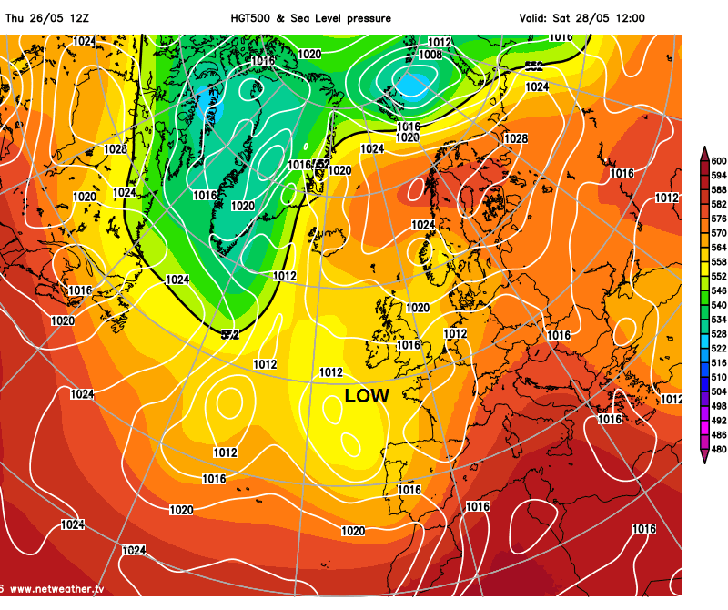
The low to the SW to start the weekend will bring a risk of heavy showers and perhaps a few thunderstorms on Saturday towards Wales, southern and western areas of England – while any showers towards eastern England look to be isolated – with many escaping with a dry and sunny day. Even those in southern and western areas that are more at risk of downpour may escape with a dry day.
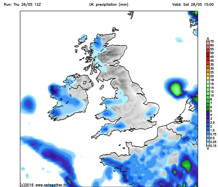
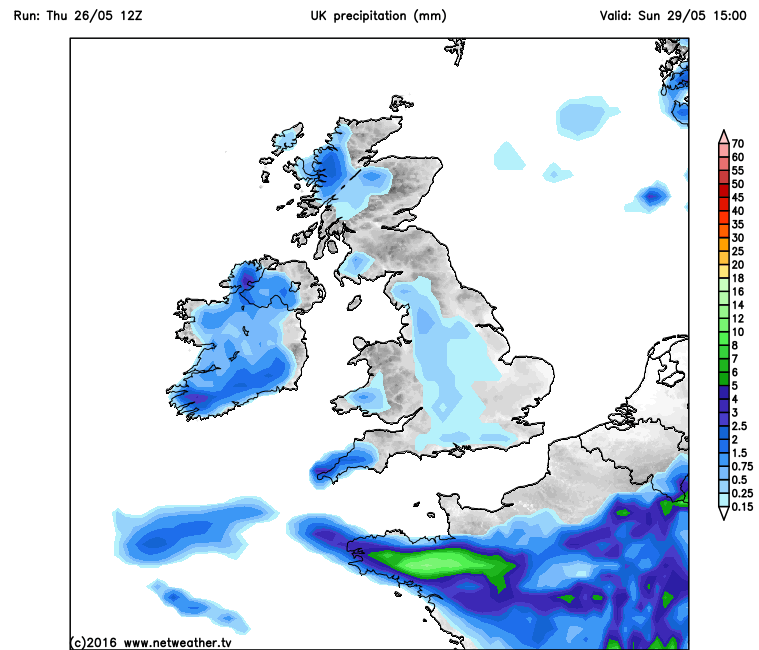
On Sunday, a lower risk of thundery downpours across England with most dry and warm, but a risk of some scattered heavy showers or a few thunderstorms developing across far SW of England, Wales, much of Ireland, N. Ireland and western Scotland. Fairly warm both Saturday and Sunday though, humid in the south, temperatures reaching 14-17C in the north, 18-21C in the south.
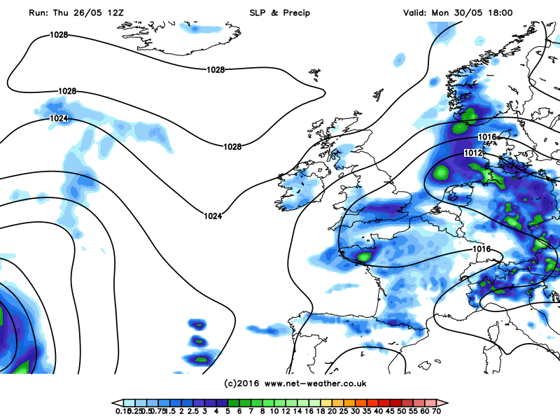
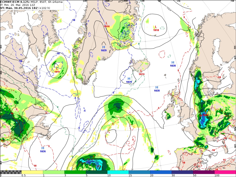
By Monday, still a lot of uncertainty, as deepening area of low pressure drifting N and NW over Germany threatens to spread heavy rain westward towards England early next week. The uncertainty lies with difference between models over how quickly and/or how far west the rain will spread. 12z ECMWF doesn’t bring in heavy rain across eastern England until Tuesday morning, with most areas dry bar some showers developing in the NW and Ireland. 06z GFS brought heavy rain in across much of England and Wales, but the latest run, the 12z, brings patchier and lighter or showery rain confined southern parts of England and Wales on Monday. So by no means is Monday resolved yet, but it will probably be cloudier and cooler than Saturday and Sunday for England and Wales, thanks to a strengthening northeasterly wind.
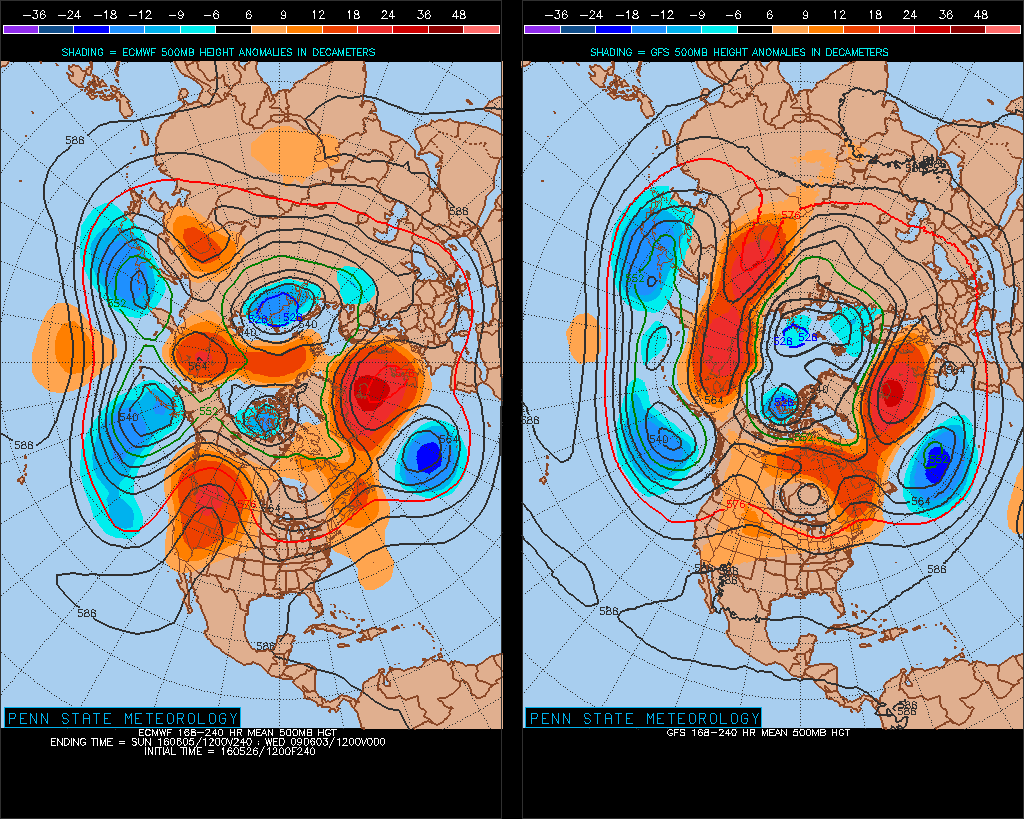
12z GFS vs 12z ECM for 18z Monday
Next week, a similar story of blocking high pressure close to northern Britain with low pressure close to the south, so after perhaps a cloudy and, in places, damp day on Tuesday, drier and sunnier for the rest of the week across northern areas, whilst southern areas see a mixture of sunny spells and perhaps heavy and locally thundery showers in places, depending on what model you look at.
8-10 day 500mb height comparison between 12z ECMWF and GFS early to mid-next week shows ridge of high pressure close to NW while pressure is lower to S and SW.