Band of rain heading SE turning to sleet and snow in some spots, though not amounting to much. More snow for Scotland at the weekend
It’s been fairly chilly these last few days, thanks to cold air flooding southwest across the UK on Sunday and Monday before high pressure built in yesterday, trapping the cold air and allowing temperatures to fall to -6.5C in Oxfordshire this morning under clear skies.
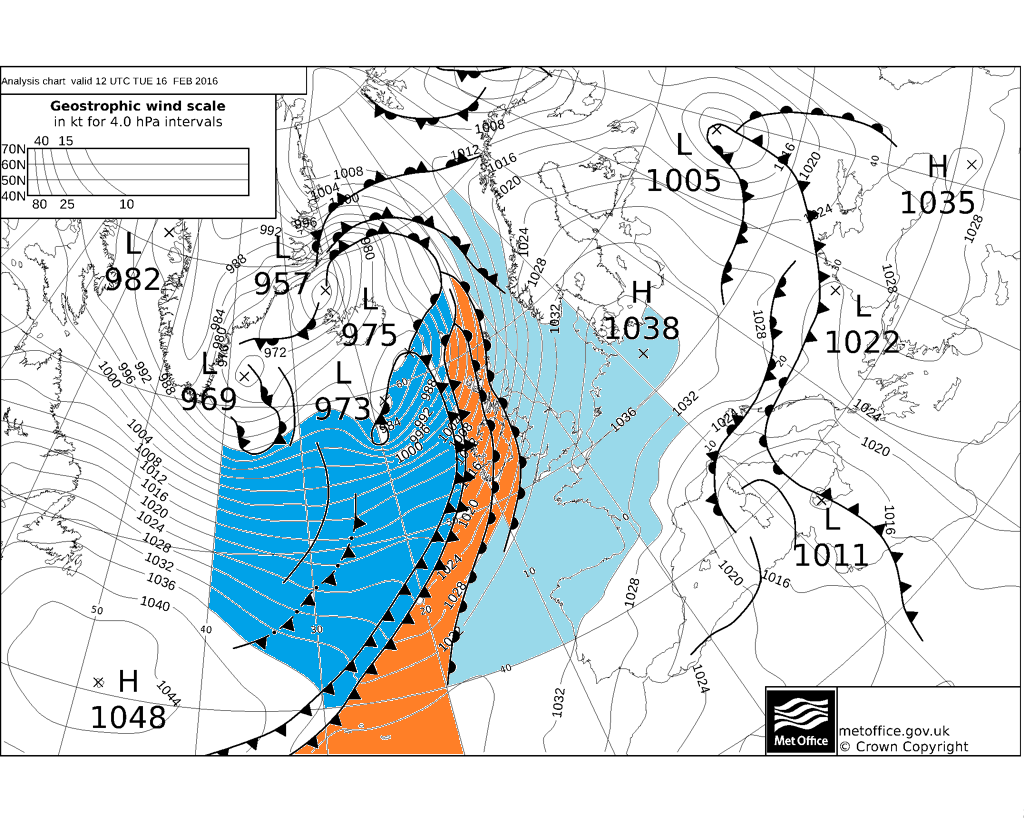
However, a change has been underway today, as high pressure retreats to the near continent to allow Atlantic weather fronts in from the west. A slow-moving warm front has been slipping east across Scotland, N England and Wales through the afternoon, bringing outbreaks of rain accompanied by a strong southerly wind and milder air across the far west. Across the far west, a cold front arrives into the west coast of Ireland and Western Isles
UKMO fax chart for 12 noon shows frontal systems spreading down from the NW, mild sector between cold and warm fronts
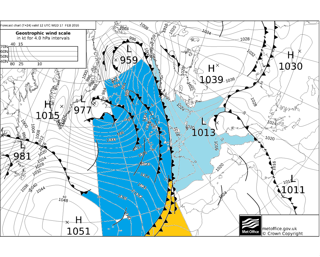
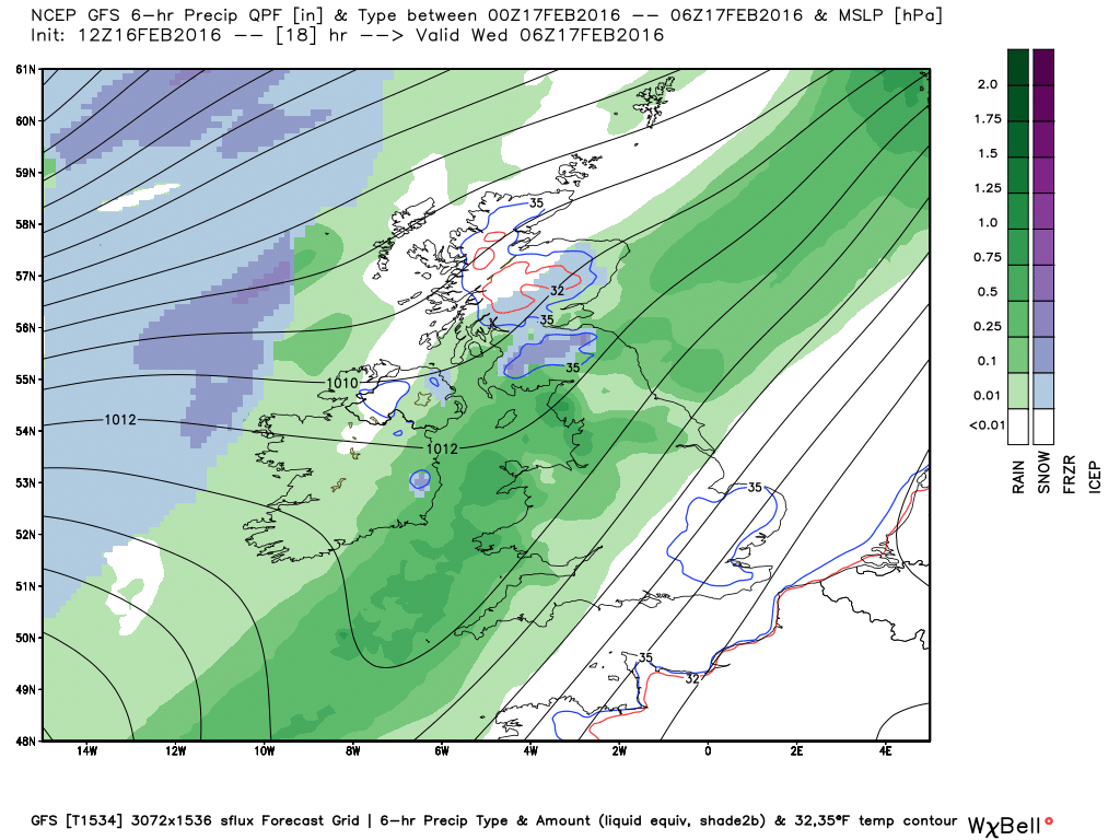
Over the next 12 to 24 hours, the cold front to the west will catch up with the warm front and so the frontal boundary will start to ‘occlude out’ milder air between the cold and warm fronts which separate cold Pm air coming in from the NW and cold dry air to the east over SE/E UK and near continent.
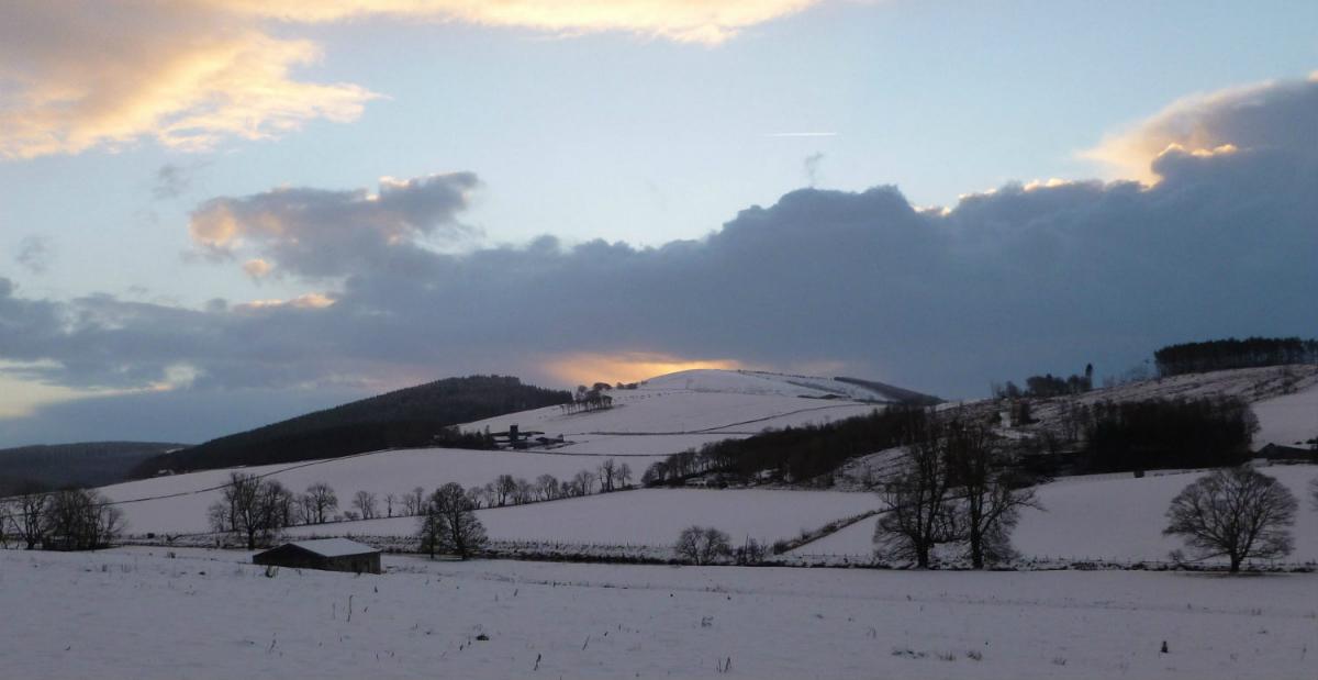
So we will start to see rain turn to snow on the back edge of rain band / cold front tonight across Ireland, N Ireland, Scotland and N. England, initially across higher ground, but perhaps increasingly to lower levels early on Wednesday – particularly in heavier bursts which allow rapid cooling of the air.
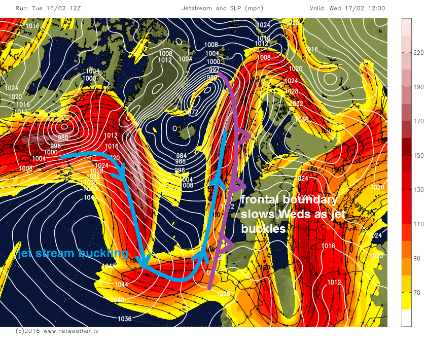
Through Wednesday, the occluding frontal boundary makes slow and erratic progress southeast across England and Wales. This is because the jet stream, that generally runs parallel to a frontal boundary separating different airmasses, buckles and slows it’s progress eastward due a blocking area of high pressure over eastern Europe. The frontal boundary develops subtle ripples along it as a result further slowing its progress.
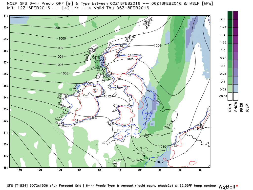
The air ahead of the front will become mixed out enough to mean rain will fall as the frontal boundary arrives. However, a combination colder air and dew points falling to 0C or below (required for snow to fall) flowing in from the NW into the slow-moving frontal boundary, will mean snow will increasingly fall over higher ground of Wales, central, southern and eastern England on Wednesday. Though snow also falling locally at lower elevations- particularly after dark Wednesday evening and overnight into Thursday, as a combination of night-time cooling and evaporative cooling as heavier bursts lower the air temperature, turn rain/sleet to snow. However, where precipitation is light, it will likely remain as rain. So, as you can understand, tricky to forecast exactly where it will snow, depending on how heavy precipitation will be, which can vary locally. Where it does fall and settle, some temporary slushy accumulations are likely, though perhaps a few centimetres over higher ground. So nothing too disruptive we don't think, though perhaps some slippery conditions over higher routes of England and Wales.
12z GFS rain/snow charts for Thursday morning
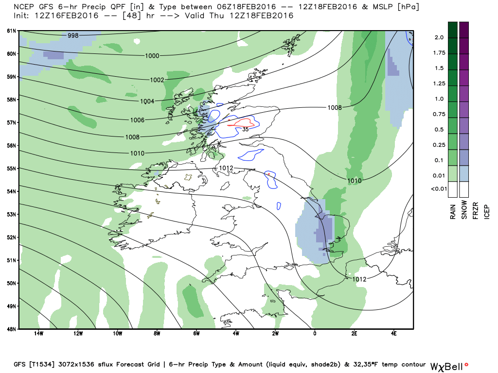
The rain, sleet and snow finally clearing SE England and E Anglia sometime Thursday late morning or afternoon. Followed by dry and brighter condtions, though with scattered showers in the west. Then on Friday, a deepening area of low pressure near Iceland will throw a frontal system across the UK, bringing cloud and rain to many areas and turning windy – especially in the north.
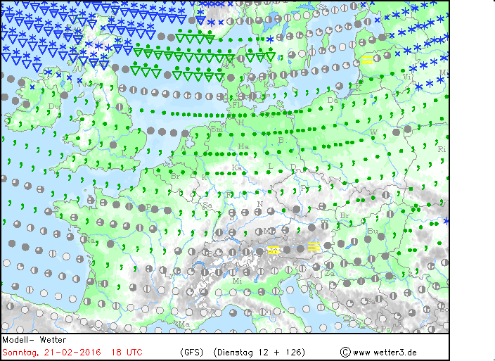
The weekend sees a stark contrast in airmass across the UK. Much milder conditions will flood across much of England and Wales, with temperatures into double figures both Satuday, Saturday night and Sunday. While across Scotland increasingly cold air will move in. The jet stream, which separates these two airmass, moves north this weekend across northern England. Southern areas will be generally dull and wet at times both days. While Scotland sees brighter but windy conditions, with increasingly frequent blustery wintry showers, falling as snow as we head into Sunday. So quite a wintry picture for the Scottish Highlands by the end of the weekend.
12z GFS shows snow showers for Scotland on Sunday, as much colder air returns to northern Britain