


Blog looking at a spell of colder weather setting in across all parts later this weekend and through next week and looking at whether it'll snow.
The coming weekend sees a battle ground develop across the UK between colder air trying to push down from the north and milder air trying to push in from the southwest with Atlantic low pressure systems. The cold air eventually wins out by the end of the weekend and hangs around at least through early next week and probably until the end of the week.
There will be some snow around too, initially as rain from Atlantic frontal systems trying to nudge in over the weekend bumps into cold air and turns to snow along the northern extent, though mostly over higher ground. Then, as the last of a few lows crossing southern Britain on Friday and over the weekend clears into the near continent, the increasingly cold northerly veering northeasterly flow may bring sleet and snow showers to some eastern parts as we start next week.
What’s happening synoptically, is the jet stream which has, up until recently, been further north and driving deep depressions across northern UK, has now moved further south and will move east across France and northern Spain. So, after a break in Atlantic systems (or what is known as a ‘col’ in meteorology), the next Atlantic low arriving on Saturday moves somewhere across southern England or through the English Channel then on into the near continent. The exact track of this low is still not certain, but the northern extent of the rain will likely fall as snow over higher parts of Wales, Midlands and northern England, with a low chance of snow perhaps falling to lower-levels across these areas in any heavier bursts. Scotland and the far north of England colder and brighter over the weekend, but with a risk of showers or longer spells of sleet and snow blowing in on an increasingly cold easterly wind, particularly towards eastern coasts of Scotland and NE England.
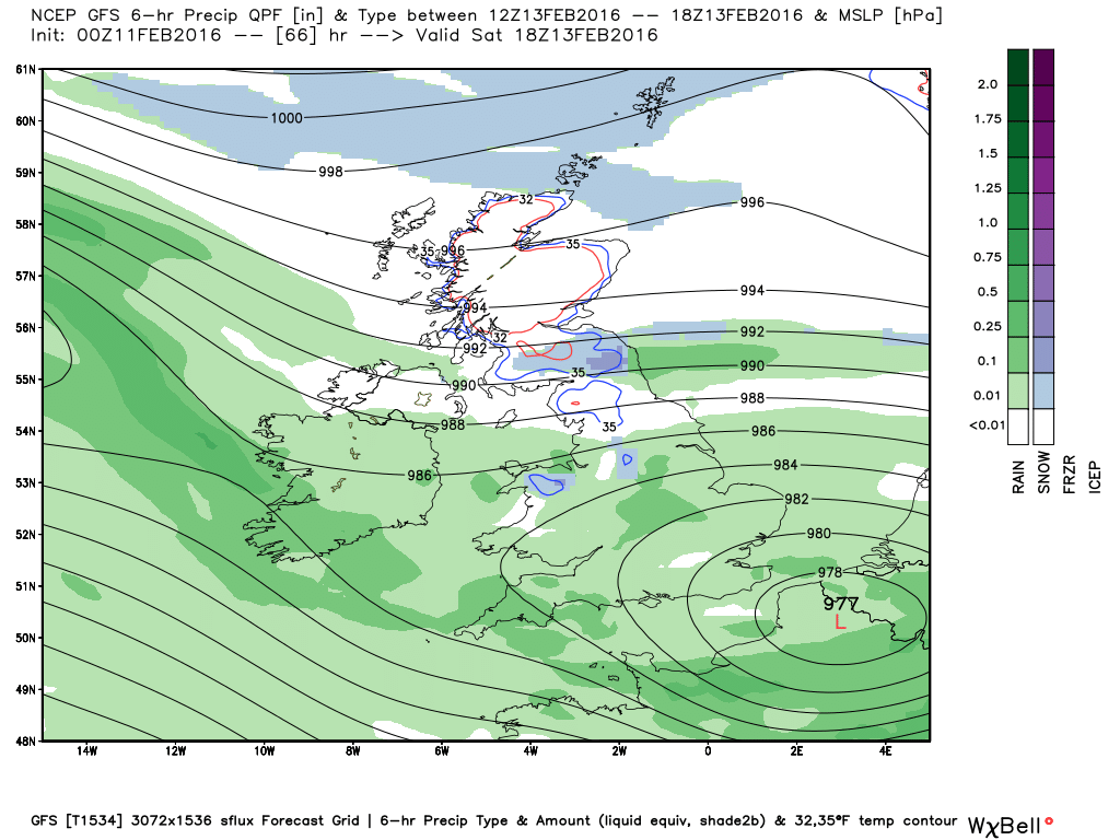
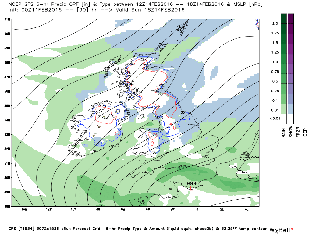
Rain and hill snow will eventually clear away from eastern England on Sunday as low pressure moves on over the near continent, perhaps rain turning to snow at lower levels across eastern areas, as colder air undercuts from the NE.
Then increasingly colder air will flood southwest across all parts to start the new week. The cold northeasterly looks fairly dry on model output, away from eastern coasts – where wintry showers are indicated Sunday night onwards through Monday. Hard frosts developing widely Sunday and Monday nights away from the immediate east coast.
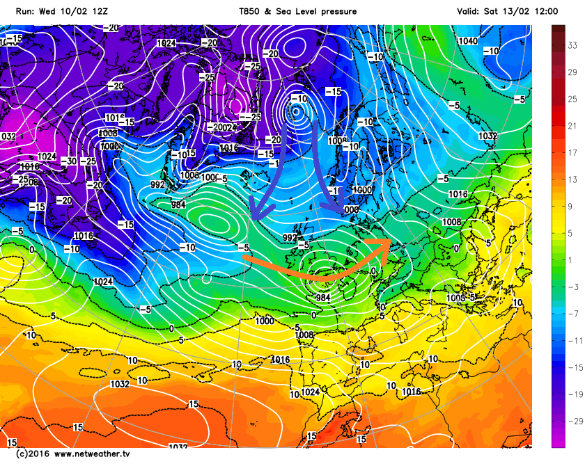
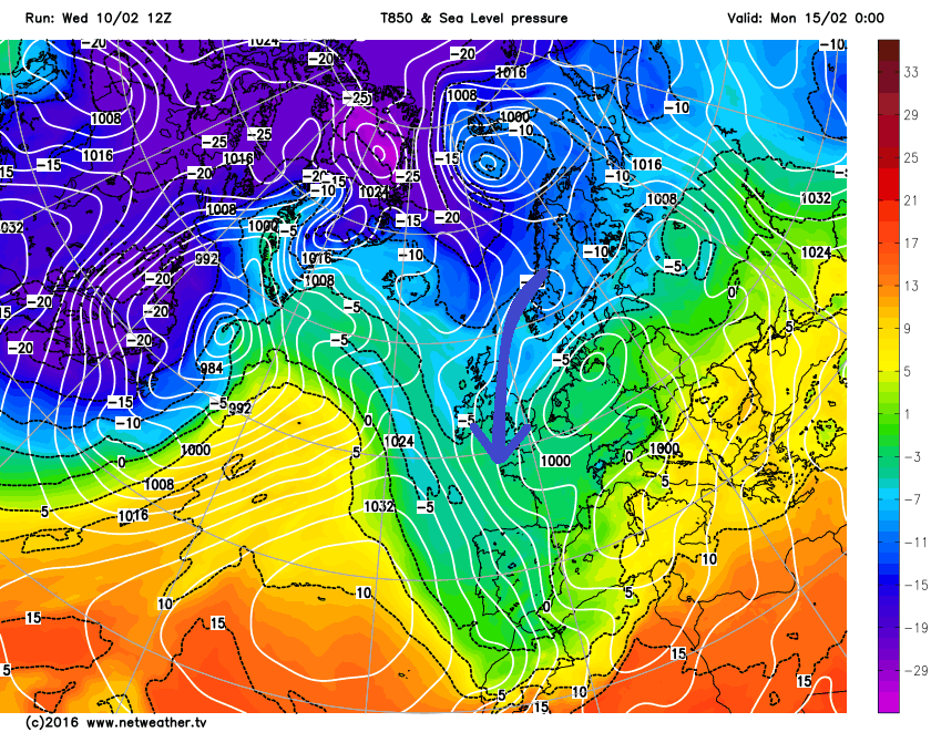
Tuesday looking mostly dry, bright and cold with showers fading from the east coast, as high pressure builds in from the west. Some uncertainty from mid-week, as a cold upper vortex originating from over NE Canada is modelled to drift ESE across Iceland and NE Atlantic. GFS over its last few runs has disrupted this upper trough/vortex as it slides SE against a blocking ridge of high pressure over northern Scandinavia and Svalbard. This means the associated frontal system and mild sector with it gets squeezed out as moves SE across the UK, allowing enough cold air to remain for a widespread marginal snow event along the frontal boundary as it moves across the UK next Wednesday.
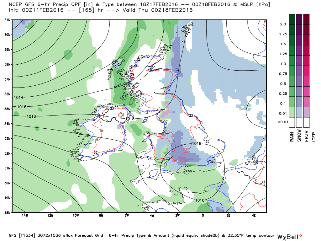
ECMWF had kept the upper trough intact as it moves in from the NW mid-week onwards, with milder air spreading in across all parts mid-week. However this morning's high resolution run has now moved towards GFS, with high pressure over the Atlantic and Scandinavia causing the trough trying to push down from the NW to disrupt. An Atlantic frontal system tries make inroads mid-week, but gets little further east than NE England, Wales and SW England before fizzling out as high pressure squeezes in from the east and west.
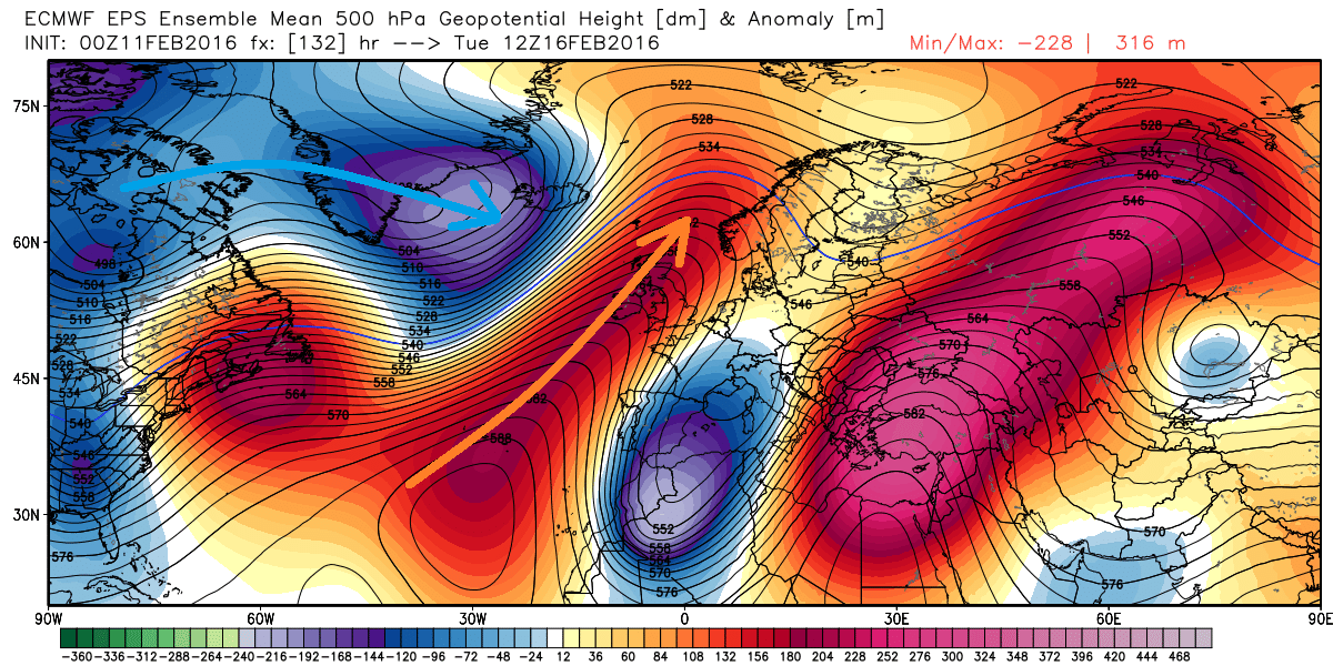
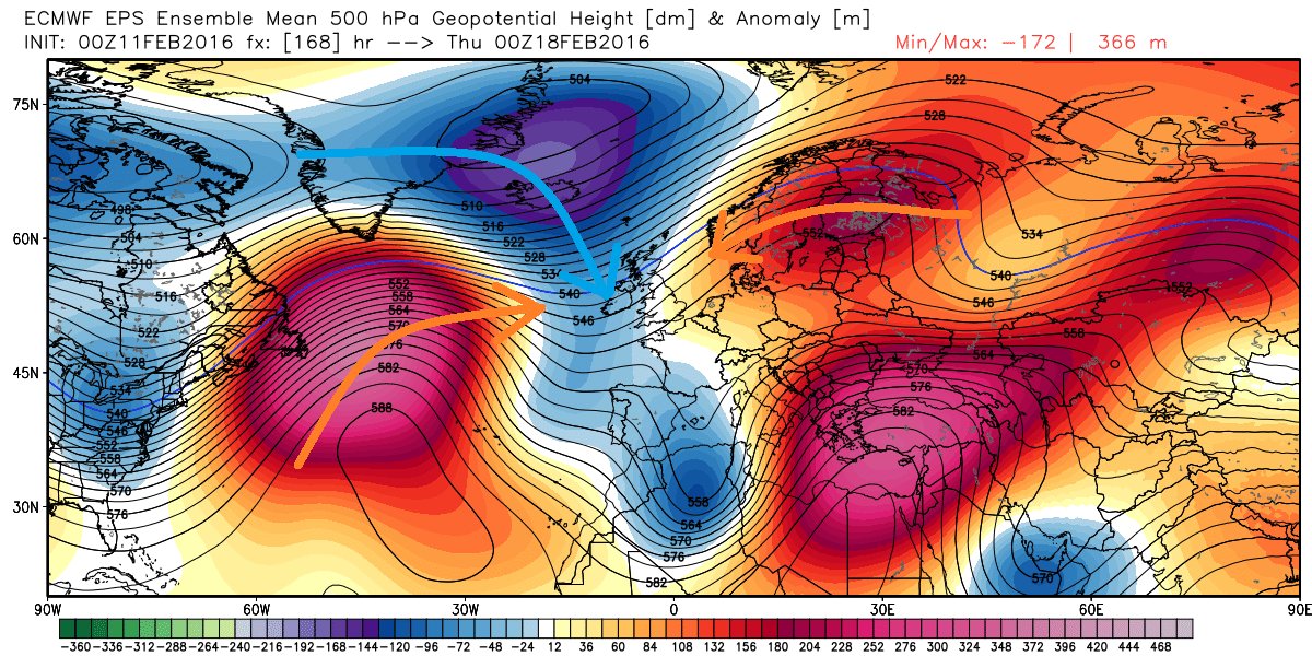
The 2 charts below show the sequence leading to trough disuption next week, as an upper trough/vortex (blues) tries to push down from the NW through high pressure ridging (reds)
So, an increasing likelyhood now that we see the cold conditions that set in early next week hang on all week, with a decreasing risk that we may see a more progressive return of Atlantic low pressure systems form the west or northwest bringing in more unsettled and milder conditions. It won't be a deep freeze though, with day time maxima generally staying above freezing away from higher ground in the north, though temperatures falling well below freezing at night, particularly where there is any snow cover.
Will keep you updated.


