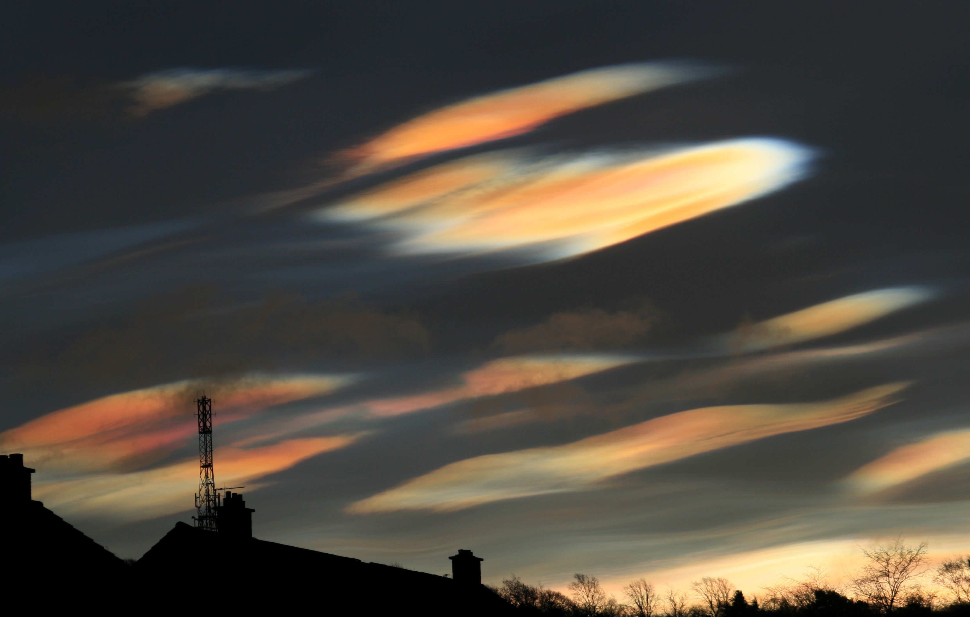
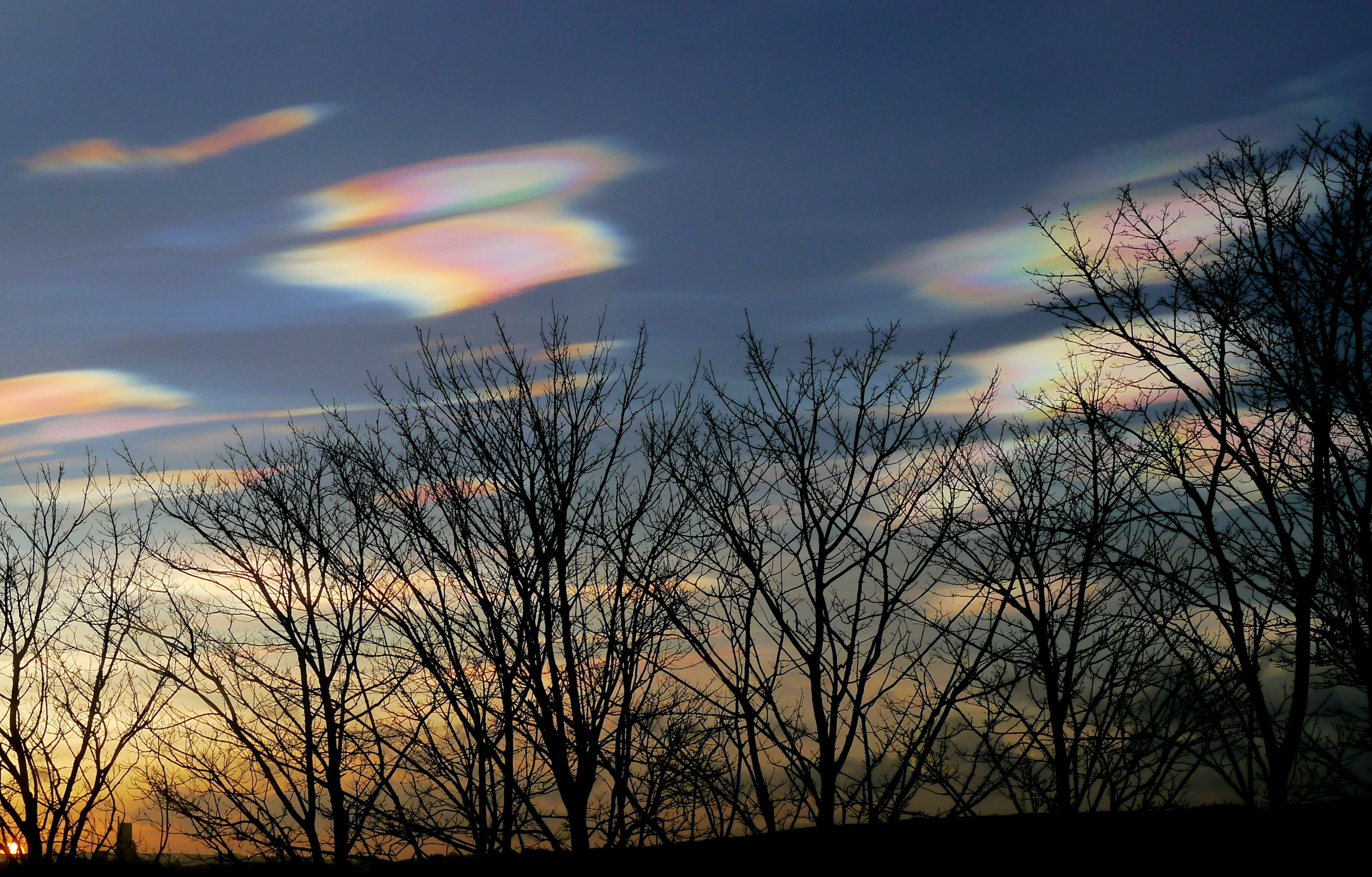
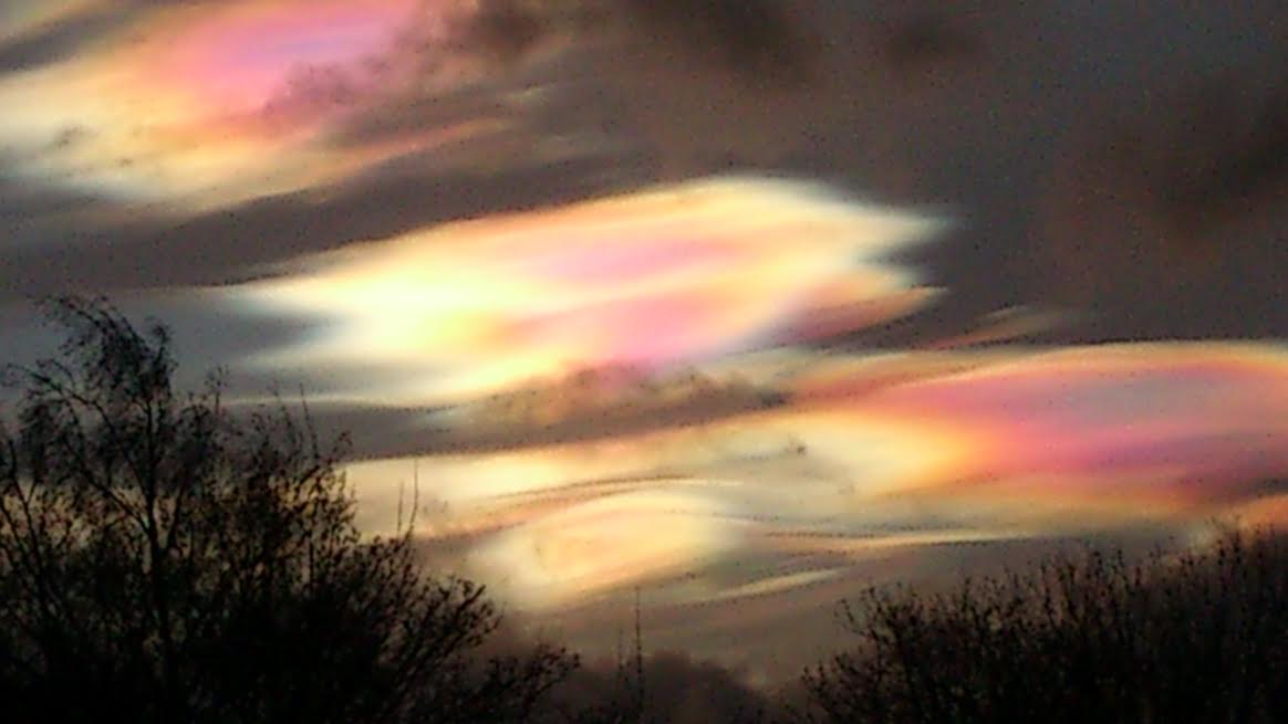
Have you seen beautiful, eerie, strange clouds during Storm Henry? Rainbow like, mother of pearl coloured clouds around dusk and first thing in the morning. These are the rare Nacreous clouds.
East Lothian Christine K
The Netweather forum has been inundated with photos of beautiful clouds during #StormHenry. Strange green pink/Rainbow/mother of pearl/iridescence colours. Blocky or wave like shapes, more angular than the usual fluffy clouds.
These clouds are higher up in the atmosphere than our usual everyday clouds. They seem to occur when we have very strong winds at the surface, like Henry has provided. You can see them when the sunlight isn’t too strong and so around dusk and after dawn are ideal times when the sunlight still provides the colours but the power of full daylight doesn’t obliterate the stunning iridescence.
Usually these clouds would only be seen in the polar regions but the show recently has been long lived and widely available. Scotland has seen the most vivid scenes but reports have come in from as far south as Norfolk. Nacreous clouds form below -78 °C temperatures. As you go up in the atmosphere, temperatures fall until you get into the stratosphere. If the surface temp is +6C, top of Cairngorm is -4C, then you have to go up very high to see -78C.
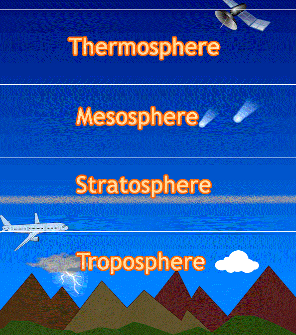
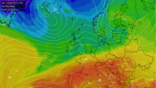
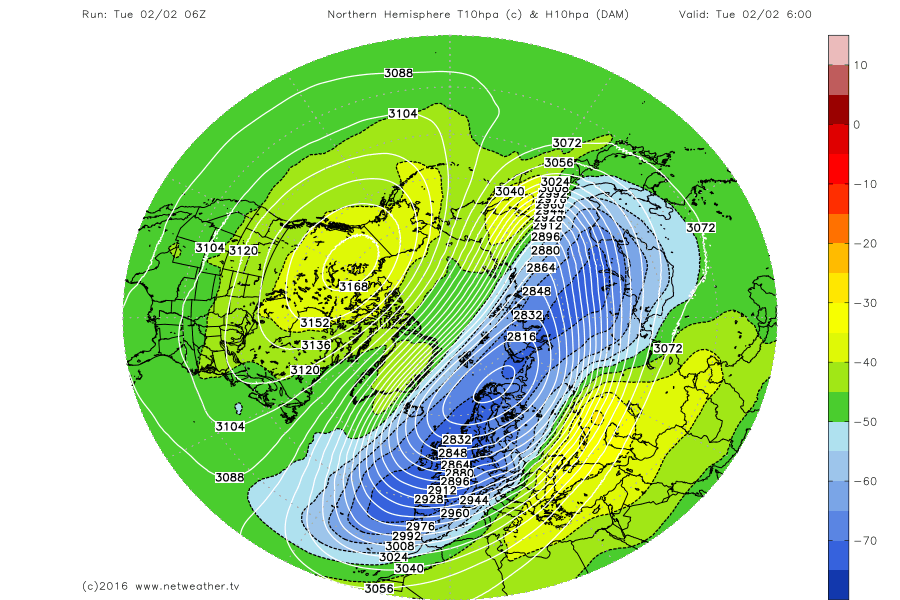
Most of our everyday clouds are in the troposphere, the section of our atmosphere closest to the ground and up to a height of about 7 miles up. The next section is the stratosphere, reaching to 30 miles up, although the dividing boundaries vary around the globe. At that height and temperature, the clouds are made up of ice crystals ( some Nacreous thought to be mixed with certain atmospheric acids) which catch the sunlight, giving the shimmering colours. Currently, there is cold stratospheric air over the UK, with below -78C air in the north.
One of our resident Stratospheric experts Ed O’Toole explains “The cold core of the polar vortex which normally resides over the North Pole has been displaced over Northern Europe and moisture in this core has allowed cloud formation to occur in the stratosphere and to be viewed from the UK.” See the blue area in Netweather stratospheric chart below
Nacreous clouds are found in the Met Office Observers book under “Special Clouds” along with Noctilucent (much higher). A description “…is brightly coloured like a glorified iridescent cloud”. Sometimes you do glimpse iridescence in clouds, the mother of pearl hints but these nacreous episodes have been spectacular
So, with the stratospheric air over the UK and Storm Henry at the surface throwing up perturbations right through the atmosphere, clear skies mainly over eastern Britain we have been lucky enough to see these rare clouds in the UK.
Edinburgh 1st Feb Duncan M.
Storm Henry threw over 100mm (4”) of rain over Sutherland in the far north of Scotland in just over 1 day. The Western Isles sustained Force 11, violent Storm force winds on South Uist 56knots 64mph with a gust of 90mph. Stornoway Airport had a gust of 81mph on Monday evening too and the top of Cairngorm mountain had a gust of 148mph
Top photo Edinburgh Silke T


.png?w=350)