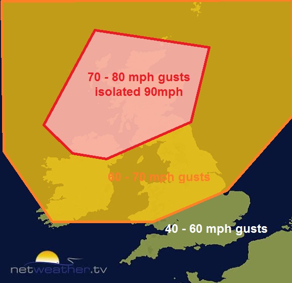
Blog looking at Storm Henry arriving Monday evening - bringing wind gusts of 70-80 mph widely across Scotland and N Ireland, perhaps 90 mph across exposed parts of the NW.
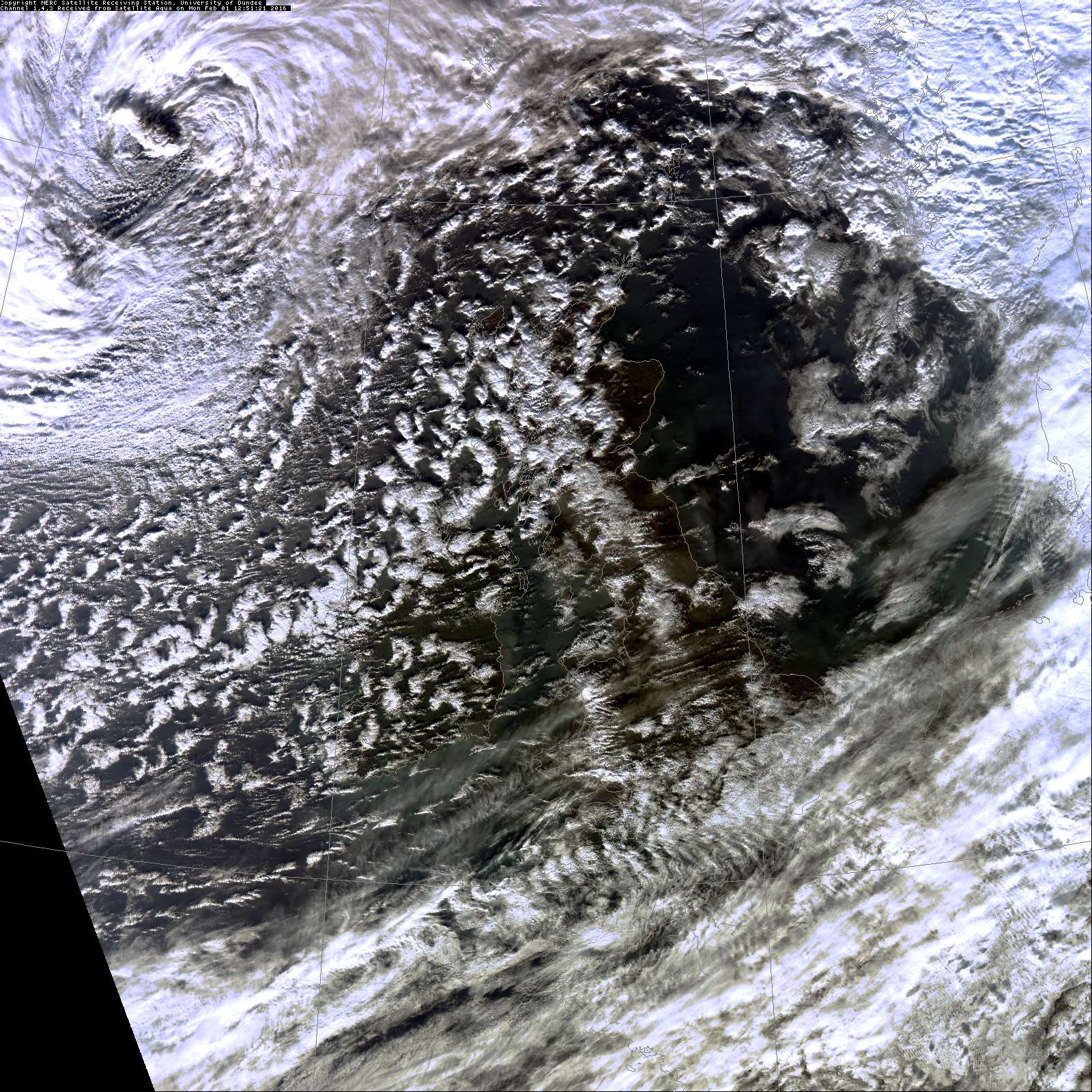
Storm Henry's centre to the NW of Scotland at 15z (image courtesy of Satellite Dundee)
Following shortly after Storm Gertrude, which brought high winds, heavy rain and travel disruption to Scotland Thursday night into Friday, the 8th storm named by the Met Office, Storm Henry, will move across the Northern Isles tonight.
Storm Gertrude brought a 91 mph gust in the Outer Hebrides and a 87mph gust at Inverbervie in Aberdeenshire. A rare red alert was issued by the Met Office for Orkney and Shetland islands for the dangerous high winds.
The Storm Gertrude depression was a fast-mover, so the height of the strongest winds experienced was fairly brief. However, the centre of Storm Henry is moving more slowly, so the strong winds will last longer.
Storm Henry has deepened rapidly over the Atlantic in the last 24 hours under the developmental left exit region of a 200mph+ jet streak and forward side of sharpening confluent trough due to cold air advection pushing SE out of NE Canada / Labrador Bay. The left exit or right entrance of the jet stream is where air at upper levels of the troposphere diverges and decelerates which causes upward motion of air at the surface. This allows areas of low pressure at the surface to deepen rapidly, with help of upward motion forced by an upper trough.
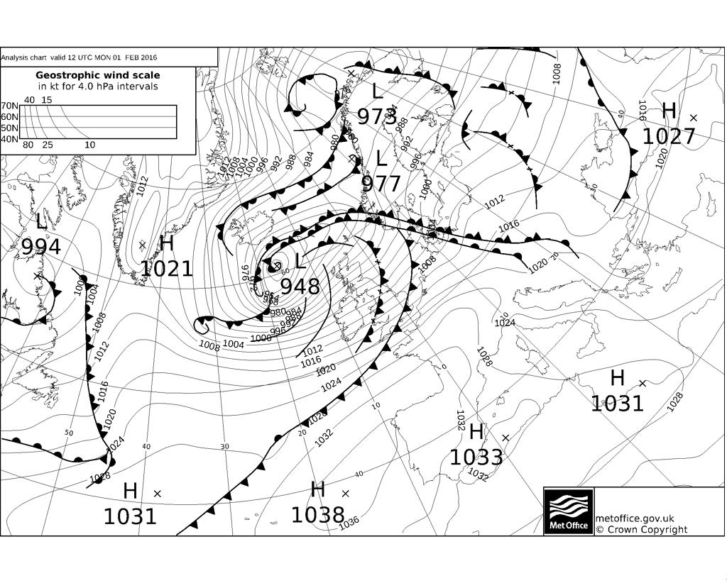
The central pressure of Henry fell some 31mb in the 24 hrs between 6am Sunday and 6am today looking at the Met Office fax charts. A low with a central pressure that falls 24mb (or more) within 24hrs is said to be undergoing rapid cyclogensis (RACY) or a ‘Weather Bomb’.
Fax chart for 6am Sunday 31st Jan
Fax chart for 06z Monday 1st Feb
Storm Henry will start to ‘fill’ this evening, i.e. the central pressure will rise, as the upper trough relaxes and associated jet stream weakens and the deep depression becomes increasing detached from the jet stream - which will lie WSW-ENE across N. Ireland and southern Scotland. The fax chart for noon today shows that pressure has risen 4mb since 6am this morning chart above.
However, Henry will still be deep enough, as the centre crosses the Northern Isles just after midnight, to bring violent and damaging wind gusts. Already the wind this afternoon has gusted to 75mph at South Uist in the Outer Hebrides and Magilligan in N. Ireland, also a gust of 68mph at Lake Vyrnwy in north Wales. Generally from the Midlands and Wales northwards winds are already gusting to 45-55mph, with higher gusts of 55-70 mph across western Scotland, higher ground and to the lee of high ground (such as NE England). As a result, the Forth Road Bridge is now closed to all vehicles.
Wind gusts (GFS) for midnight Monday night
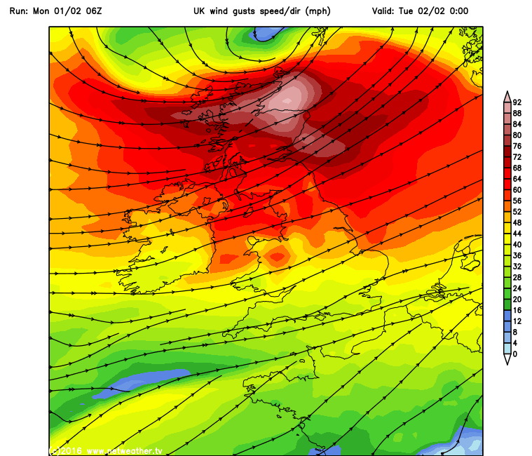
As isobars tighten further with the approach of Henry this evening and overnight, gusts of 70-80mph are expected quite widely across Scotland and N. Ireland, with isolated gusts of 90mph possible across exposed areas such as the Western Isles and parts of western Scotland. Across northern England and north Wales, gusts of 60-70mph are likely, perhaps more over exposed sites. These very strong winds are creating large swells over the Atlantic, with the K5 Weather Buoy to the NW of Scotland recording waves reaching a height of 45 feet or 13 metres. So a risk of coastal flooding in the west and dangerous conditions along seafronts as large waves crash on the beaches and breach defences.
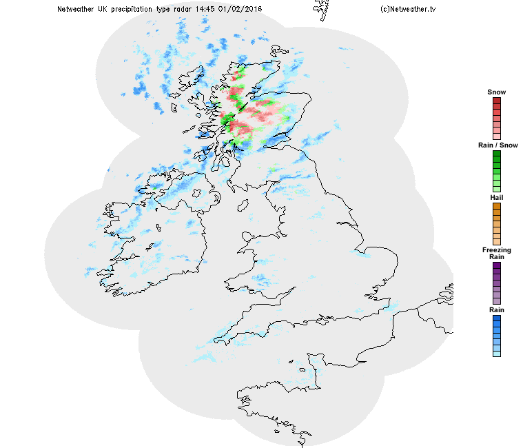
Colder air is now sweeping south behind a cold front clearing SE England this afternoon, the air cold enough for sleet and snow to fall over the Highlands from the heavy showers blowing in across Scotland, so blizzard conditions likely over higher ground.