


This week's rain has resulted in some of the first Flood alerts and warnings of the season. Here's a reminder of where to find the information from the Environment Agencies
October 2015
UK flood alerts are popping up. As Autumn continues, so will the wet weather and with more heavy rain the flood warnings will only increase
The heavy rain midweek has been over eastern Britain on Wednesday with more to come for NE Britain. 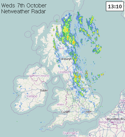
England and Wales Floodline on 0345 988 1188
GOV website https://flood-warning-information.service.gov.uk/
Environment Agency Floodline http://apps.environment-agency.gov.uk/flood/31618.aspx
The environment agency cover 6 English regions and Wales. You can view a map or list of current Live alerts of warnings
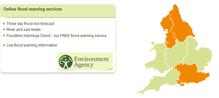
Flood alerts showing in orange - Flooding is possible. Be prepared
Flood warnings in red - Flooding is expected. Immediate action required
Severe flood warnings also in red - Severe flooding. Danger to life.
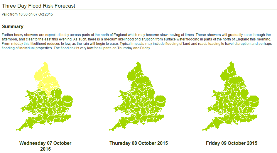
There is lots of information against each alert/warning with a map and timings. Also available is a 3 day ahead forecast, although it is issued around 10:30am and one of the days is today.
Scotland - Floodline 0345 988 1188 (same number)
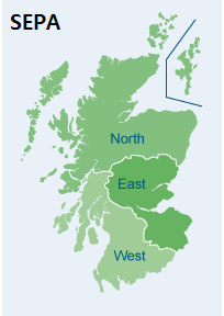
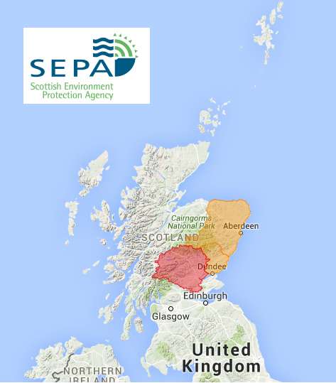
SEPA - Scottish Environment Agency issue flood alerts and warnings for 3 regions North, West and East.
http://www.sepa.org.uk/environment/water/flooding
http://www.floodlinescotland.org.uk/flood-updates/
There is not currently the 3 day ahead forecast
Northern Ireland
There is some flood information at http://www.nidirect.gov.uk/flooding-in-your-area but not a specific service.
| Type of flooding | Description (from SEPA) |
| River | Occurs when a river cannot cope with the amount of water entering it. The level of the river rises until it eventually overflows onto surrounding land. |
| Coastal | Occurs as weather and tidal conditions increase sea levels. Current predictions for climate change anticipate an increase in sea levels, storm surges and waves all around Scotland’s coastline and it is predicted that the frequency and severity of this type of flooding will increase. |
| Surface water | Happens when there is rainfall on ground that is already saturated, or on paved areas where drainage is poor. The water has nowhere to go and so pools on the surface. |
| Groundwater | Groundwater flooding is a type of flooding that is more complex to assess and therefore show on a map as groundwater flooding alone does not usually cause flooding but instead is a contributing factor. Groundwater flooding can happen when rainfall causes the water that is naturally stored underground to rise to the surface. It can flood, or contribute to flooding, of low-lying area in particular. Our flood maps show areas where groundwater may be a contributing factor. |
| Drain, sewer and broken water mains | Drain, sewer and broken water mains flooding is not a natural type of flooding and is managed and assessed by water boards, roads authorities or local authorities. |


