


Latest Blog looking at short to medium range. High pressure with settled conditions persist for rest of week and into weekend before unsettled conditions return by early next week.

High pressure is floating around near or over the UK this week, which means it will stay settled until the end of the week. So most parts of the UK can enjoy warm, sunny days and chilly nights with mist and fog forming in places, particularly central and eastern areas. There will be subtle differences at opposite ends of the UK, with it turning breezy in the south and far northwest. Cloud and patchy light rain will continue to affect northwest Scotland until mid-week, while in the south a strengthening easterly wind will make it feel noticeably cooler, particularly around southern and eastern coasts where the wind will be strongest.
High pressure in charge this week
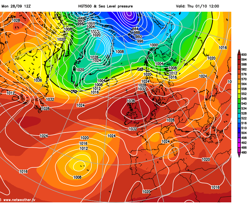
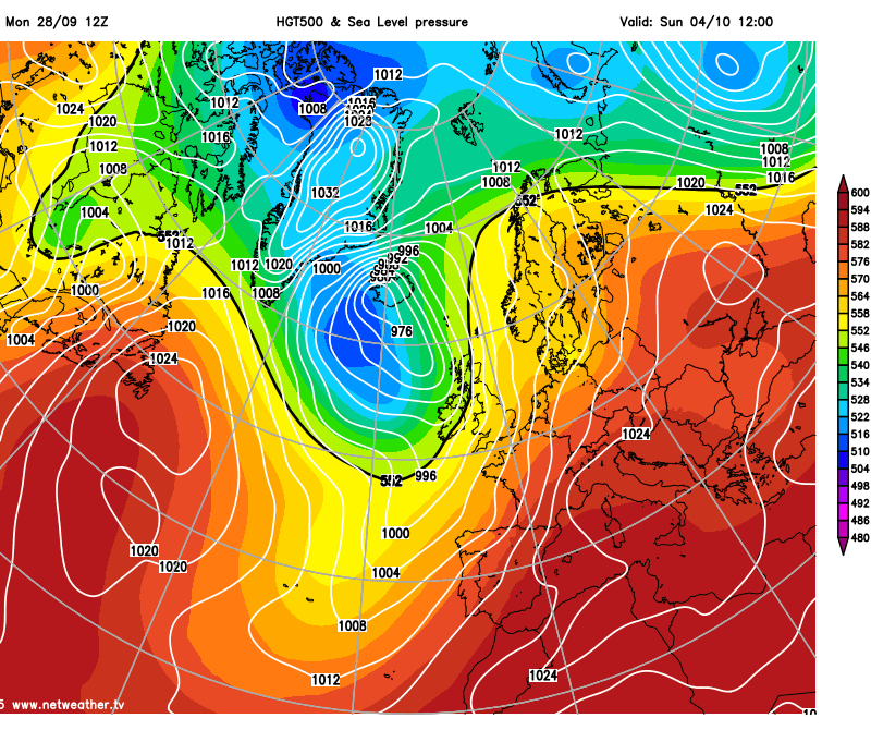
But on the whole, the short-term outlook is settled and dry as we enter the first few days of October. But, the weather models are signalling a change later this weekend or early next week, as the ridge of high pressure sat over the UK during this week begins to drift east into the near continent, while an upper trough slowly moves in from the Atlantic. So it looks likely that we will see a gradual decline from the west in the settled conditions on Sunday or early next week, as Atlantic frontal systems move in. So western areas will likely be the first to see this breakdown, some model disagreement on how soon this will start, Monday’s 12z GFS operational brings cloud and rain in across the far west Saturday night, before spreading across most parts Sunday. Whilst ECMWF keeps the UK dry all weekend before rain arrives across Ireland and SW UK Monday morning before spreading northeast across most parts in the afternoon.
Breakdown by Sunday as per 12z GFS?
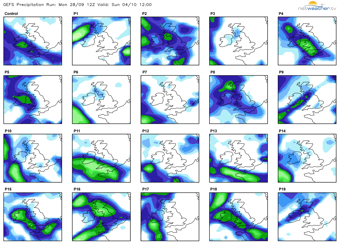
A look at the 20 individual members that make up Monday 12z GFS ensembles (GEFS) run reveal a roughly 50:50 split between being mostly dry on Sunday or bringing rain across the UK.
With this transition to more unsettled conditions, we lose the chilly nights as winds pick up and switch to a warmer southerly or southeasterly direction before switching southwesterly, with temperatures generally becoming average by day and night.
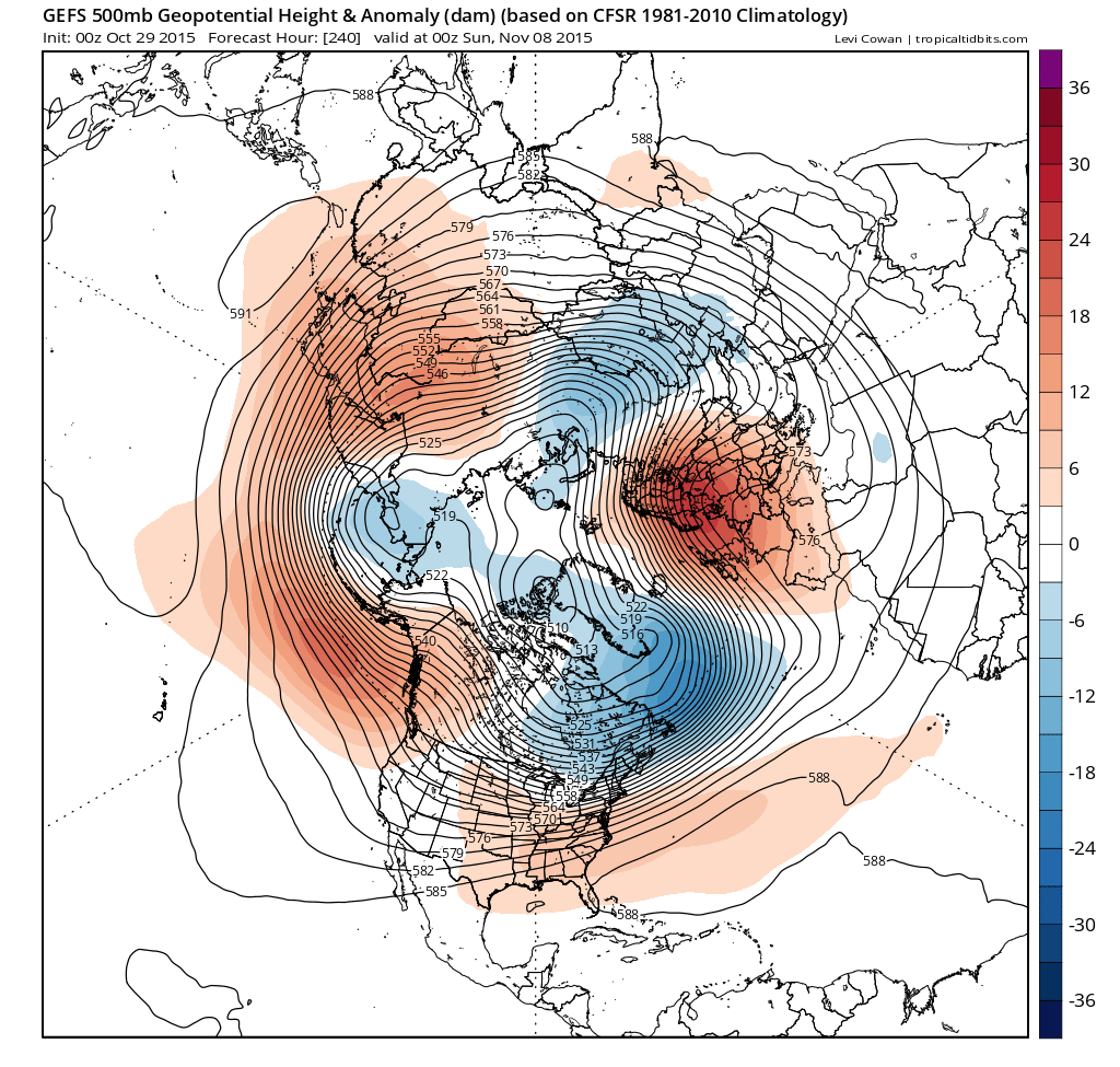
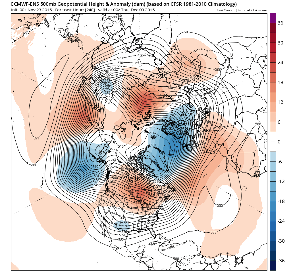
Despite the uncertainty of when the transition to unsettled conditions will occur across all parts. The models generally agree into the medium range that changeable conditions will prevail throughout next week, with spells of rain crossing the UK interspersed with sunny spells and showers. There is some differences between GFS and ECMWF operational with the position and alignment of the troughs and ridges which are more apparent on Monday’s 12z run than 00z run. GFS digs further east into NE Europe with the troughing with a more mobile westerly flow – whilst ECMWF keeps the trough more amplified with the trough axis close to western UK. In fact the GEFS and EPS (ECMWF ensemble) 500mb height mean and anomaly charts (below) reflect the same differences of their respective oeprationals. With EPS H500 mean a lot more amplified with the trough close to UK and ridge over Scandinavia - while GEFS H500 mean has a flatter upper trough which extends into NE Europe.
GEFS H500 mean and anomaly at day 10
EPS H500 mean and anomaly at day 10
In a nutshell, although both ECMWF and GFS are unsettled into medium range up to day 10 (T+240) the more amplified ECMWF would be warmer than GFS, particularly early next week in the south.
And, incidently, Monday's NOAA Climate Prediction Center 8-14 day prognostic H500 chart is more in line with the EPS H500 mean too.


