Synoptic Analysis - turning unsettled and colder over the weekend and into next week, but will it last into early May?

Following weeks of generally dry, settled and sunny weather, thanks to high pressure in control, we will see a big change in the weather pattern by the time we reach the weekend.
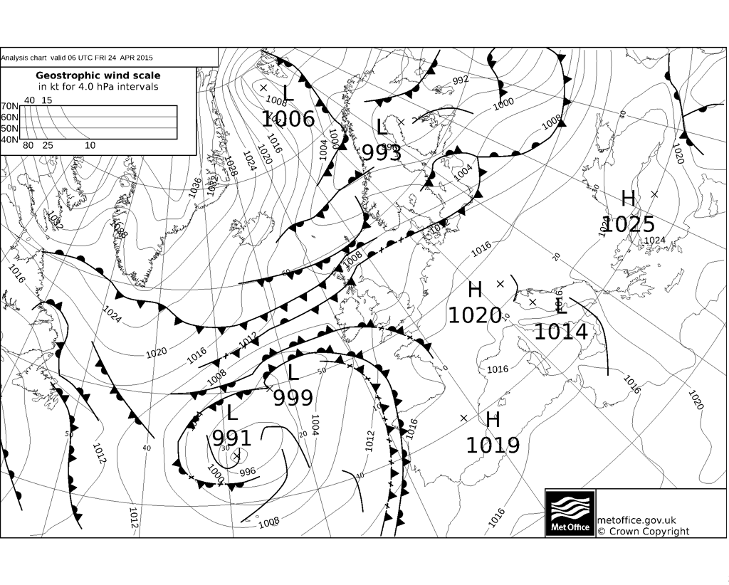
Over the last few days, the UK and NW Europe has been under a ridge of high pressure stuck between the polar front jet stream (PFJ) way to the north (running west to east from Greenland and on into Scandinavia) and the sub-tropical jet stream (STJ) to the south and SW (running west to east across the Atlantic into SW Europe). By the weekend, the PFJ sinks south into Scotland, whilst the STJ pushes NE across from Spain towards southern Britain.
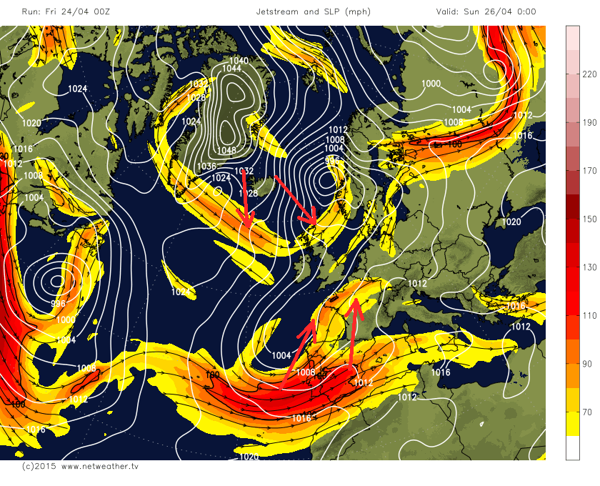
These two jet streams coming together across NW Europe will effectively squeeze out high pressure currently across us, replacing it with falling pressure from both the SW and also from the north over the weekend. So it won’t be the usual straight forward breakdown from the west and, in fact, we will have two-pronged breakdown from Friday, with weather fronts pushing in from the SW and also fronts spilling down from the north across Scotland and northern England.
So it will turn colder across Scotland, Northern Ireland and eventually the far north of England on Saturday, as colder air all the way from the arctic plunges south behind a cold front. This front will bring a band of rain south, which could turn to snow on its back edge over the Highlands of Scotland and by the evening, we will start to the showers arriving across northern Scotland in the cold northerly flow turn increasingly wintry with snow falling over higher ground. To the south of the cold front, we hold on warmer southwesterly flow, so we will see temperatures reach the mid to high teens, perhaps 18-19C across SE England, maybe 20C somewhere. These warm temperatures and the moist airmass will trigger some heavy and perhaps thundery showers though.
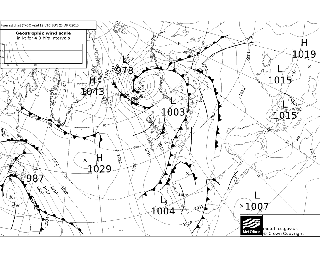
The cold front moving south, then arrives across southern England and East Anglia on Sunday – where it looks to grind to a halt and wriggle around a bit – bringing cloud and outbreaks of rain to these areas before the front eventually clears south later on Sunday evening. So it looks like a wet day for the London Marathon. Further north – sunshine and showers for Sunday and with temperatures in single figures (double figures south of cold front), it will be chilly with a risk of snow falling from showers over northern hills.
So the cold front clears out of the way by Monday, so early next week all of the UK will be in a cool and showery Polar maritime flow, cold enough in the north for showers to fall as snow over higher ground. Maximum temperatures on Monday and Tuesday reaching only 7-9C in the north, low to mid-teens in the south. By mid-week, still on the cool and unsettled side and we could see a more organised area of rain and stronger winds move across England and Wales though uncertainty over the exact track of the low bringing the rain, Scotland and N. Ireland remaining bright and showery. Mid-week wind and rain clears England and Wales Thursday, then remaining cool and showery until the end of the week, with a risk of snow over higher ground of Scotland and a risk of frost overnight where skies clear.
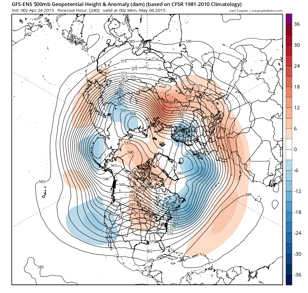
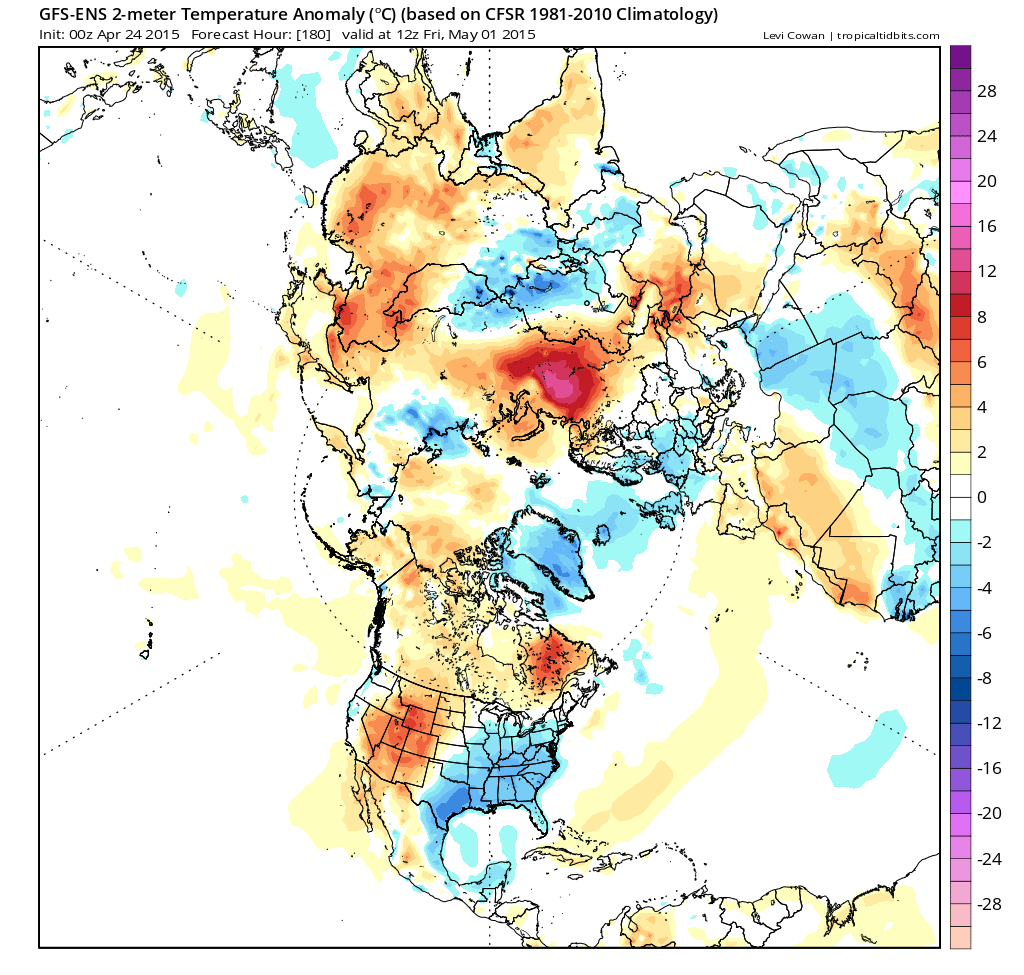
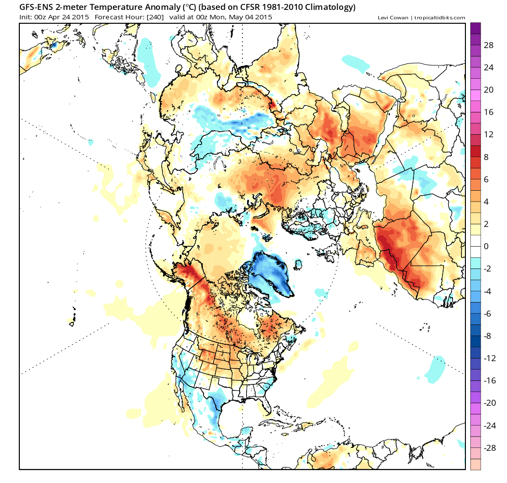
May starts on Friday and it looks like the first few days into the first weekend of the new month we’ll still be in a cool and showery northwesterly or westerly flow, with temperatures still below average. But by the first new week of May, a look at the GFS and ECMWF ensembles suggests we may see winds switch to a more southwesterly direction with temperatures returning to average, but still remaining unsettled with low pressure close to the west, bringing a risk of rain at times. However, some uncertainty between the GFS/ECMWF ensemble guidance and their operational runs over whether it will settle down or not, operational runs hinting at high pressure close by, so it may turn more settled early May.
Staying unsettled and temperatures below average to start May:
Temperatures then turning back to average after the first weekend of May, but remaining unsettled:
GEFS 500mb heights and anomaly shows low heights close to the west of the UK = unsettled: