


Latest Synoptic Outlook - high pressure gives way to low pressure from the Atlantic later this week, but high pressure returns even stronger from Tuesday next week.
At the end of last week we saw high an area of high pressure build in from the west and it did look, back then, like it would persist through much of this week. That is still the case for much of this week. However, we see pressure fall from the west later this week, with Atlantic fronts brining rain for many by the end of Friday. The rain clears south on Saturday to a mostly dry weekend, but rain may return early next week, before high pressure builds back in again from Tuesday.
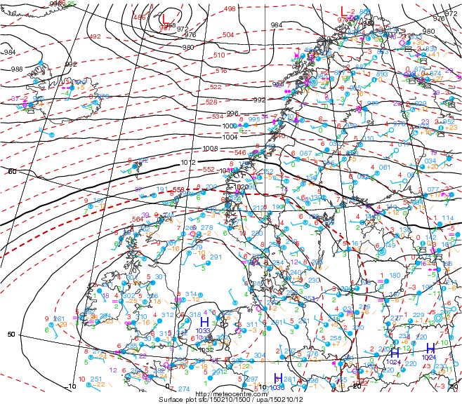
Yesterday we saw the temperature reach 13.1C in Liscombe in Devon, thanks to mild air moving down from the NW around high pressure centred over Ireland. However, today, the temperature has struggled to 3.4C, a good 9-10C lower than yesterday. This is because we have seen the high pressure centre drift east into the Low Countries today, this has allowed the wind to turn southeasterly across southern areas of the UK, bringing in cooler air off the near continent today, which combined with cloud cover, has led to a chilly Tuesday. Though not as cold as last week, with the near continent less cold than it was last week.
With the high continuing to move slowly east over the near continent over the next few days, we will see low pressure to muscle in from the west on Friday, this means pressure will fall across the UK on Friday accompanied by a strengthening southerly wind, with frontal systems spreading east bringing outbreaks of rain across many areas by the end of the day. We then see Friday’s rain clear southern areas on Saturday morning with a weak ridge of high pressure building in over the weekend as the low over France continues to sink south.
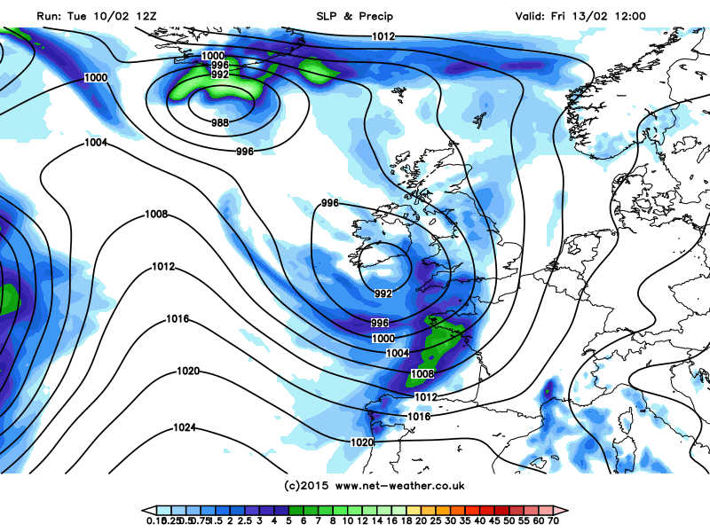
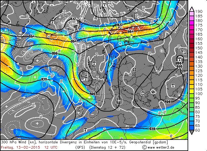
Looking at the upper pattern, we can see the reason for this change in more unsettled conditions later this week. A fairly strong westerly jet streak coming east across the Atlantic later this week, tied in with a shortwave upper trough exiting NE Canada, disrupts and split as it hits the blocking ridge of high pressure close to the east over central Europe. So by the end of this week - we see the jet stream split into a northern arm moving NE/E across Iceland and Scandinavia, while a southern arm of the jet moves SE into SW Europe. On the northern side of the southern arm of the jet, an area of low pressure slides SE across the UK and then on into mainland into France before filling and sinking south towards the Mediterranean.
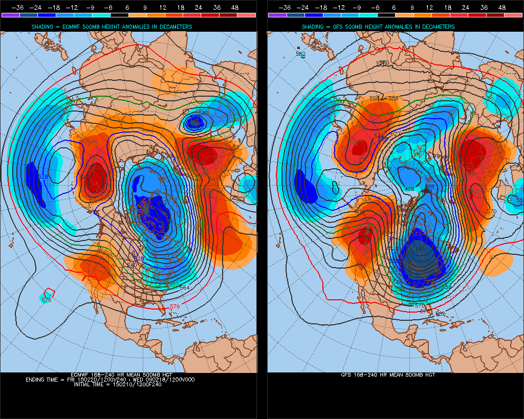
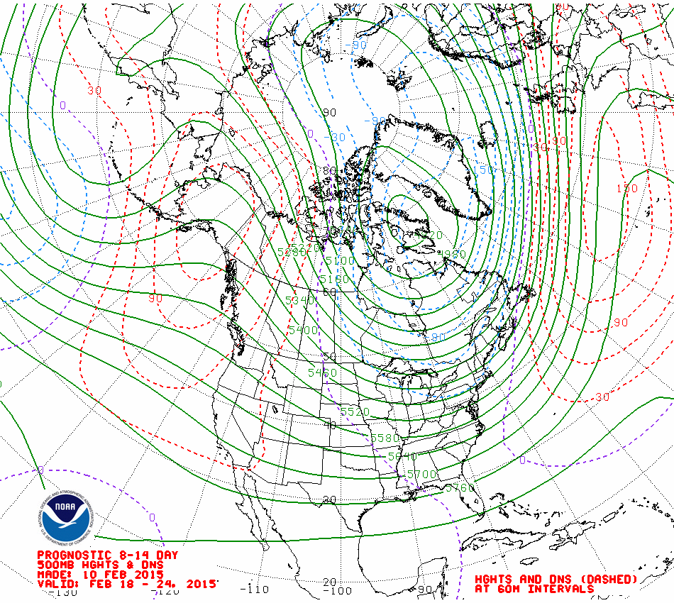
The split flow and southern arm of the jet pushing SE allows another trough and accompanying Atlantic frontal system to dig SE on Monday though, so another spell of rain pushing east possible. But we then see shift in emphasis early next week from the upper flow pattern from 12z GFS, ECMWF and GEM model operational runs. We lose the split flow and see all the energy go into the northern arm of the jet as a broad deepening upper trough carves out across the NW Atlantic. This forces a mid-latitude ridge of high pressure to build NE across the UK/NW Europe from Azores from Tuesday. The jet to the north of this ridge eventually loops back SW on the southern side of the ridge. These anticyclonic conditions lasting through much of the next week. The CPC prognostic 8-14 day 500mb height chart issued today and the 12z 8-14day ECM and GFS mean 500mb height comparison broadly show this picture below:

For snow lovers, I’m afraid there is a negligible chance of any snow over the next 10 days and most probably up to the next 14 days away from the Scottish mountains. We will see a blip in the anticyclonic conditions later this week, over the weekend and into Monday, but anticyclonic conditions look to return on Tuesday and probably setting in for the rest of next week and perhaps beyond. So a dry February looking likely.


