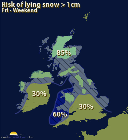
Snow showers will continue for a few more days at least, with some heavier pulses mixed in at times along with a biting wind chill and freezing temperatures overnight leading to an ice risk.
The snow showers continue for a few more days, with some heavier pulses mixed in, especially for northern areas.
On top of the snow, as Jo mentions, overnight frosts and biting windchill add to the wintry picture with some icy conditions likely until later next week at least.
The snow showers will ease a little as we head through the weekend, but before then there will some reasonable accumulations, especially for higher ground, though lower levels could see a centimetre or two as well. The showers are blowing through on a cold north/north westerly wind, and not everywhere will see one, while others could see a stream of them arriving. You can check your chances of seeing snow using the Will It Snow forecast page.