


A dry, sunny respite in the south today, before a showery end to the week for all tomorrow. High pressure builds in from the Atlantic this weekend, bringing mostly dry conditions with sunshine in the west, but it will remain cloudy and cool in the east
It’s been showery this week and on the cool side for the second half of April, thanks to low pressure close by to the east and a north to northwesterly flow. Fortunately, high pressure looks set to build in from the Atlantic for the weekend, bringing drier weather. But it doesn’t look to be any warmer though for eastern areas, with a northerly breeze bringing more in the way of cloud here. Western areas will see more sunshine and higher temperatures. However, before then, cloud and rain will move southeast across northern areas through today, reaching the south tonight. This will be followed by sunshine and showers towards the east on Friday, while western areas are drier and sunnier, as high pressure starts to build in from the west.
After a showery end to the week, high pressure builds in from the west this weekend, so turning drier and sunnier in the west, cooler and cloudier in the east:
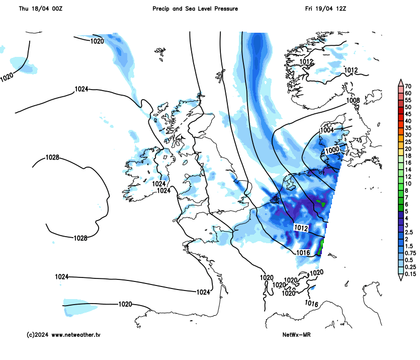
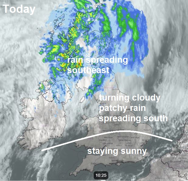
Most of England and Wales has started Thursday on a sunny but rather cold note, with a widespread forming overnight across inland parts of northern England, Wales, Midlands and SW England. The temperature fell as low as -4C at Shap in Cumbria, -3C at Sennybridge in south Wales. Blue skies across many areas to start the morning, but north of the border, cloud and persistent rain will continue to spread southeast across Scotland and N. Ireland, spilling down across northern England through the morning and into the afternoon, reaching the Midlands and East Anglia late afternoon and early evening. But ahead of the cloud and rain, it will stay sunny across southern areas for much of the day. A freshening westerly or northwesterly wind through the day across many parts, highs a little warmer than yesterday across England, Wales and N. Ireland, as we lose the northerly wind here, temperatures reaching 11-15C. Turning cooler across Scotland though, reaching 10-11C at best.
Cloud and increasingly patchy rain will reach southern areas of Britain later this evening, most of any rain towards East Anglia and SE England, before clearing away into the near continent in the early hours. Clear spells but also some scattered showers following from the north, but with a brisk northerly wind, it should stay generally frost-free and milder than last night.
Friday will be a breezy day, windy towards the east, as low pressure moves down the North Sea. For most there will be variable amounts of cloud and sunny spells, but also scattered showers – which will be most frequent and heaviest towards East Anglia and SE England. Winds easing by the evening away from the southeast. Temperatures reaching 12-14C, cooler along North Sea coasts and northern Scotland.
Into the weekend, high pressure over North Atlantic will build east across the UK, settling the weather down. But, there will still be a brisk northerly wind towards eastern England on Saturday, bringing more in the way of cloud and perhaps a few light showers over East Anglia. Cloud and rain affecting the far north of Scotland too. Best of the sunshine and lighter winds towards the west on Saturday and this is where we will see the highest temperatures – reaching 12-14C, while towards the east reaching 10-11C.
West is best for sunshine and warmth over the weekend
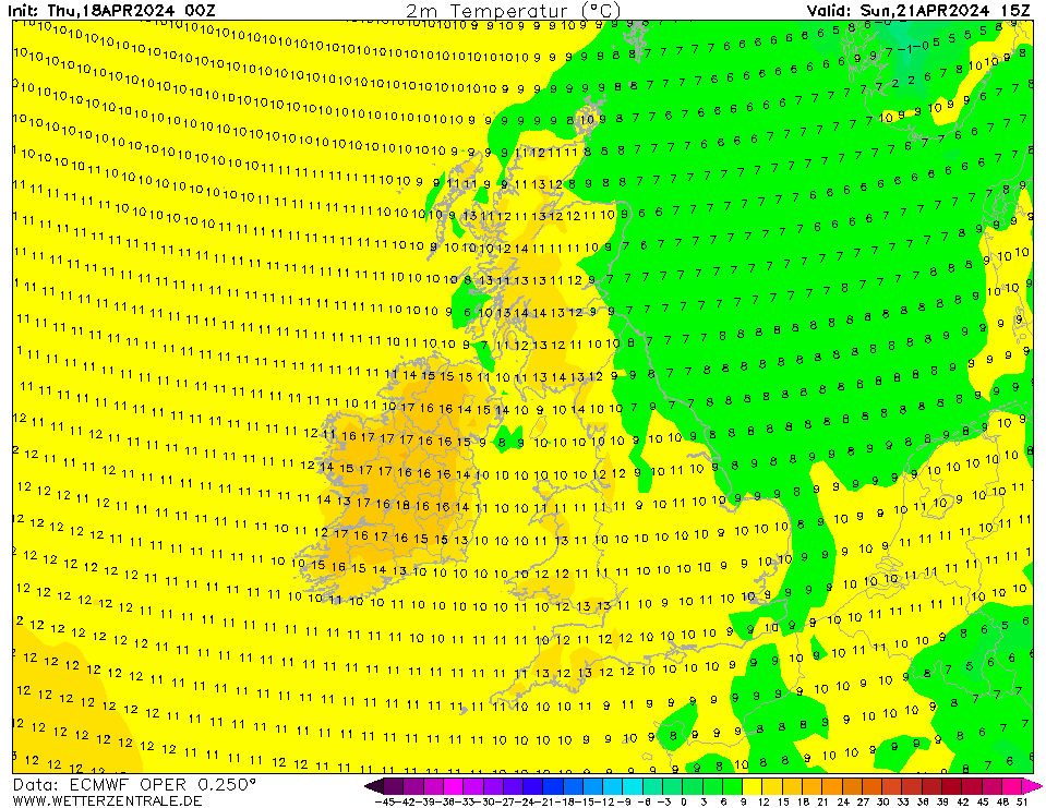
Sunday will see more in the way of cloud across central and eastern areas England and eastern Scotland, with some showers pushing inland from the North Sea coasts of Eastern England, it will be rather cool towards the east again, especially SE England and E Anglia with a brisk northeast wind here, temperatures reaching 11C at best. Sunniest, driest and warmest towards the west, temperatures reaching 13-15C.
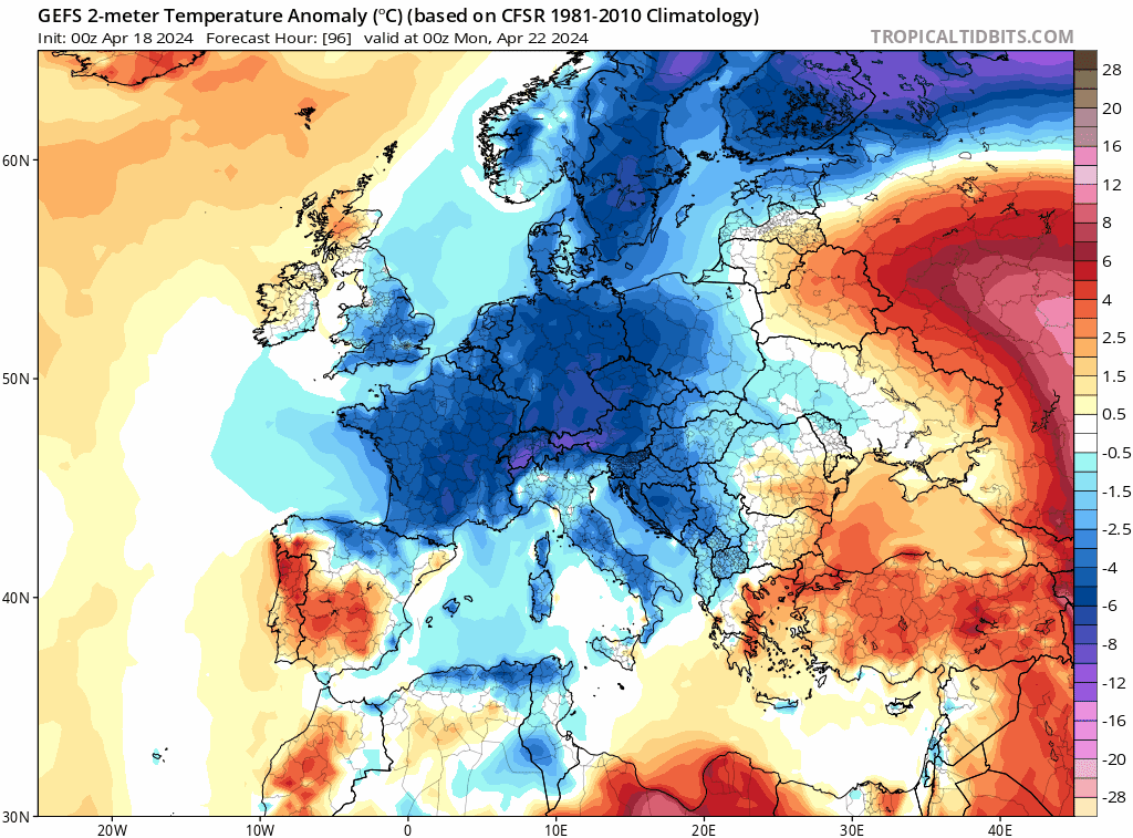
If you’re hoping for warmer weather to see out the rest of April, I’m afraid you will be disappointed to hear that northeasterly winds look to develop more widely through next week, as high pressure over the UK drifts back west and northwest over the North Atlantic, while pressure falls over the near continent. This will favour winds to strengthen from the north and northeast next week, bringing generally cool conditions with below average temperatures, though some uncertainty for now how close low pressure to the east will get – which will determine whether eastern areas will see showers or not.
Staying cooler than average for many next week, with a risk of overnight frost where skies clear
We may see low pressure drop down from the north later in the week, bringing some showers to northern and eastern areas too. But it looks to stay mostly dry towards the west, closer to high pressure. A risk of frost overnight too, where skies clear. Perhaps prudent for gardeners to protect tender plants outdoors sensitive to cold for at least another week or so.


