Once Monday's band of rain fades, the next few days will be drier. However, it will feel cool, even cold, in the breeze or under gloomy skies, with an increasing risk of frost.
This week the UK stays in a flow of cold air from the north. The southeast of Britain has had a nippy start with clearer skies. There has been a band of rain and drizzle over a good part of England and Wales with more cloud and to the northwest of this is the milder air which allowed County Tyrone to reach 19.3C on Sunday. In County Mayo, the top temperature was 20.1C with the warmest day of the year so far, and it’s been a struggle this year. For much of Britain, Sunday felt cold, with temperatures around 10C and plenty of cloudy, even damp weather.
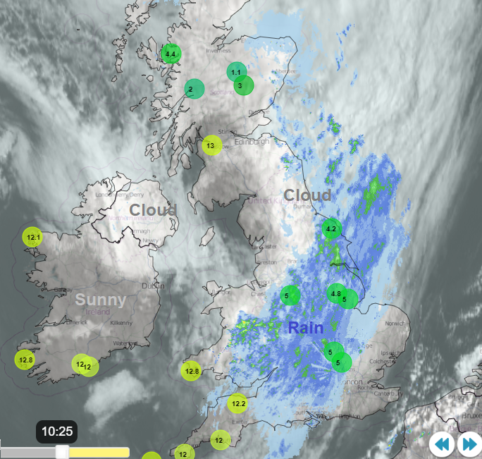
Netweather Radar showing a rainband over Britain on Monday 22nd, areas of cloud but also clear (darker) parts where temperatures are up, in the milder air to the west. Top ten highest and lowest temperatures from the hourly observations.
Nothing disturbs this colder-than-average air in the coming week. It remains across central Europe and the UK in the coming days. Czechia has low temperature warnings with agricultural concerns
“Expected frost can cause damage to vegetation, especially vegetables, grape-vine and blossoming fruit trees.”
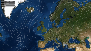
The jetstream is meandering all over the place as the high pressure from this weekend retreats nearer to the Azores. As a result, everything is rather slow-moving.
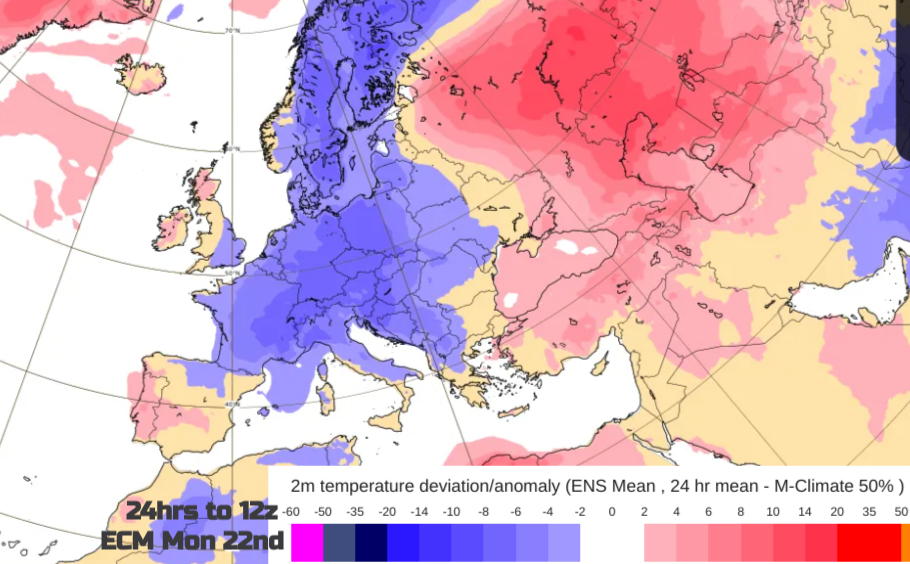
Chart shows the anomaly in the temperature at 2 m above the earth’s surface (in °C) during a 24 hour period immediately preceding the chosen valid date/time. ECMWF
Monday
This cold air will keep us on our toes. Where the sunshine appears, it will feel pleasantly warm, away from the wind. Under cloud cover, in the breeze by day, or after dark with clear skies it will feel chilly. And where it is damp or exposed you really will notice the colder air. In the last bit of mild air on Monday temperatures might reach into the mid-teens for northwestern parts with bright spells.
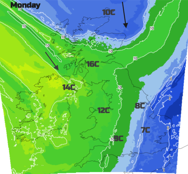
The straggly frontal band bringing cloud and light rain this morning won’t move much today. The focus of the heavier pulses looks to move from North Sea coasts and the Midlands down towards the Bristol Channel and southwest England this afternoon and also affecting eastern Wales, Cardiff and along the Welsh border later. Another band is forecast for the Yorkshire coast this evening, moving down from NE England and reaching The Wash tonight. This leaves clearing skies and dipping temperatures.
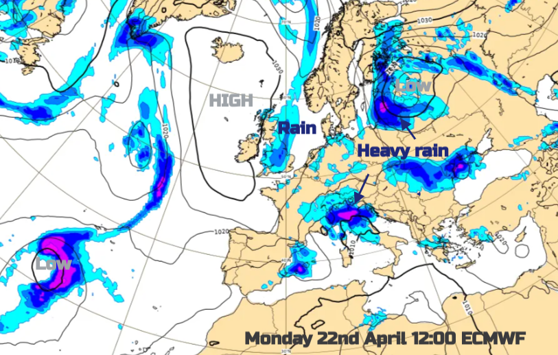 So we have a quieter cooler spell which will become drier. Elsewhere in Europe, there is an active low pressure near the Baltic Sea with weather warnings for snow, ice and wind. It has been a more wintry picture for the start of the week for Helsinki, Stockholm, Riga and Tallinn and the low will head northwards into Finland.
Southern Germany also has a warning for light snow on Monday and low temperatures/frost warnings for Tuesday across the country. Ljubljana, Slovenia has a snow warning and it is looking very unsettled for northern Italy. There are warnings of strong winds for Alpine Italy, Sardinia and Sicily around a lingering low pressure. If you are fed up with the cool, unsettled weather here, being abroad doesn’t guarantee fine, warmer weather either. Even desert Dubai was submerged last week after torrential rains and widespread flooding. The heat in Europe looks to focus on Turkey and the eastern end of the Mediterranean in the coming week.
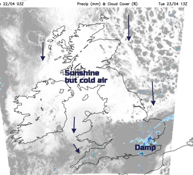
Tuesday
The showery rain from The Wash will still be around for the start of Tuesday with more cloud and further outbreaks for East Anglia and the Home Counties, even a bit for London. With cloudy skies for southeastern Britain, the damp weather and the cold air, it will feel chilly in the northerly flow. Southwest England could also see the odd showery outbreaks with more cloud and the occasional brighter spell. Further north it will be clear and sunny but after dark there is the risk of frost. So if you did buy seedlings at the weekend just think about where they are, or what they might need this week.
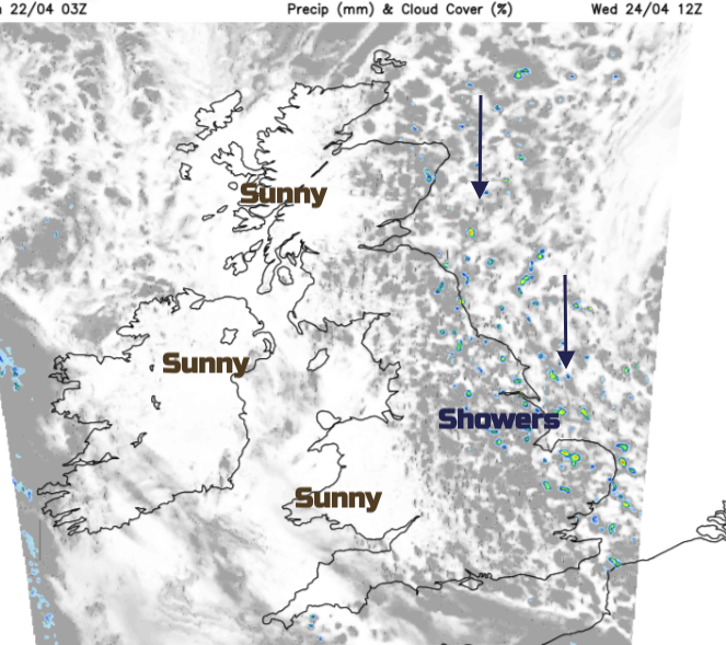
Wednesday will feel cold for eastern counties, particularly along North Sea coasts in a moderate north wind. There will be cumulus clouds and a scattering of showers in that flow, mostly of rain but with a bit of sleet appearing too.
Wednesday night sees a more widespread frost. Thursday starts in a similar vein but the winds fall light and there will be more cloud about by the afternoon as the temperatures stay subdued. Overall it's a drier week than the soggy months we have been seeing but it's not warm.