


Issued 2024-04-16 07:15:52
Valid: 16/04/2024 0600 - 17/04/2024 0600
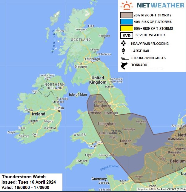
Upper trough extends south across Scandinavia / North Sea down into central Europe on Tuesday, the UK on the western edge of the trough. Surface low over Netherlands will move east while another low moves south across the N Sea close to the NE this evening. Steep lapse rates from surface heating beneath cold mid-levels towards the east with presence of upper trough will yield instability to support scattered showers across many areas, turning heavy as surface heating increases. Wind convergence zone between NW and N winds looks to develop between NW and SE England through the day, this will increase the risk of a few thunderstorms developing in this zone as well as perhaps across East Anglia close to a front this afternoon, with a risk of hail, localised flooding and gusty winds. Isolated lightning can’t be ruled out elsewhere with showers, but deemed to be below 20% probability.
Issued by: Nick Finnis
Issued by the Netweather forecast team whenever there is a risk of storms or severe convective weather, these discussion based and in depth forecasts will highlight the areas at risk and give an in depth description of the risk and the factors surrounding it.


